We were delighted to welcome Philip Parker back to Stanfords on Thursday to talk about his new book History of Cities in Maps.
From ancient civilizations to modern-day metropolises, maps have played a crucial role in urban progress.

We were delighted to welcome Philip Parker back to Stanfords on Thursday to talk about his new book History of Cities in Maps.
From ancient civilizations to modern-day metropolises, maps have played a crucial role in urban progress.
It was a full house at Stanfords last night as we hosted a talk to celebrate the launch of the Slow Ways Pocket Atlas. The atlas creators Charlie Peel, Hannah Engelkamp and Daniel Raven-Ellison explained the initial ideas and the evolution that lead to the finished atlas.

A brand new atlas of walking routes connecting all of Britain’s towns, cities and national landscapes by Slow Ways CIC and Urban Good.
Discover a network of over 9,000 walking routes connecting all of Britain’s towns, cities and national landscapes. This bright and beautiful new collection of maps shows every Slow Way route in Great Britain, which between them join up 2500 settlements via 130,000km of existing paths, lanes and trails. Use the pocket atlas to dream of journeys. Colour in where you’ve been or where you’d like to go. This pocket atlas has been made thanks to thousands of people. Contributors have volunteered hundreds of thousands of hours plotting, walking, wheeling, testing and reviewing the routes. In this atlas you can find out more about the Slow Ways movement, how it is changing what we think is possible, and creating a network of connection and joy!


The creator
Urban Good CIC and Slow Ways CIC have worked together on mapping the new walking network from the start. Their existing maps have a popular and unique style to highlight the routes. Both organisations are Community Interest Companies.

Available in store from 24th October
Tuesday 22nd October19:00 – 20:30.
Stanfords London, 7 Mercer Walk, Covent Garden, WC2H 9FA

We invite you to join us for the official launch of the Slow Ways Pocket Atlas. The evening will feature talks from Hannah Engelkamp, Daniel Raven-Ellison, and Charlie Peel, who will share the stories behind the making of this atlas and the powerful movement that connects over 2,500 towns and cities through over 9,000 walking routes.
Tickets £7 Includes glass of wine/soft drink and a discount off the book when purchased on the evening. Buy tickets here.
10 maps we are talking about. Paris edition
With the Olympics and Paralympics being set in Paris, we’ve been getting lots of enquires about the different kinds of maps we stock. Here are 10 maps on our shelves that we’ve been talking recently:
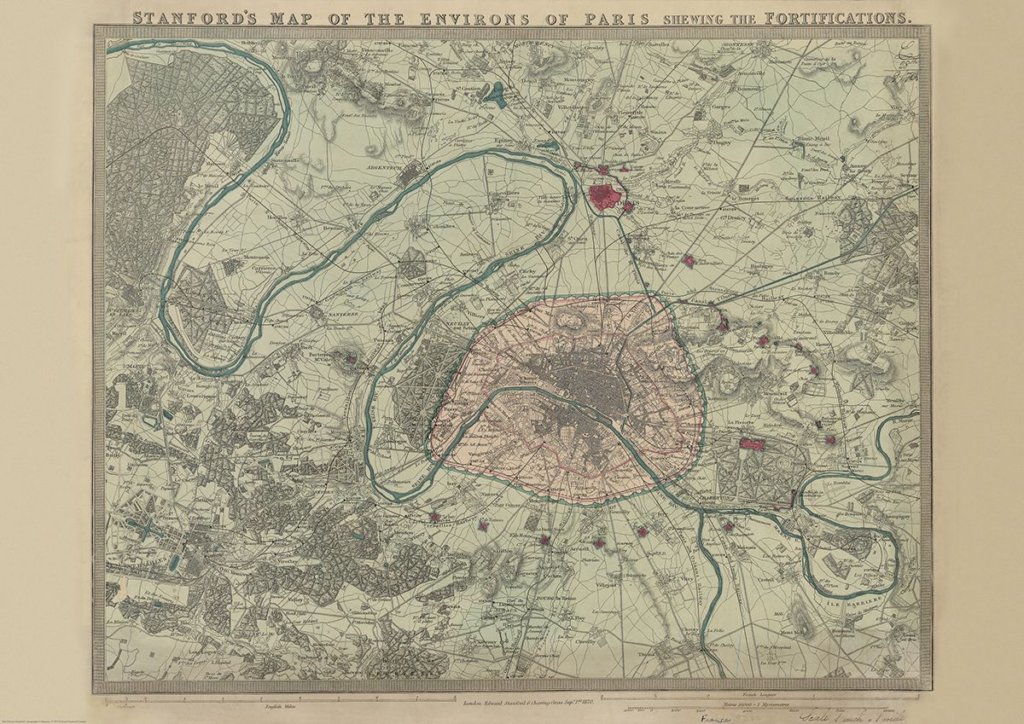
Stanford’s Map of the Environs of Paris (1870)
£14.99
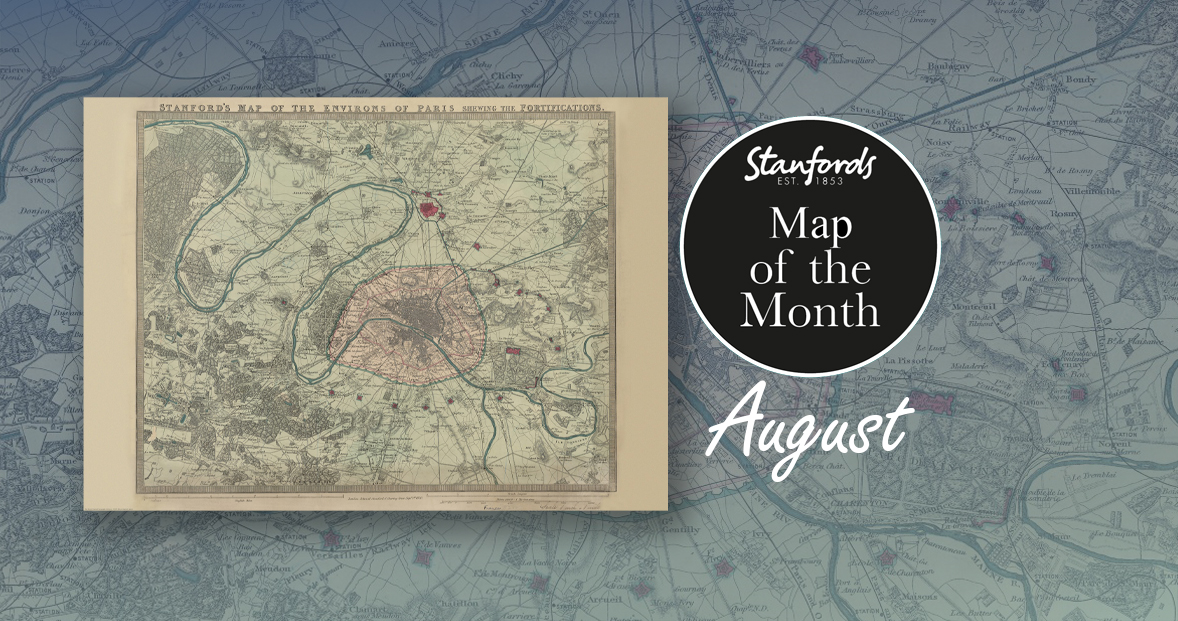
First up, it’s our August Map of the Month from our Edward Stanford Cartographic Collection archive.
It is dated September 1st 1870 which is just a couple months after the Franco-Prussian War began. The Eiffel Tower wasn’t erected for another nineteen years so you can see the empty space at the Chaps de Mars where the iconic landmark now stands.
It’s fascinating to compare this map with modern maps of Paris. This is definitely one of our most beautiful maps and will appeal to anyone interested in this great city.
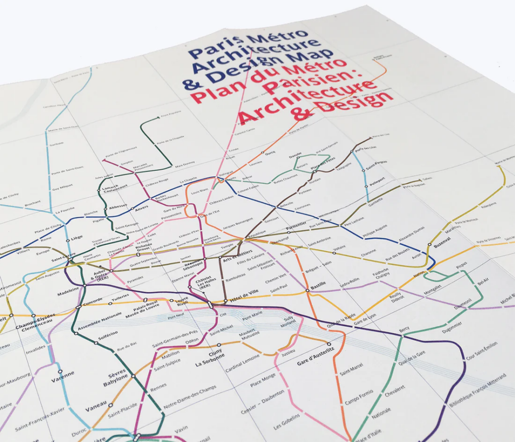
Paris Metro Architecture & Design Map
£9
Curated by transport design historian and broadcaster Mark Ovenden, with original photography by Nigel Green, this two-sided cartographic guide is an original and fascinating insight into architecture and graphic design for transport lovers, students of design and anyone interested in the history of Paris. The guide includes a geographical Metro map with featured stations marked, with corresponding photography and details on the reverse along with tips for where to find unique and unusual signage, ornamentation, architecture and more.
Continue reading #MapMonday: 10 maps we are talking about. Paris editionOur Map of the Month for August is the 1870 Stanford’s Map of the Environs of Paris.
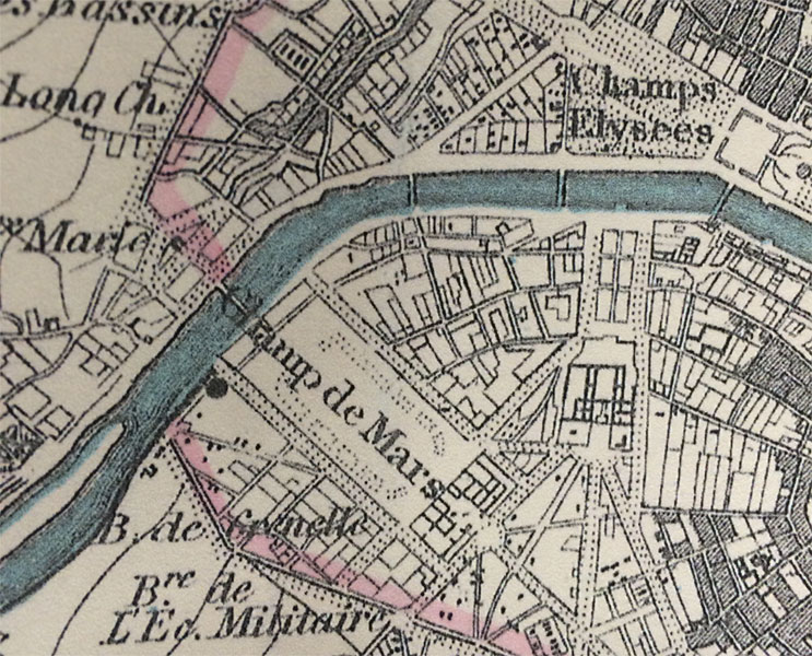
With all eyes on Paris right now, we thought it was a good time to look at this map from our Edward Stanford Cartographic Collection archive. The title reads; ‘Stanford’s map of the environs of Paris shewing the fortifications.’ You can see the fortifications in pink and notice how they form a ring around the old city wall.
It is dated September 1st 1870 which is just a couple months after the Franco-Prussian War began.
The Eiffel Tower wasn’t erected for another nineteen years. In this close-up, you can see the space at the Chaps de Mars where the iconic landmark now stands.
Here are five maps that have caught our attention recently at Stanfords:
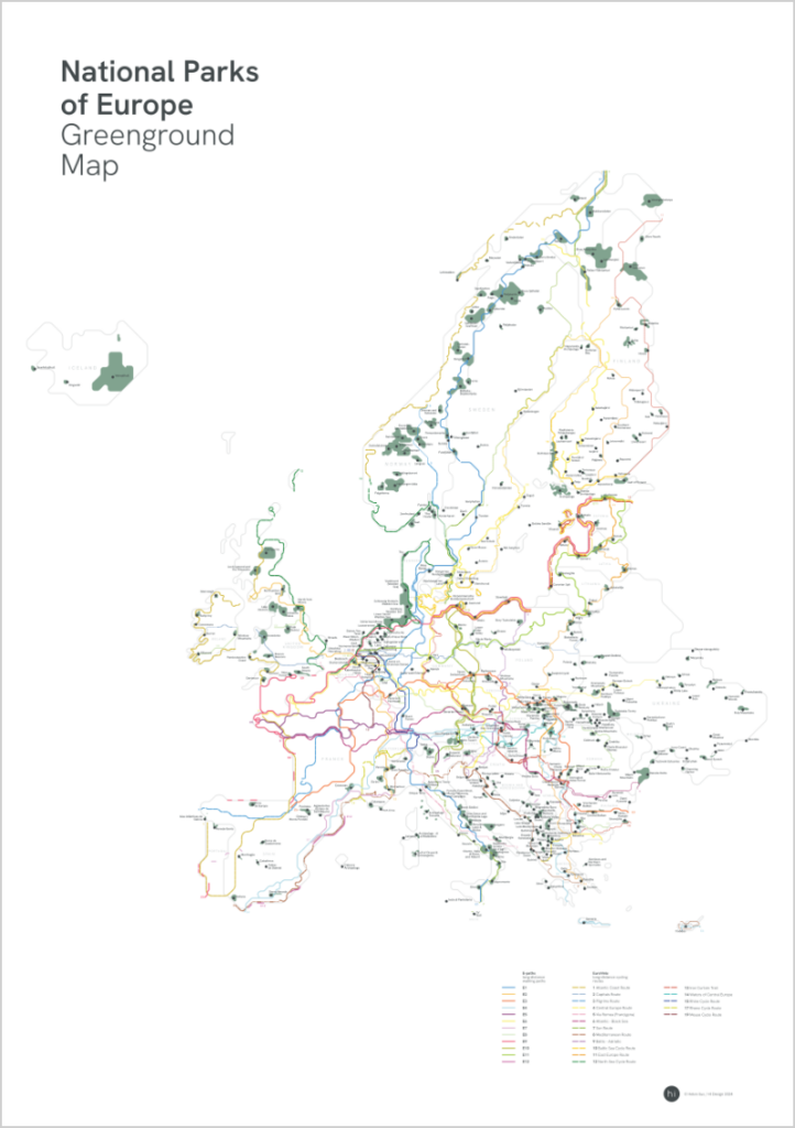
National Parks of Europe Greenground Map
£24.99
NEW
From the graphic designer and map maker that brought you our Map of the Month back in May; The London Greenground Map, Helen Ilus has just launched this new minimalist map that aims to connect Europe’s National Parks with official long-distance walking and cycling routes. With 400+ National Parks, 12 official E-paths and 17 EuroVelo routes, the map is a useful tool for planning nature adventures across Europe either on foot or on bike. The visually stylised map makes the connections between National Parks easy to see and helps with the planning as well as being an inspiring wall map between the adventures.
Continue reading 5 Maps We’re Talking AboutUrban Good launches London Flipped, the first ever full-size upside down map of London. This innovative map offers a unique perspective on the capital, challenging conventional viewpoints and inviting Londoners and visitors alike to explore the city in a whole new way.
A Fresh Take on London
London Flipped rotates the traditional map of London by 180°, placing south at the top and north at the bottom. This playful yet thought-provoking reorientation is designed to disrupt conventional navigation and encourage users to reimagine their spatial relationships with the city.
Continue reading NEW MAP: London FlippedCurrently on display on our gallery wall in the Stanfords Coffee House in our Covent Garden store, is a beautifully curated selection of Mike Hall’s maps.

The full collection of Mike Hall’s Retro London Boroughs are available to buy from Stanfords for £34 each.
These bold, colourful illustrated maps of London’s 32 boroughs and the City of London are inspired by colourful, modernist graphic design of the 1950s and 1960s.
Continue reading Mike Hall Maps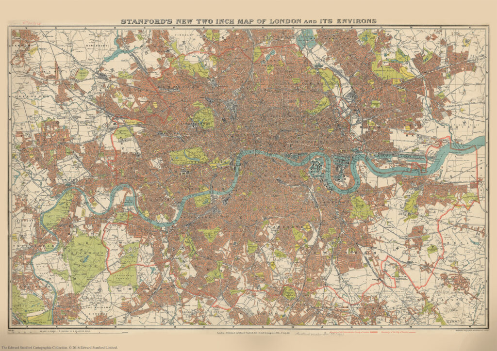
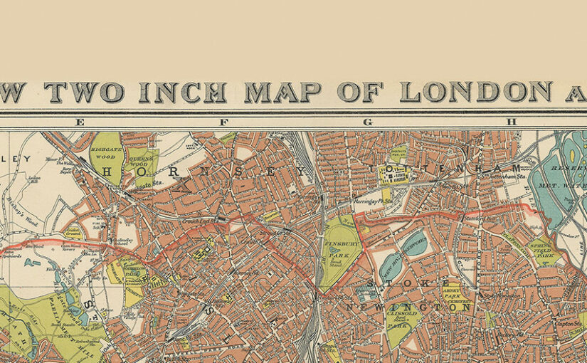
We are about to celebrate the 111th birthday of our Stanford’s New Two Inch Map of London and its Environs, 1913.
Published by Edward Stanford Ltd, 12,13 & 14 Long Acre . W.C . 1st July 1913.
This map from our Edward Stanford Cartographic Collection archive shows the capital the year before WW1 broke out at a scale of two inches to one mile.
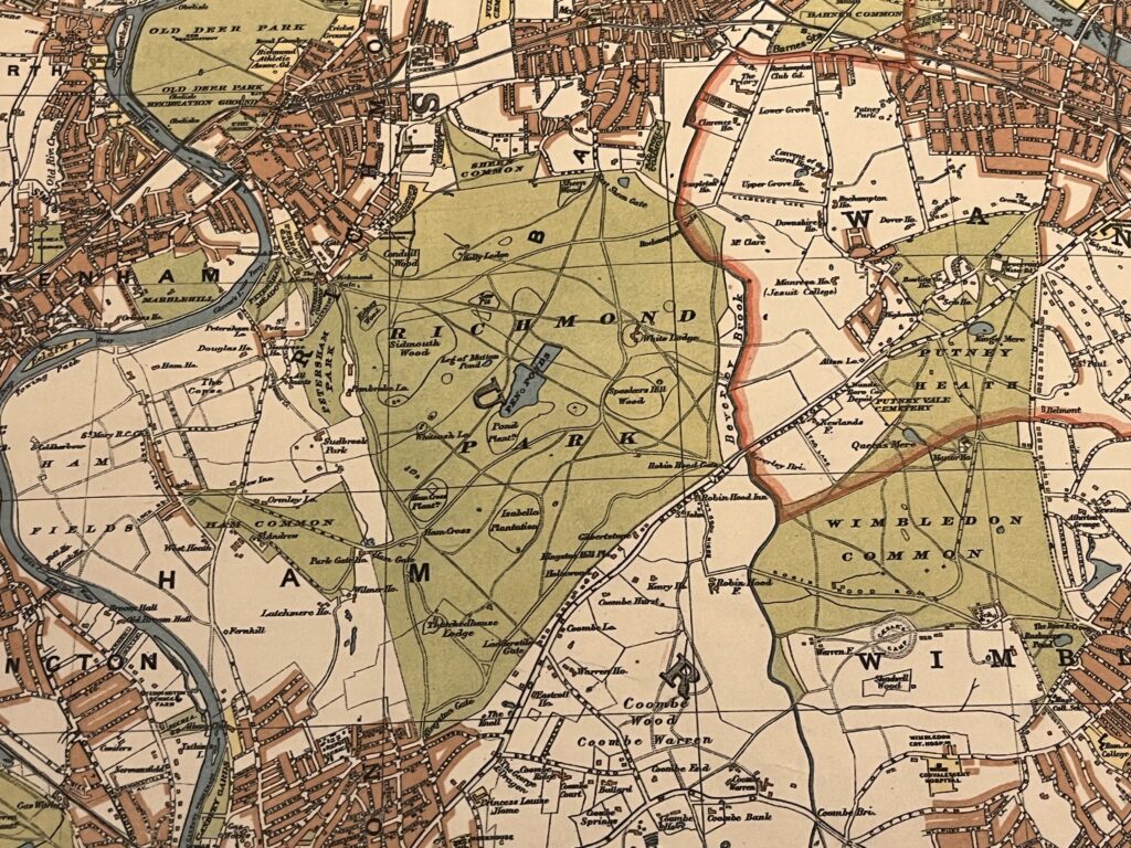
A thick red line shows the Boundary of the Administrative Country of London while a thinner red line shows the Boundary of the City of London.
Edwardian London saw a great deal of new building development which was halted by WW1 so not too many major changes would have occurred to this map for a few years.
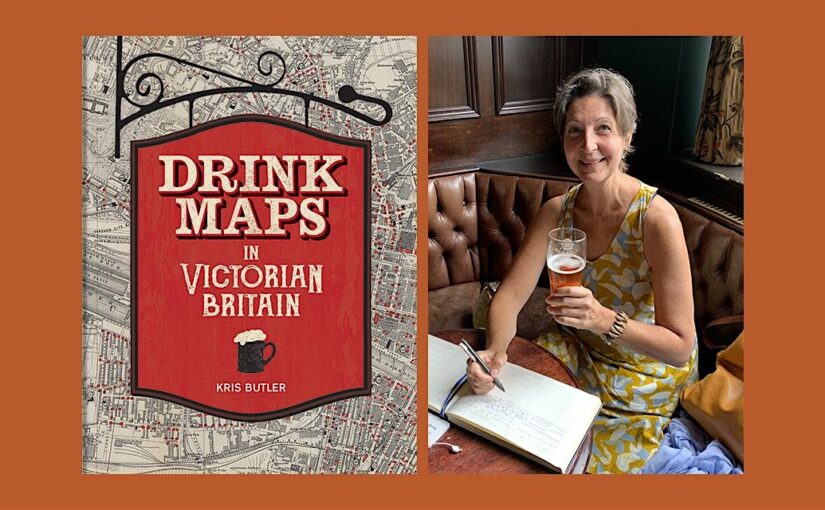
Continue reading Stanford’s New Two Inch Map of London and its Environs. 1913Kris Butler shares with us a map featured in her new book Drink Maps in Victorian Britain.
-By Kris Butler
Drink maps were created by anti-drinking groups to deter drinking, not encourage it. But you might not guess that when you first look at them, given that they exaggeratedly and colourfully show where to find a drink. What this 1877 map, called One Half-Mile Square in the Heart of London, lacks in colour it made up for in size. The original was a whopping 8 foot by 8 foot, floor-to-ceiling backdrop to a traveling temperance lecture given by Dr Thomas Nichols. This image is of the pocket version; the larger one is not known to have survived.
Continue reading Drink Maps in Victorian Britain