Stanfords Specialist Mapping Services

As well as stores in London and Bristol, we also have a Stanfords For Business map team in Manchester who specialise in mapping for Planning Applications, Land Registry enquiries and much more.

Some customer orders we have worked on include aerial maps of places of worship for a community project, A-Z mapping for a college to help new students familiarise themselves with the local area, historical mapping for a sports club celebrating an anniversary, OS planning application mapping for a farmhouse wanting to add an outbuilding and an OS 1:25k site centred map showing the location of an engagement to give as a wedding gift.

Stanfords is one of the UK’s leading suppliers of mapping and geographic data.

Continue reading Stanfords Specialist Mapping Services
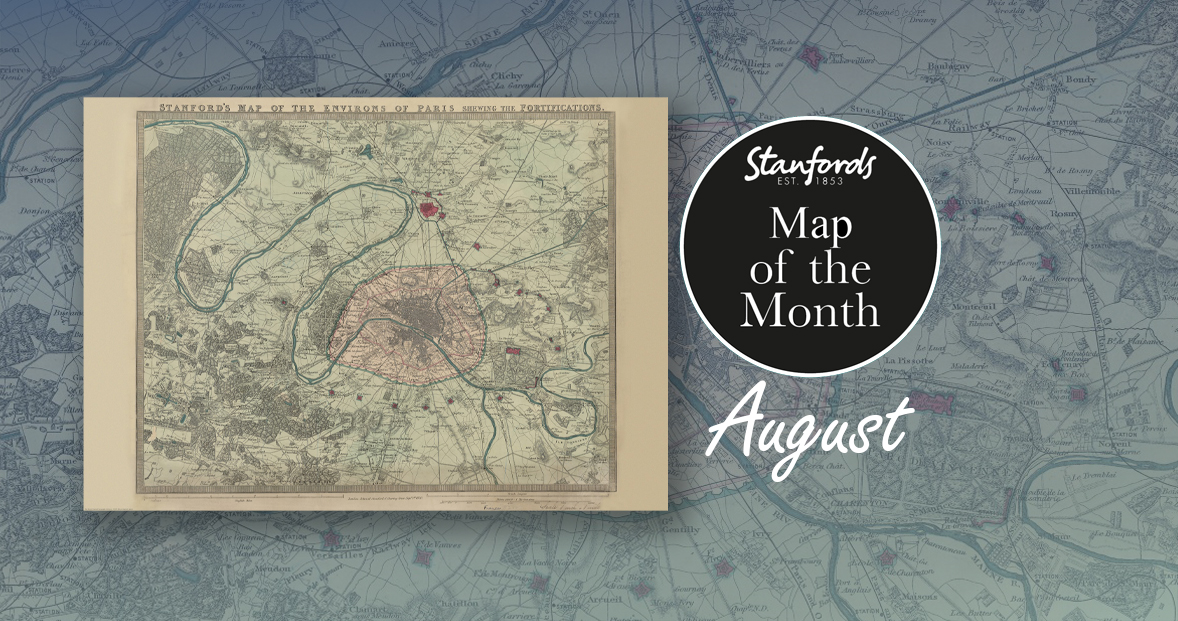
Map of the Month: 1870 Stanford’s Map of the Environs of Paris

Our Map of the Month for August is the 1870 Stanford’s Map of the Environs of Paris.

With all eyes on Paris right now, we thought it was a good time to look at this map from our Edward Stanford Cartographic Collection archive. The title reads; ‘Stanford’s map of the environs of Paris shewing the fortifications.’ You can see the fortifications in pink and notice how they form a ring around the old city wall.

It is dated September 1st 1870 which is just a couple months after the Franco-Prussian War began.

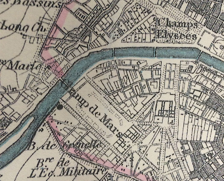
The Eiffel Tower wasn’t erected for another nineteen years. In this close-up, you can see the space at the Chaps de Mars where the iconic landmark now stands.

Continue reading Map of the Month: 1870 Stanford’s Map of the Environs of Paris

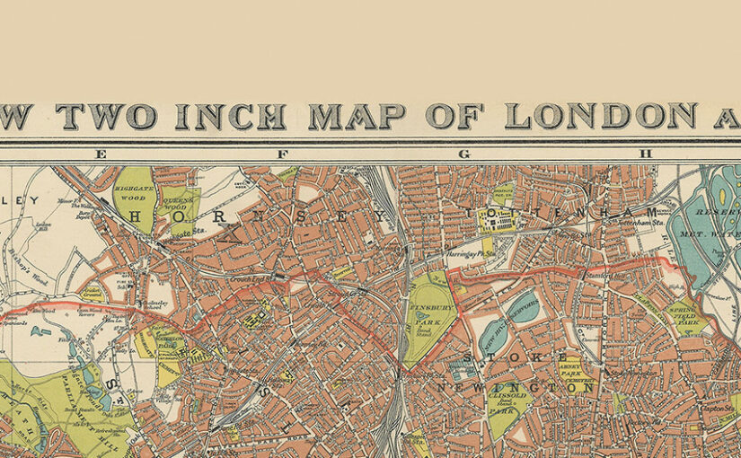
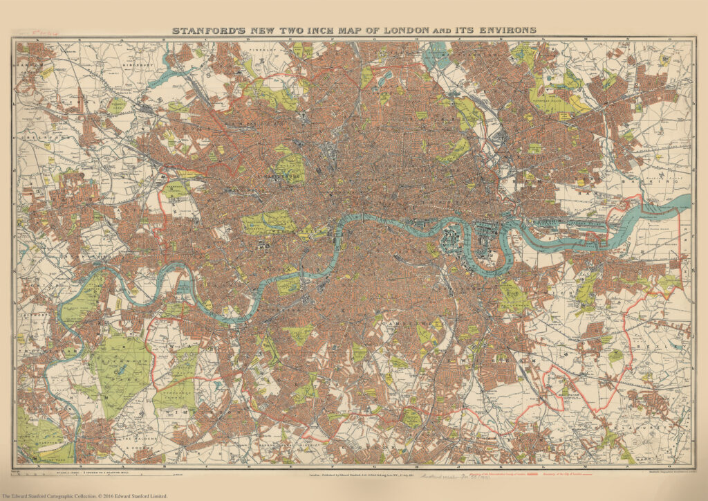
Stanford’s New Two Inch Map of London and its Environs. 1913

We are about to celebrate the 111th birthday of our Stanford’s New Two Inch Map of London and its Environs, 1913.

Published by Edward Stanford Ltd, 12,13 & 14 Long Acre . W.C . 1st July 1913.

This map from our Edward Stanford Cartographic Collection archive shows the capital the year before WW1 broke out at a scale of two inches to one mile. 

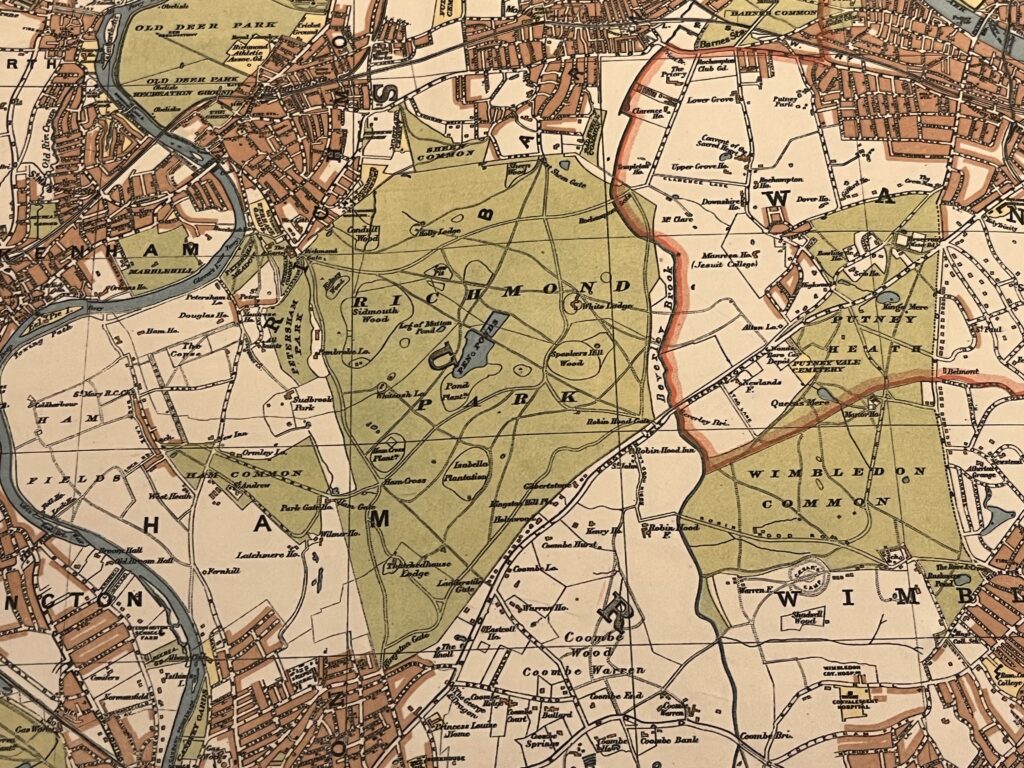
Richmond Park and Wimbledon Common sitting just outside the thick red line showing the Boundary of the Administrative Country of London

A thick red line shows the Boundary of the Administrative Country of London while a thinner red line shows the Boundary of the City of London.

Edwardian London saw a great deal of new building development which was halted by WW1 so not too many major changes would have occurred to this map for a few years.

Continue reading Stanford’s New Two Inch Map of London and its Environs. 1913

IMIA Map Industry Summit 2024

Yesterday we celebrated the International Map Industry Association (IMIA) Industry Summit sponsored by Harper Collins. Following the Mapping Forum at the Harper Collins offices, we hosted the third annual Industry Social in our Stanfords Covent Garden store.

The IMIA Summit is a fantastic opportunity to network with other members and associates and reflect on industry trends.

We had a great time connecting with industry colleagues over drinks while looking at our extensive map collection and participating in a fun Map Quiz.

If you are interested in joining the IMIA and joining us at events like this you can do so via this link: imiamaps.org/how-to-join

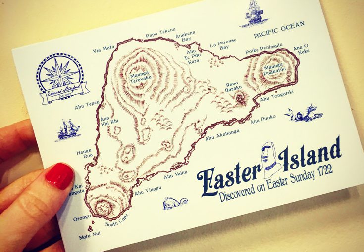
Happy Easter Island

Easter Island (also known as Rapa Nui and Isla de Pascua) is one of the most remote inhabited islands in the world. The nearest continental land mass is over 3,700 kilometres away.

The Dutch explorer Jacob Roggeveen landed on the Island on Easter Sunday in 1722 and gave it its European name. Continue reading Happy Easter Island