Map of the Month: David Bowie’s London

“I don’t know where I’m going from here, but I promise it won’t be boring” – David Bowie

Our Map of the Month for March 2025 is David Bowie’s London by Herb Lester Associates, written by Paul Gorman, design & illustration by Kit Russell.

This meticulously researched guide reveals the streets, studios, and secret spaces that shaped one of the 20th century’s most transformative artists.

From the back streets of Brixton to the Victoria & Albert Museum, each location tells a story of Bowie’s remarkable metamorphosis. 

Trace his journey through 61 pivotal sites: recording studios where groundbreaking albums were born, bohemian enclaves that nurtured his radical creativity, and underground clubs that became launching pads for entire cultural movements.

Continue reading Map of the Month: David Bowie’s London

#MapMonday: 10 maps we are talking about. Paris edition

10 maps we are talking about. Paris edition

With the Olympics and Paralympics being set in Paris, we’ve been getting lots of enquires about the different kinds of maps we stock. Here are 10 maps on our shelves that we’ve been talking recently:

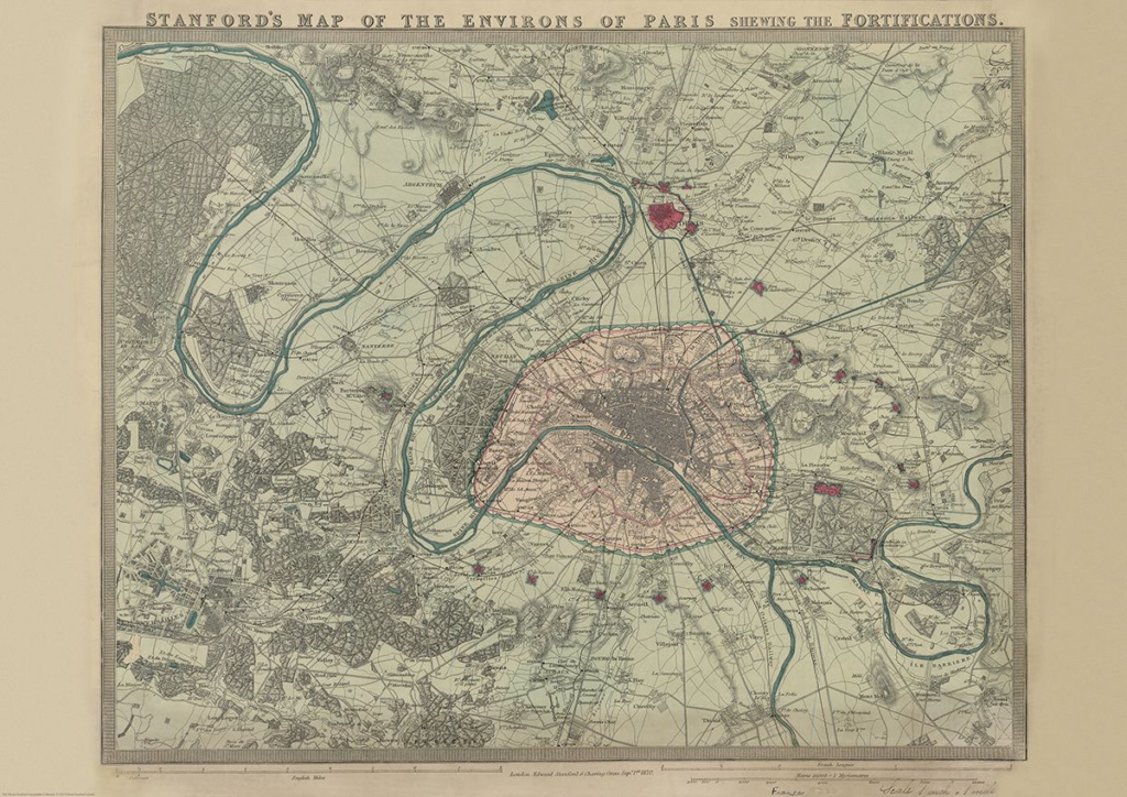
Stanford’s Map of the Environs of Paris (1870)

£14.99

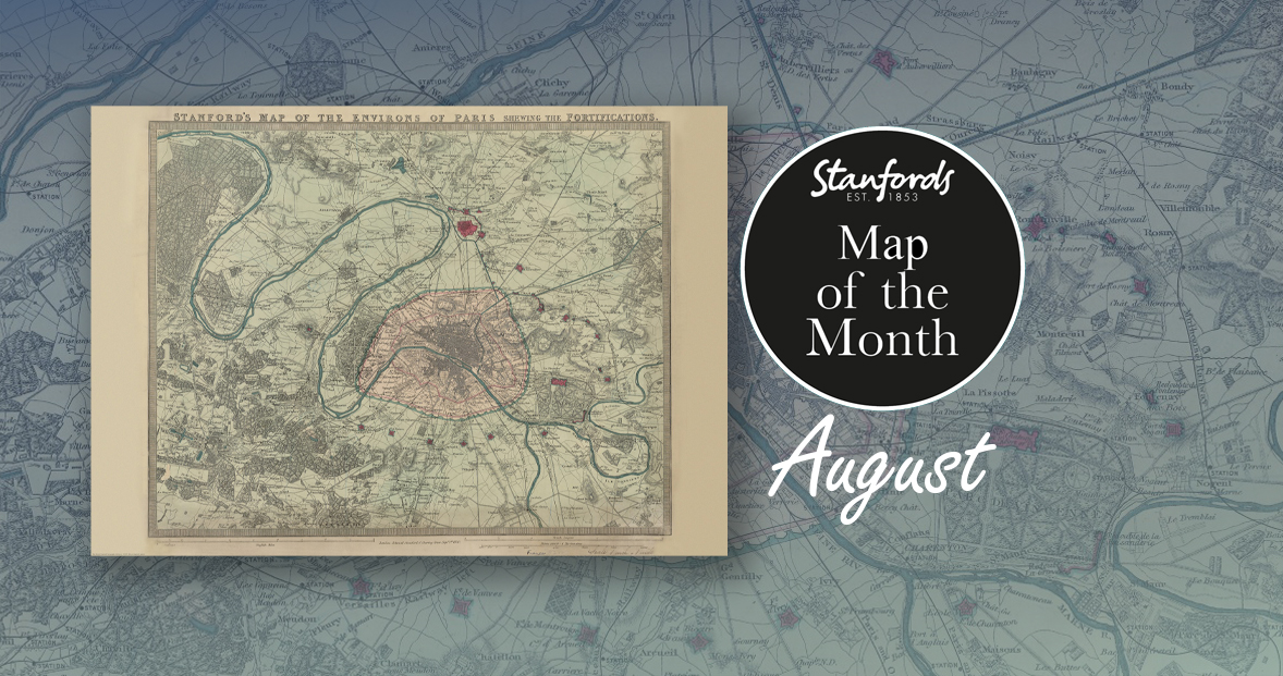
First up, it’s our August Map of the Month from our Edward Stanford Cartographic Collection archive.

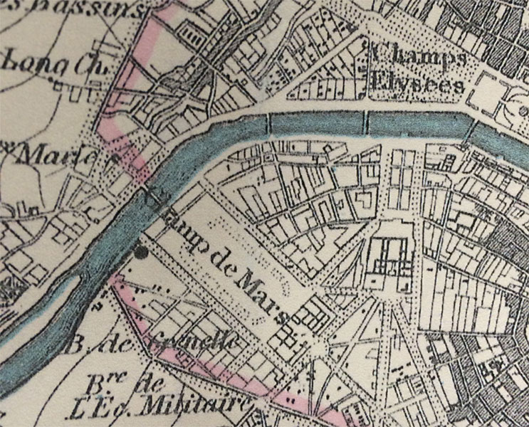
It is dated September 1st 1870 which is just a couple months after the Franco-Prussian War began. The Eiffel Tower wasn’t erected for another nineteen years so you can see the empty space at the Chaps de Mars where the iconic landmark now stands.

It’s fascinating to compare this map with modern maps of Paris. This is definitely one of our most beautiful maps and will appeal to anyone interested in this great city.

Paris Metro Architecture & Design Map

£9

Curated by transport design historian and broadcaster Mark Ovenden, with original photography by Nigel Green, this two-sided cartographic guide is an original and fascinating insight into architecture and graphic design for transport lovers, students of design and anyone interested in the history of Paris. The guide includes a geographical Metro map with featured stations marked, with corresponding photography and details on the reverse along with tips for where to find unique and unusual signage, ornamentation, architecture and more.

Continue reading #MapMonday: 10 maps we are talking about. Paris edition

Map of the Month: 1870 Stanford’s Map of the Environs of Paris

Our Map of the Month for August is the 1870 Stanford’s Map of the Environs of Paris.

With all eyes on Paris right now, we thought it was a good time to look at this map from our Edward Stanford Cartographic Collection archive. The title reads; ‘Stanford’s map of the environs of Paris shewing the fortifications.’ You can see the fortifications in pink and notice how they form a ring around the old city wall.

It is dated September 1st 1870 which is just a couple months after the Franco-Prussian War began.

The Eiffel Tower wasn’t erected for another nineteen years. In this close-up, you can see the space at the Chaps de Mars where the iconic landmark now stands.

Continue reading Map of the Month: 1870 Stanford’s Map of the Environs of Paris

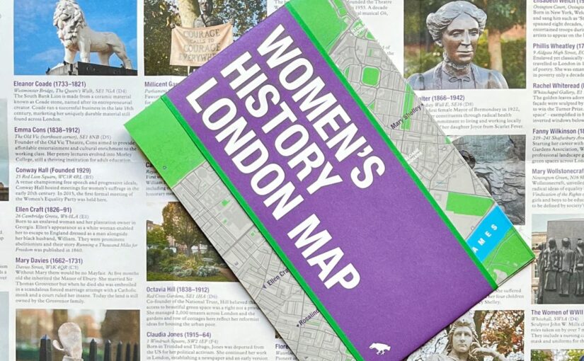
NEW MAP: Women’s History London Map

This new map has conveniently arrived on our shelves just in time for International Women’s Day and Mother’s Day.

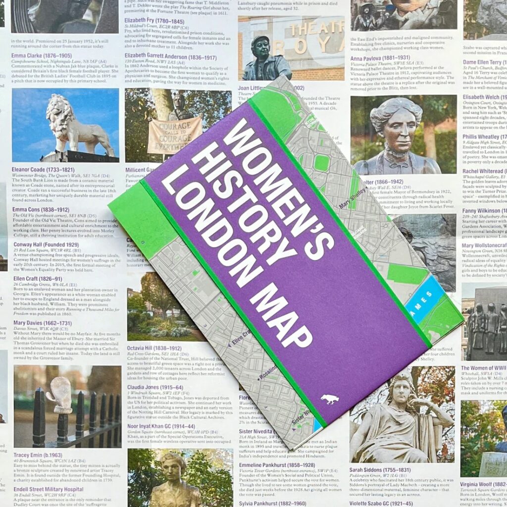
Explore London through the lens of women’s history. This Women’s History London Map highlights 50 statues, sculptures, blue plaques, gravestones, buildings and monuments – dedicated to women such as Millicent Garrett Fawcett, ​​Virginia Woolf, Aphra Benn, Ada Lovelace and Phillis Wheatley. 

With an introduction and descriptions by Katie Wignall, author, city history tour guide and Londoner, and original photography by Jo Underhill, the map guide is a companion to begin exploring the lives of some of London’s most impactful women, and to inspire the next generation to continue their work.

Women’s History London Map is available now for £9.95

Map of the Month: The Ultimate UK Cycle Route Planner

‘It is by riding a bicycle that you learn the contours of a country best, since you have to sweat up the hills and coast down them.’- Hemmingway

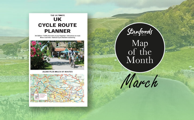
Our Map of the Month for March is The Ultimate UK Cycle Route Planner.

This best selling UK cycle publication gives an overview of all the main signed UK cycle routes – the only publication that has all these together on one single map.

This map features:

Continue reading Map of the Month: The Ultimate UK Cycle Route Planner

Map of the Month: Wheelie great BRAND NEW cycling maps

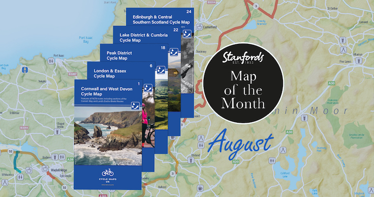
Our Map of the Month for August is not just one map, we are excited to introduce the first five maps in a brand new series that will soon cover the whole of the UK. 

Cycle Maps UK are produced at a scale of 1:100 000 showing important features including the National cycle Network. Sections on road, off road and traffic free are all shown in differing colours along with their route number. Other roads and their classification are shown enabling you to link rides or explore sections and discover new routes at home or further afield.

Continue reading Map of the Month: Wheelie great BRAND NEW cycling maps

Map of the Month: 1904 Stanford’s Map of the Siberian Railway

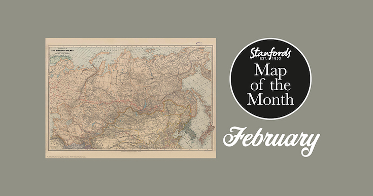
Our Map of the Month for February 2022 is the 1904 Stanford’s Map of the Siberian Railway.

The Stanford’s Map of the Siberian Railway is from a fascinating series of reproductions from our Edward Stanford Cartographic Collection archive.

Depicting the great land route to China and Korea, this map was published by Edward Stanford, Long Acre on the 1st February 1904.

This vital rail route was also known as the Moscow Highway or the Tea Route because of the large quantities of tea exported from China. It connected European Russia to Siberia and China. Construction started in 1730 and was not completed until the mid 19th-century.

Continue reading Map of the Month: 1904 Stanford’s Map of the Siberian Railway

Brilliant Maps

Maps that help put the last 12 months in some context

-by Ian Wright

I’m honoured that Brilliant Maps An Atlas for Curious Minds has been selected for Stanfords December book of the month. I really enjoyed writing it and hope you’ll enjoy reading it just as much. 

Since December is the last month of the year, I thought I’d choose a few maps that help put the last 12 months in some context. And given Christmas is coming I can’t resist including a couple of Christmas themed maps too.

Continue reading Brilliant Maps

Map of the Month: Antarctica and the Arctic BAS

We thought we’d end the year with something new, so from now on we will be having a Map of the Month. Stanfords Map of the Month for December 2021 is the British Antarctic Survey’s Antarctica and the Arctic double-sided folded map.

Here’s Laura Gerrish, GIS and Mapping Specialist at British Antarctic Survey to tell us a bit more about this map:

Continue reading Map of the Month: Antarctica and the Arctic BAS

AmazingWorld Children’s Maps

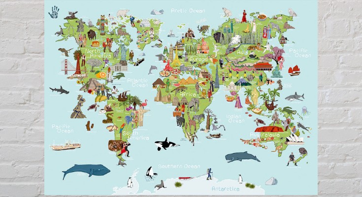
The latest addition to our map department are these seven new AmazingWorld children’s A2 wall maps.

These lovingly crafted maps introduce little ones to the many wonders awaiting them around the world. Spark up conversations and fuel their curiosity to guide them as they discover more about the animals, foods, people, places, cultures, and plants across the globe.


Build their knowledge and develop an understanding of the similarities and differences that connect them to people & places around the world.

Continue reading AmazingWorld Children’s Maps