Get your cartographic fix right here with these 10 maps that have caught our attention recently:
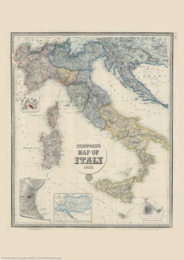
Stanford’s Map of Italy (1859)
£19.99
We are celebrating this map’s 165th birthday. It was originally published on 2nd May 1859 by Edward Stanford.
The map catches the country in an interesting stage of its history, just before the unification, and still shows the individual states: the Kingdom of Piedmont – Sardinia, the Grand Duchy of Tuscany, the Kingdom of the Two Sicilies, the Papal States, etc, all in different colours. Hachures are used to show the spine of the Apennines and other mountainous regions.
Interesting insets show enlargements of the environs of Venice, Genoa and Naples with Vesuvius, and another panel presents the whole of the Austro-Hungarian Empire which then still included Lombardy and north-eastern Italy.
This reproduction is Print on Demand so is available in other sizes.
Continue reading 10 Maps we are talking about