
Last night we hosted an event with renowned travel and architecture writer Christopher Beanland as he spoke about his new book Station: A Journey Through 20th And 21st Century Railway Architecture And Design published by Batsford.
Continue reading Author Event: Station by Christopher Beanland
Lonely Planet’s Guide to Death
Lonely Planet’s Guide to Death, Grief and Rebirth is an illuminating book that reveals how cultures and communities around the world grieve their loved ones – with lessons we can all learn from to help us all live (and die) well.
Divided into four key chapters: Celebrating, Commemorating, Mourning, and Offering, readers will discover resting places, burials, rituals, and symbols that have been associated with death throughout time.
Continue reading Lonely Planet’s Guide to Death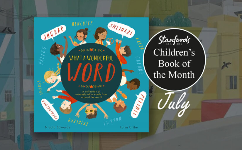
Children’s Book of the Month: What a Wonderful Word
Our Children’s Book of the Month for July is What a Wonderful Word by Nicola Edwards, illustrated by Luisa Uribe.
Have you ever wished there was a word for friends who are like family to you, or for the way you hesitate when you’ve forgotten someone’s name? Did you know there was a special word for the distance a reindeer can travel before needing the toilet? Or for when you search for something in the water using only your feet?
Continue reading Children’s Book of the Month: What a Wonderful Word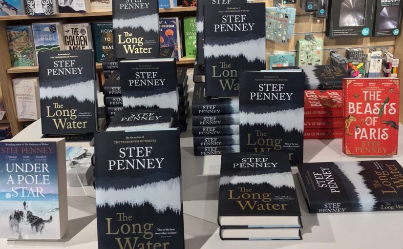
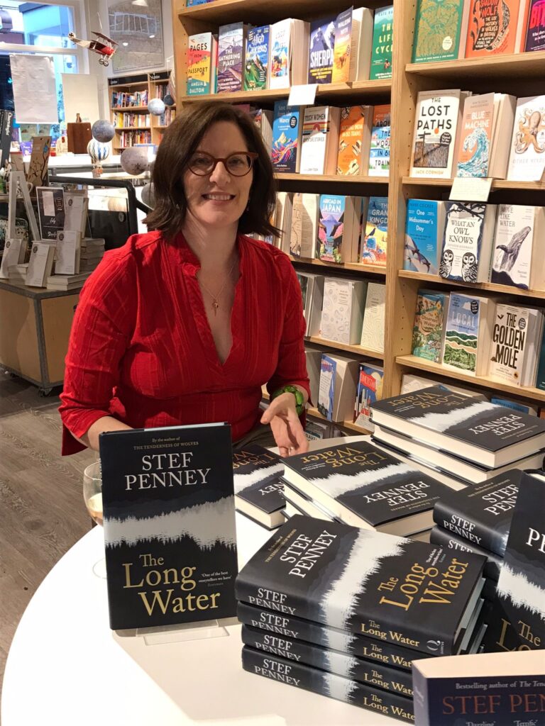
Book Launch: ‘The Long Water’ by Stef Penney
Last night we hosted the launch of The Long Water by Stef Penney.


Guest Post from Clare Hammond author of ‘On the Shadow Tracks: A Journey Through Occupied Myanmar’
Being a map and travel bookshop, we are famous for showing people the world from the comfort of their armchairs. When we can’t travel somewhere, we really rely on maps, books and travel writers to help us learn about the history of a country and its people so we can keep ourselves informed. A perfect example of this is Clare Hammonds new book On the Shadow Tracks: A Journey Through Occupied Myanmar. Here she shares with us some things she has learnt while travelling by rail around Myanmar.
Tips for rail travel in Myanmar
By Clare Hammond
In 2016, while working as a journalist in Myanmar, I came across an obscure map that showed a web of new railways spanning the length and breadth of the country – railways not shown on any other publicly available maps at the time.
It inspired me to pack a small backpack and set out on a three-month journey to piece together the story of why these mysterious railways were built. This journey would transform my understanding not only of Myanmar’s modern history but also of Britain’s colonial past. I hope my new book, On the Shadow Tracks, will inspire others to discover more about this shared history, including by (one day) travelling to Myanmar. Which brings me to my first tip for rail travel…
Continue reading Guest Post from Clare Hammond author of ‘On the Shadow Tracks: A Journey Through Occupied Myanmar’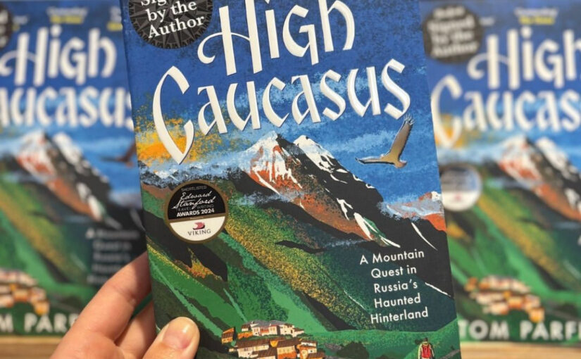
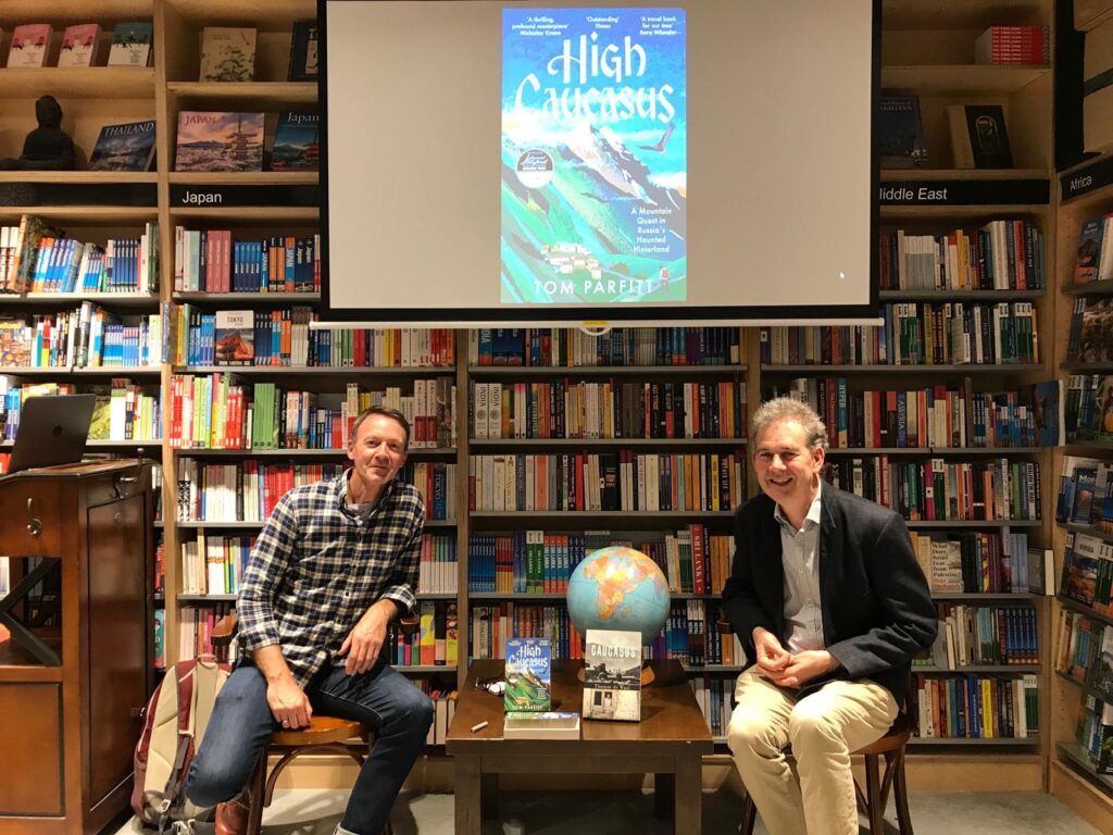
Author Event: High Caucasus by Tom Parfitt
To celebrate the paperback launch of this 2024 Edward Stanford Travel Writing Awards, Travel Book of the Year shortlisted book, Tom Parfitt came to Stanfords last night to talk to Tom de Waal about High Caucasus. It was such a fascinating, moving and sobering evening hearing these two experts on the region talk about reminiscences and predictions.
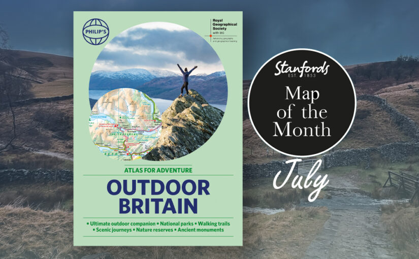
Map of the Month: Philip’s RGS Outdoor Britain
Our Map of the Month for July is the Philip’s RGS Outdoor Britain: An Atlas for Adventure.
Ever wanted to explore Britain’s finest National Parks, go surfing on the best beaches or follow the Pilgrims’ Trail? Philip’s RGS Outdoor Britain maps it all, from the majestic heights of the Scottish Highlands to the lush valleys of Wales and all the heritage and activities in between.
This ultimate outdoor companion clearly illustrates all the parks, trails, long distance footpaths, pilgrim routes and much more. So grab your boots (or swimmers), pack your rucksack, and reconnect with nature.
Contains information on the following:
Continue reading Map of the Month: Philip’s RGS Outdoor Britain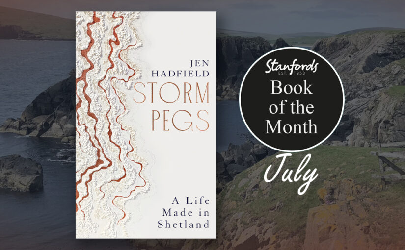
Book of the Month: Storm Pegs by Jen Hadfield
Our Book of the Month for July is Storm Pegs: A Life Made In Shetland by Jen Hadfield.
In her late twenties, celebrated poet Jen Hadfield moved to the Shetland archipelago to make her life anew. A scattering of islands at the northernmost point of the United Kingdom, frequently cut off from the mainland by storms, Shetland is a place of Vikings and myths, of ancient languages and old customs, of breathtaking landscapes and violent weather. It has long fascinated travellers seeking the edge of the world.
Continue reading Book of the Month: Storm Pegs by Jen HadfieldAuthor Talk: Atlas of Imagined Cities by Matt Brown, Rhys B. Davies and Mike Hall
Last night we welcomed the award winning team from Atlas of Imagined Cities, Matt Brown, Rhys B. Davies and Mike Hall to Stanfords for a fun filled evening.
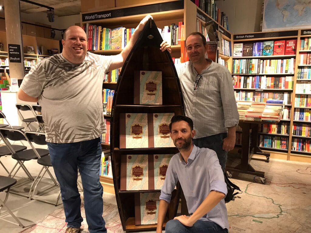
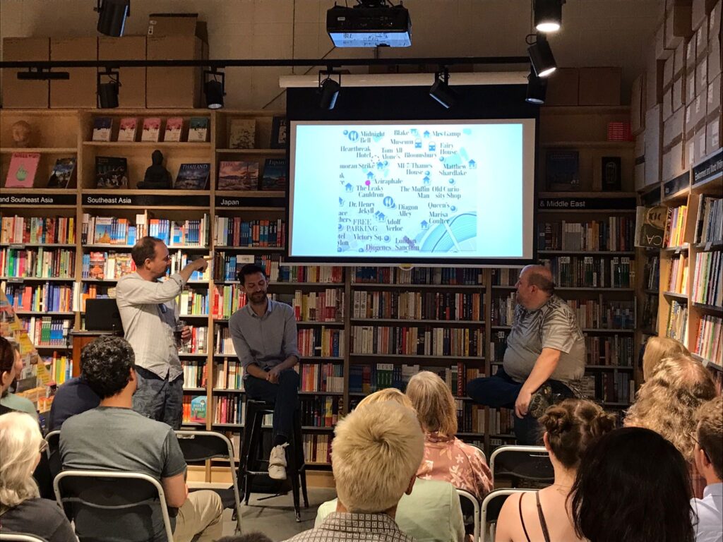
Following the success of their Edward Stanford Travel Writing Award winning previous book Atlas Of Imagined Places, this new atlas looks specifically at cities.
From the Ghostbusters HQ in New York to Nemo’s fish tank in Sydney, from the Phantom of the Opera’s Parisian lair to scenes from Grand Theft Auto in LA, this is an amazing atlas of imaginary locations in real-life cities around the world. Locations from film, TV, books, computer games and comics are ingeniously plotted on a series of beautiful vintage-looking maps.
Continue reading Author Talk: Atlas of Imagined Cities by Matt Brown, Rhys B. Davies and Mike Hall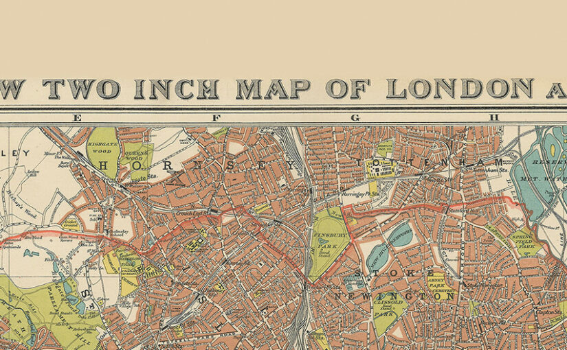
Stanford’s New Two Inch Map of London and its Environs. 1913
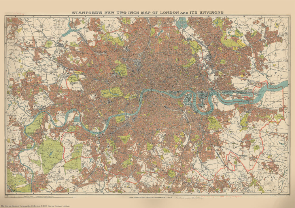
We are about to celebrate the 111th birthday of our Stanford’s New Two Inch Map of London and its Environs, 1913.
Published by Edward Stanford Ltd, 12,13 & 14 Long Acre . W.C . 1st July 1913.
This map from our Edward Stanford Cartographic Collection archive shows the capital the year before WW1 broke out at a scale of two inches to one mile.
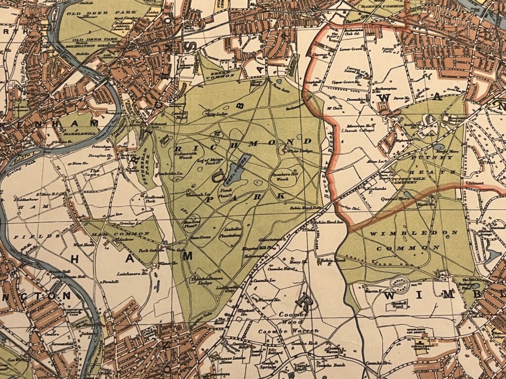
A thick red line shows the Boundary of the Administrative Country of London while a thinner red line shows the Boundary of the City of London.
Edwardian London saw a great deal of new building development which was halted by WW1 so not too many major changes would have occurred to this map for a few years.
Continue reading Stanford’s New Two Inch Map of London and its Environs. 1913