Wroclaw

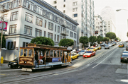
Here’s a story which you won’t find in many guidebooks, and not even in the highly acclaimed history of Wroclaw, Microcosm by Norman Davies. I found it in a little guide available in the city’s numerous bookshops and pass it on, if in a somewhat enlarged format from the original brief comment!

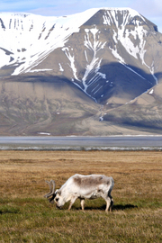
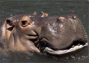
Before the war, Breslau – as the city was then called – had a fine zoo, opened in 1865, with its first animals donated mainly by local burghers. One of its most important early additions was an elephant bought in 1875 from the London Zoo with funds organized through raffles.

When, during the last war the eastern front started getting closer and the city began preparing itself to become Festung Breslau (Fortress Breslau – one of a string of cities which, it was hoped, would delay, if not prevent, the Russian Army reaching Berlin), some of the zoo’s animals were evacuated to the surrounding villages, among them its hippopotamuses. Whilst the animals which remained in the zoo were shot on the orders of the commandant of Festung Breslau, the hippopotamuses survived – the little guide does not mention just what the victorious Red Army soldiers thought of such fine examples of German livestock. And, sometime between the city’s final surrender on 6 May 1945 (three days after Berlin) and the reopening of the zoo in July 1948, the hippopotamuses returned to the place they had left, no longer Breslau but now Wroclaw.

So, thousands of Breslau’s citizens died, many of them having fled westwards to the neighbouring Saxony and its capital Dresden, only to perish there on that fateful night, and those who survived were eventually expelled from the city by the newly established Polish authorities. But the hippopotamuses not only survived, but also, presumably – because the little guide is silent on that point – successfully made the transition from being German hippopotamuses into pure Polish hippopotamhood.

Strange place, Mitteleuropa!

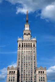
We recommend the Wroclaw Top 20 street plan published by Daunpol for a visit to the zoo and the surrounding area. The area includes many outstanding examples of early 20th century architecture – including the Hala Ludowa (People’s Hall), built in 1912 as Jahrhunderthalle to commemorate the defeat of Napoleon with, at that time, the largest reinforced concrete dome in the world. There is also the beautiful 1929 Bauhaus-style building designed as a model for flats for young singles or couples and now occupied by the Park Hotel, and the nearby Sepolno suburb built between 1919 and 1935 as one of the first ever “garden-city” projects –. For anyone particularly interested in the city’s history, a street plan of Wroclaw/Breslau from Höfer Verlag shows both the current and the pre-war German names.

Browse our collection of travel guides and maps to Warclaw >

Author: Malgorzata Ross

The Annapurna Circuit, Nepal

Peaks of 8,000 metres, Earth’s deepest valley and a dizzyingly high mountain pass are just some of the attractions to draw you into Nepal’s Annapurna region. Also on offer is a complete absence of cars and a veritable feast, both literally and figuratively speaking, of yak-based products!

Having longed to visit Nepal for years, my eventual arrival as I travelled overland from Delhi could not have been more anticlimactic. A combination of 36 hours solid travel, a road accident, and being scammed by a travel agent on the border meant my spirits were seriously low as I headed north. But when I was jolted out of my fitful sleep for the hundredth time on my ‘luxury’ night bus, I caught my first glimpse of the Annapurna Range towering above Pokhara, and all was well in my world once more.

The city of Pokhara is an experience in itself. Most tourists wind up in Lakeside, located, unsurprisingly, on the side of Phewa Lake. Lakeside is essentially one long road packed full of exceptionally slow web cafes, restaurants serving western food, and countless vendors of fake North Face gear. While not really capturing the essence of Nepal, if you’ve just arrived from India Pokhara can seem like an oasis.

Perhaps more importantly, the city is home to the offices of the Annapurna Conservation Area Project (ACAP), as any adventure into the Conservation Area will require an entry permit. I arrived in Pokhara with the intention of trekking alone, but after half an hour in ACAP HQ I’d teamed up in a gang of four. A new issue with trekking in the park is the recent advent of Trekking Permit legislation. The appeal of visiting the Nepalese Himalaya has traditionally been the feasibility of independent, or teahouse – trekking; new rules, however, mean you are obliged to take a guide. Having said that, the situation seemed fairly fluid when I was there, so check the ACAP website for up to date information. As it transpired, our guide Arjun only served to enhance what was an amazing experience.

Nepal Anapurna 
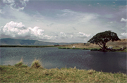
Within the Conservation Area there’s scope for a huge variety of treks long and short. We opted for the Annapurna Circuit, a long distance trek of around 300km that usually takes two to three weeks. Providing you’re in reasonably good shape and kitted out with some good boots the circuit should really hold no fear for you. Despite two or three tough days, particularly the Thorung La pass at 5,416m, the real danger is that the duration of the trek means the daily grind of getting up early and walking all day can turn into a slog. Fortunately, the scenery is varied and breathtaking, and unless you’re in a mad dash to catch a flight there’s nothing to stop you having a few slack days along the way to boost energy levels – the trekkers’ fuel of choice in these parts is usually apple pie. I’d recommend the villages of Braga (cake), Marpha (cider) and Sikha (daal-bhat) as good locations for rest days!

Like so many popular treks around the world, the Annapurna Circuit is in danger of becoming a victim of its own success and at times you find yourself in a continuous stream of human traffic. It seems unfair to decry this too much though as tourism provides a vital income for what is one of the world’s poorest nations. The popularity also ensures a fantastic infrastructure of teahouse accommodation serving excellent wholesome food along the way.

As well as the human traffic, the region is home to a rich variety of animals. Foremost amongst these, particularly at higher altitudes, is the yak. Whether it’s yak cheese, the New Yak Hotel, yak wool hats or Yakdonalds (I kid you not), this hairy Himalayan beast is inescapable. I only indulged in one yak burger on the entire trek, though I doubt the blackened hunk of meat served up between two slices of stale white bread would have passed the quality control in Yakdonalds. My standard fayre was the omnipresent daal bhat (lentils, rice and vegetable curry), which was generally superb.

At the risk of sounding clichéd, the worst thing about trekking the Annapurna Circuit is that it has to end. Despite the sense of achievement and the inevitable reward of ridiculously cheap steak washed down with copious amounts of beer in Pokhara, the descent from the village of Ghandruk towards driveable roads and civilisation left me feeling massively deflated. Having been back in Manchester for a couple of months now, the whole experience seems like a dream – a magical dream featuring golden eagles, avalanches on Gangapurna, and deep fried Snickers. I feel sure it is only a matter of time until I’m Nepal-bound once more.

Having previously used Trailblazer’s guide to the West Highland Way, I had no hesitation in picking up Trailblazer’s Trekking In The Annapurna Region. Although it would be pretty difficult – though not impossible – to get lost on the circuit, this guide added to my enjoyment every step of the way. I soon got into the habit of reading what was in store the following day as I was wrapped up in countless layers within my counterfeit sleeping bag. In addition to comprehensive information on treks in the Annapurna region, it also includes chapters on Pokhara and Kathmandu, as well as a wealth of background on Nepali history, culture and wildlife.

Browse our collection of travel guides and maps to Annapurna Region >

Author: Dan Weston

Himachal Pradesh

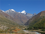
A week in Delhi is more than enough to make most people crave clean mountain air and I was no exception as four days of traffic-choked madness drove me in the direction of Himachal Pradesh.

Himachal literally means ‘Abode of Snow’ and the state nestles between Uttaranchal and Kashmir, sharing a mountainous border with Tibet to the east. Any exploration of Himachal is likely to begin in Shimla, formerly summer capital to the British Raj and popular with Indians and foreigners alike. Set in the Himalayan foothills, Shimla is a pleasant place to kick back for a few days but it doesn’t even come close to the wonders that wait if you head East. The road towards the Kinnaur Valley follows the route of the old Hindustan-Tibet Highway, though it now bears the somewhat less inspiring name of NH-22. Don’t however let the road’s designation as a National Highway fool you into believing that it will resemble anything remotely like a British motorway. The route to Kinnaur and Spiti is largely unpaved single tracks that spend much of their time clinging to the side of the impossibly steep Sutlej Valley. Local TATA buses are robust, but cramped in the extreme, and the stretch of ‘road’ between Rekong Peo and Tabo is truly hair-raising, with your view of the road’s edge being replaced by a 500m near-vertical drop to the seething boulder strewn Sutlej River below. In short, it rocks.

As the highway winds its way ever upward through Kinnaur, Hinduism gradually surrenders its hold and Buddhism becomes increasingly evident. The food also changes, with the mountain staple being daal & rice served in epic proportions. The rule of thumb seems to be that your plate is continuously refilled until you submit! The route is littered with small villages, a personal favourite of mine being Sarahan, and finding a bed is rarely a problem. A side trip to the Baspa Valley is well worth the effort – Chitkul, the final village accessible by road before reaching Tibet, offers possibly the most beautiful scenery I’ve ever strayed across. For the more adventurous, Chitkul is also a good base to start or finish a trek around Kinnaur Kailash – check out Lonely Planet’s guide “Trekking in the Indian Himalaya”.

The contrast between the alpine pastures and pine forests of Kinnaur with the barren desert constituting the Spiti Valley could not be starker. As NH-22 moves into a region sheltered from the monsoon by the rain-shadow it’s like stepping onto another planet. Weird and wonderful rock formations are dotted around a vast arid landscape and seemingly ubiquitous prayer flags are whipped by fierce dry dusty winds. Although I subsequently visited Daramshala, home of the Tibetan government in exile, the tiny villages of Spiti certainly came closest to my preconceived ideas on Buddhism.

From Spiti, it is a long and arduous bus ride to Manali in the Kullu Valley. Fortunately I was sustained by a combination of ferociously hot roadside food and mind-blowing views as we crawled our way over Kunzum La, a pass at 4,551m. Manali itself, with its large backpacker community, tends to divide opinion – I was a big fan, particularly of the old town. Though it’s quite possible to spend all your time listening to bad techno music, Manali’s surrounds offer similar scenery to that of Kinnaur in a less remote location. If you like walking but find multi-day treks intimidating Manali is perfect, with daylong valley walks aplenty. It’s also home to Dylan’s coffee bar, purveyor of the finest coffee and shortbread I stumbled across on my trip!

It may not be as hyped as the Manali to Leh road, but the journey through Kinnaur and Spiti is truly an epic.

I would highly recommend the Footprint India Handbook and Lonely Planet’s India guidebook, both of which I found to be invaluable.

Browse our collection of maps, guides and travel literature:
> India travel guides
> India road maps and atlases
> Travel literature inspired by India

Author: Dan Weston

The Rif and The Mediterranean

My chosen summer destination in 2006 was the Rif, an area of Morocco steeped in history and a site in modern times of transit and migration between Africa and Europe. The Rif stretches from the intense, profligate Tangier – home to the Beat writers in the 1950s – by the Strait of Gibraltar and the Spanish enclave of Ceuta in the far north of the country, through the Mediterranean towns of Tetouan and Al Hoceima, all the way to Nador and the calm beach resort of Saïdia – the last town in Morocco before you reach the heavily guarded Algerian border. Further inland, you’ll find mountain lakes, forests, tight hairpin turns and endless fields of Moroccan hashish – kif.

My own journey to this region, dominated by the mountains of the same name, involved arriving by ferry from Málaga early one evening in May. My point of arrival was a Spanish-owned enclave in Morocco – Melilla. It is an intense yet safe way of beginning a trip to North Africa – a site of languages, cultures and religions living side-by-side. I was never quite sure whether I was in Europe, Africa or the Middle East. Perhaps it’s all of these in one.

Although Melilla is a claustrophobic place to visit, surrounded as it is by the sea on one side and high border fences on the other, there is enough there to merit at least a day of your attention. A walk along the ancient walls of the medina at midnight was a unique and eery experience – as was the sight of a statue of General Francisco Franco hidden behind a builder’s storage unit near the port!

As there is no rail service to speak of in the Rif, travel between towns is necessarily by road – this can be done either by bus or shared taxi. I took a taxi, a five-seater Mercedes holding a driver and six squashed passengers, on my way to the Cap des Trois Fourches and the most beautiful lighthouse and secluded beach I have ever seen. Translated as the Cape of Three Forks, the name perfectly describes the shape of the coastline on this secluded peninsula, north of Melilla. Here, I learnt quickly the warmth and generosity of Moroccan people, on meeting both a soldier who was guarding the lighthouse and a local teenager offering an insight into the life and geography of the area. My extremely useful Rough Guide to Morocco and CR Pennell’s compact history of the country, Morocco: From Empire to Independence, were my other aids in this area, while I should have taken Carima’s Rif Occidental map too.

After a short, mapless, trek along the coast, taking in gorgeous vistas and being greeted by Berber families working their land, I arrived at Tibouda, a tiny, desolate fishing village of several small houses and many more boats. Moroccan hospitality was once again on the plate. After a polite request to pitch my tent in the village, I was served an afternoon Moroccan mint tea by a soldier who later that night gave me an impromptu lesson in the Arabic of astronomy as I gazed up at the clarity of the stars and the moon.

An early rise the next morning allowed me to see the fishing community in full action, with men leaving and others returning with their catch. But a rule I like to follow on my travels is to leave a place just when I feel comfortable, so I took another taxi to the relative hustle and bustle of Nador, before planning where I would next pitch my tent along the coast. The next few days took in Kariet Arkmane, Ras El Ma and Saïdia, all places where I could swim in the sea and sample mint tea, coucous and fresh Moroccan fish. At Saïdia, the long stretches of clean sand were punctuated by the Moroccan-Algerian border. When a soldier’s gun was raised as I brazenly brushed my feet through the first grains of Algerian sand, I realised my journey along the coast had come to an end.

With my coastal trip at a close, I decided it would be good to end my Moroccan adventure with a journey inland to Taforalt, a mountain village found in the Beni Snassen mountain range. Here I was warmly welcomed by a local farmer who gave me a tour of his fields, beehives and the beautifully decorated lounge and courtyard of his home. I also had the opportunity to meet his 80-year-old father who had been born here, attended the local school and fought against the French colonial army to defend his own fields.

The Rif, then, may be Morocco’s poorest and most underdeveloped region, but it offers the richest of experiences.

Browse our collection of maps, guides and travel literature:
> Morocco travel guides
> Morocco road maps and atlases
> Travel literature inspired by Morocco

Author: Tim Cleary

Arctic Europe

At 66 1/2º north the sun never sets on the longest day of the year, yet never rises on the shortest. This is the Arctic Circle, encompassing a suprisingly large part of Europe, including northern Scandinavia, to the east of this the Kola Peninsula in Russia, Greenland to the west and the Norwegian-owned Svalbard archipelago 1,000 miles north of Norway.

Amongst this variety of landscape is to be found a surprising diversity of flora and fauna, as climate changes from the wet coastal areas of Norway warmed by the Gulf stream to the dramatic dry ice walls of Thule in west Greenland.

Here are some highlights we’ve picked out for you:

Norway

Off the north-west coast the atmospheric spikes of Lofoten Islands pierce the sea, towering over tiny fishing villages. Opposite is Narvik, where you can ski above the coastline. Further north is Tromso, Europe’s most northern university town, and even further, NordKap, claimed to be Europe’s most northern point, and spiritual center for indigineous Sami people.

Sweden

Hike to Kebnekaise, Sweden’s highest mountain and an excellent area for climbing and cross-country skiing/snow shoeing/trekking. Further south is the Sarek National Park – ‘Europe’s Serengeti’, beautiful and challenging, it’s the continent’s biggest wilderness. At Ritzgrantzen there is a resort where you can ski or snowboard under the midnight sun.

Stay in The Ice Hotel – or just drink out of ice at the Ice Bar – just outside Kiruna, a stunning, majestic, artistic structure which melts into oblivion every summer.

Finland

Travel north through endless forests and lakes to Rovaniemi, the capital of Lappland. Planned in the shape of reindeer horns, it’s the home of Santa Claus’ post office and a great base for reindeer sledging. More remote is Utsjoki where you can see the lifestyle of the indigeneous reindeer herding population, the Sami. If you want to leave civilisation completely, trek or sled through the Saariselka Wilderness National Park.

Svalbard

Despite its geographical remoteness, these spectacular icefield and glacier covered islands are quite accessible (flights from Tromso in Norway for approx £250). Here you’ll find a suprising variety of flora and fauna, including seals, walruses, arctic foxes, polar bears, and many whales. There are many tours operated from the capital, including trekking, skiing , mountaineering, and wildlife watching. But beware, polar bears are a common sight!

Kola Peninsula, Russia

This rather unknown area of tundra and taiga forests is actually no further from England than Turkey is. It stretches east from its borders with Finland and Norway, bounded by the Barents and White Seas.

In Laplandsky Zapovednik, a 3,000 km^2^ natural wonderland, you’ll find excellent and remote ski-touring. More challenging is the Khibins Mountains, an area for hiking and mountaineering. Then there is Nikel. In contrast to Laplandsy, this is a moving landmark of post-apocalyptic mining hell, surrounded by 50km of devastated vegetation. Emphatically worth visiting for similar reasons to those that could take you to Pompeii.

Greenland

This place of tortured ice rivers, rocky peaks and tundra, surrounded by seas infested with icebergs and ice floes is quickly being discovered. It is partly covered by a 3km ice sheet. At Ilulissat Kangerlua there is an extraordinary icefjord, carved by a 1,100m deep glacier moving at 25m a day. Visit Tasilaq Peak on Ammassalik Island, with its crazy views of icebergs and ice floes on one side, an ice sheet on the other and a nature-filled valley with a wild town in it. Uummannag is a town hanging off rock faces, with an ice golf course. The favourite word here is “immaqa” – “maybe”.

Resources

The best all-round book to give you a taste is Lonely Planet’s Greenland and The Arctic which more or less covers everything worldwide above the Arctic Circle. Bradt do Tony Soper’s The Arctic: A Guide to Coastal Wildlife – “as vital as longjohns”. The Rough Guide to Scandinavia deals with the mainland only, though exhaustively. Lonely Planet’s Scandinavian Europe guide covers all of Denmark, Norway, Sweden and Finland, and also includes Svalbard and a detailed section on Greenland. Greenland is covered photographically in Kalaallit Nunaat: North East Greenland by Christian Kempf. You should also check out the colourful and authoritative Norsk-Polarinstitutt series covering Svalbard’s flora, geology and wildlife. Meanwhile the Kola Peninsula is covered in Lonely Planet’s now out of print Russia and Belarus.

Warsaw

I don’t like Warsaw, the city where I was born just three months before the most calamitous event in its history, the Warsaw Uprising, and where I lived until I came to London in 1965. To me Warsaw is ugly and characterless, but then what else can you expect from a city with such a horrendous past.

For my generation, and that of my parents, that uprising and the preceding years of wartime occupation still dominate the city, not just in the shrines and plaques on buildings, always well looked after and often decorated with fresh flowers, or in the numerous monuments, big and small, many of which have been erected since the political changes of the early 1990s, but in the very fabric of the city. The uprising, ruthlessly suppressed, gave rise to an order, equally ruthlessly executed in the central parts of the city, to have Warsaw wiped off the map, and the post-war decades have not been kind to it. Left with so many buildings destroyed and so many empty spaces to fill, urban planners and architects could exercise their meagre talents just as unsuccessfully as they did everywhere else worldwide, but simply on a greater scale. Continue reading Warsaw

Tanzania

East Africa: Home to the Big Five, the African wilderness and African snow. And it’s all in Tanzania.

I arrived here having crossed the world’s largest tropical lake, and indeed the second largest fresh water lake, Lake Victoria, to camp at Speke Bay – named after John Hanning Speke the British explorer who first sighted the lake in 1858, believing it to be the source to the Nile. Driving to nearby Mwanza takes you past some strange granite formations that seem to have been balanced by a giant in times past.

From there we headed into the Serengeti in an effort to spot the Big Five. And we weren’t disappointed. A pride of lionesses rested mid-attack as a wounded buffalo staggered around – these were true ladies that lunch. Elsewhere giraffe, with their long gait, seemed to glide around, while baboons, jackals and antelope frolicked at their feet. One of our party proved her amazing eyesight as we headed out of the park when she spotted a cheetah among the long grasses several hundred metres away. It would remain the only one we’d see in the wild over the next three months. The endless savannah, with the odd rocky outcrop offering a smattering of shade in the sun, is a sight that will never leave me.

Next stop: Ngorongoro Crater. The caldera that remains from a long-extinct volcano provides fantastic protection to the wildlife inside – and it is teeming. The only animals you won’t find here are giraffe, whose legs can’t cope with the steep crater walls, but flamingos and other birdlife are plentiful, as are hyenas, warthogs, and elephants. You even get the chance to leave your vehicle, but be careful because you can still be attacked, as I was. But it was only a bird swooping down to steal my sandwich; even so it was quite a whack to the head!

We wended our way towards Dar-es-Salaam, in the shadow of Mount Kilimanjaro, and stopped off at the small town of Arusha. Like many towns in this region street vendors sell everything from machetes to decorative spears, from necklaces to batiks.

Lonely Planet’s East Africa edition is chockfull of interesting items and suggestions, but if you want a guide to the wildlife – and trust me, you do – Insight Guides’ East African Wildlife gives clear information on seemingly everything. And if you’re feeling more energetic than I was, you may want to do more than just pass by the foot of Mount Kilimanjaro, in which case Kilimanjaro Trekkers Guide by Stanfords’ Alexander Stewart will be invaluable. Reise Know-How Verlag’s Tanzania map gives good detail.

Browse our collection of Tanzania Maps and Guide books here >

Tanzania travel information >

Author: James Innes Williams

USA – San Francisco, California

San Francisco, like New York, is an un-American city. They’re different from the rest. And while New York is characterised by its hurly-burly and take-no-prisoners population, San Fran has gone completely the other way.

Downtown is, of course, reaching for the sky, but elsewhere building heights are limited to only a few storeys – meaning that from almost any hill you have a view stretching right out to the city limits.

Continue reading USA – San Francisco, California

Canada – Northwest Territories

Canada

I first came to Canada to paddle down the Nahanni River in the Northwest Territories. We flew into our starting point, just south of the Arctic Circle, in a DeHavilland Single Otter sea-plane. Landing at Moose Ponds was almost the end of the trip, however, as the pilot nearly ran out of lake…

A three-week trip takes you past glacial lakes, hot springs, and numerous rapids. Hiking opportunities are plentiful, and it’s definitely worth taking a day to climb the mountain peak at Virginia Falls – an unspoilt waterfall twice the height of Niagara.

While the pilot nearly killed me on day one, I had a go myself while clambering over Virginia Falls, but the closest we came was in the middle of the night when our river island flooded – we clambered into our canoes only once the water had reached knee-height.

Eventually you pass through Hell’s Gate whose walls tower 460m above, and then the river becomes calmer (well, ok, you do have Deadman Valley and Headless Creek to negotiate too). But it’s well worth taking the trip to spot all sorts of truly wild wildlife including moose, beaver and the odd grizzly bear if you’re (un)lucky. And you may also see the Northern Lights.

A few years later I came back to western Canada on a tour of North America. Following a quick couple of days in a rainy Vancouver we headed east to Banff National Park. So much snow set in that we could not even leave the campsite, and so spent a few days in the public sauna and around an old Space Invaders table.

Once the sun had been out long enough to free our truck we headed north to a frozen Lake Louise. The lake and its surroundings are quite magnificent, but if you want to come in from the cold you can enjoy the views from the warmth of the lavish Fairmont Chateau on the edge of the shore.

Any trip to this area requires a visit to the world’s biggest mall in Edmonton, complete with rollercoaster, ice rink, and waterslides all under one roof. If that sounds a bit tame however, head to Calgary, the host of the Winter Olympics in 1988, and, with your heart in your mouth, slide down the luge.

It’s a vast area, but to mark out my various destinations the Canada: The West road atlas by Hildebrand was indispensable, but now out-of-print, along with the North Canada Bradt Guide, which provided excellent detail on the Northwest Territories. Now instead try and the Moon. Robert Twigger’s book, Voyageur provides plenty of tales and adventure as he journeyed across the Rocky Mountains in a birchbark canoe.

Browse our collection of Canada Maps and Guide books here >

Author: James Innes Williams