England – Essex

Essex

I know a place that’s the best spot in Britain to avoid the rain, find unspoilt sandy beaches, eat freshly caught oysters, and walk through scenery unchanged since the early 19th century. Why, it’s beautiful Essex of course.

For starters, believe it or not, Essex has one of the longest coastlines in England at no less than 300 miles. And in most places it’s actually rather attractive. You don’t get any of those nasty uncomfortable stones of Brighton beach, instead there is sand – yes, soft, golden, glorious sandy sand. You can sink your toes, build castles, dig out boats, bury dad… Continue reading England – Essex

Stanfords’ award for printed mapping 2008 announced

The winner of the Stanfords Award for Printed Mapping was announced at this year’s British Cartographic Society’s (BCS) symposium, and our own shop floor manager Stephen Edwards was there to present our awards certificates.

The British Cartographic Logo Society The Stanfords Award for Printed Mapping was created to encourage any printed products to be entered, from coffee-table atlases to maps featured in leaflets or topical articles. Past entries have ranged from world map wallpaper to artistic interpretations.

Stephen said, “I really enjoyed visiting the BCS symposium and awarding the prizes. The maps entered were all of a very high standard and between them, the five winning entrants represented a diverse range of printed mapping.”

The judges decided as well as the winner, two highly commended and two commended certificates should be presented. Continue reading Stanfords’ award for printed mapping 2008 announced

Baarle-Nassau

First of all, before I’m found out by some obvious blunder, let me confess. I have never been to the two places I intend to write about now. Somehow during my nine years living and working in Amsterdam, I never got round to going there. Terrible lack of curiosity, I know! I’m simply hoping that without any articles about Belgium or the Netherlands in our “We’ve been there” section, this piece will get accepted for inclusion there.

I learned about Baarle-Nassau and Baarle-Herzog by accident. A customer in the Amsterdam shop where I worked left a Dutch survey map lying around and before putting it away, intrigued by some of the markings, I had a quick look at it. And that’s how I discovered one of those curious leftovers from Europe’s complicated history – Belgian enclaves in the Netherlands, with Dutch enclaves inside them! Unlike enclaves in other parts of the continent – Campione or Livia (Llivia) – this one is not just a bit of Belgium stuck inside its neighbour but… I think Wikipedia can say it better than I can: Continue reading Baarle-Nassau

The Lecrin Valley, Andalusia

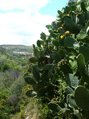
For my holiday, I travelled back in time. Or at least, that’s how it felt. I stayed in a whitewashed village in Spain where mules laden with panniers plod the narrow lanes; men sit in doorways weaving basketware, while women in black dresses sweep the paths outside their homes.

Best of all, there are no tourists…well, hardly any.

We had rented a house in Albuñuelas – a gorge-side village at the very end of the road in the Lecrin Valley, Andalusia. This valley is situated opposite the Alpujarras, 20 minutes off the motorway between Granada and the coast, but feels a million miles – and years – away. The crowds have yet to stray across here, but the scenery is just as stunning and the villages just as dazzling white as those in the Alpujarras. In fact, although we set off on this holiday specifically to trek in the Sierra Nevada and wander through the honeypot villages of Bubion, Campiliera, Trevelez and so on, we never set foot in any of them. For, you see, there was something about Albuñuelas that made it very hard to leave, and it wasn’t just the rudimentary and winding road that is its only access route.

Albunuelas Village
Albuñuelas dates back to Moorish times – the name derives from Arab for abundance – and was on the route of Arab traders such as Leon the African and Al Idrisi, the famous early geographer. As recently as early last century, the village was accessed by nothing more than a mule track. Most of the streets within the village are too narrow, steep and zig-zaggy for modes of transport other than mules, so these are still used by the farm workers to transport their produce. We got very excited whenever we heard the clip-clopping of hooves in the street below and would rush to the balcony to watch this pastoral sight with glee.

Many of the village houses remain in the traditional layout, with the lower ground floor used as animal stables, and the families’ living quarters on the upper floors, with miradors (open-fronted rooms, or balconies) on the top floors used for hanging chillies and hams to dry in the air.

We learnt quickly to communicate in basic Spanish, and despite our stumbling grasp of the language, the villagers waited patiently as we stuttered out words – we even managed, “I have enjoyed myself very much!” after one particular bar visit.

As this is one of the few remaining areas of Spain where the tradition of receiving the tapas free still holds strong, we fell only too easily into the custom of cerveza (beer) and tapas at the village bars. We found it hard to stop drinking when such delights as chorizo, garlic potatoes, spinach omelette, ham and bread, fresh olives, or black pudding would appear with each round.

Mule On Gr7 Walk From SaleresThere is an abundance of walks from Albuñuelas and the long-distance GR7 trail makes its way straight through the village on the way to Istanbul or Algeciras – depending on which way you’re heading. We joined a short section of it from the village of Saleres back to Albuñuelas at the end of a circular walk. It looked as though no-one had walked it for a long time as the path was hard to decipher at points, overgrown almost entirely with tall grasses and weeds, we were concerned we were in fact following a dried-up stream on many occasions.

Following the River Santo, the path passes impressive Aloe Vera plants, whose soothing juice the locals discovered long before the beauty industry did. Thinking we might be lost forever in the foliage, all of a sudden we were walking on concrete and were immediately in one of Albuñuelas’ lanes.

Our house was situated in the lower barrio (quarter) of the village, and within moments of our doorstep, we could stand on the side of the gorge surrounded by orange and lemon trees and massive flowering cacti, with nothing to hear but trickling acueqias (water channels to the farms) and enthusiastic birdsong.

The views from here are spectacular, bordered by the Sierra de Albuñuelas (where fugitives lived after the Spanish Civil War) and the Sierra de Guajar, with vistas of the first high peaks of the Sierra Nevada.

It is easy to walk up onto the ridge above the village where parvas (large circular stones used for threshing flour) lay, only recently abandoned for more up-to-date techniques.

Our last day came round all too quickly of course, and we were reluctant to leave this little spot of unspoilt Spain, and return to the clamour of modern-day life.

The Michelin Costa del Sol 1:200 000 map (124 Zoom) was perfect for all our driving needs, from negotiating the slip roads of Malaga airport and Granada, to motorways and to the winding mountain roads. It covers from Gibraltar to Almeria and from the coast up to Granada.

The 50K Military Topographic Survey Map of Durcal Sheet reference: 19-43 has the best coverage of the Lecrin Valley of any map currently printed.

The Cicerone Walking the GR7 in Andalucia guide includes the route of the GR7 through Albunuelas and the rest of the Lecrin Valley, with a brief guide to the village’s amenities and sights.

Just come into stock while I was writing, East of Malaga by David Baird includes Albuñuelas and other towns in the Lecrin Valley in this ‘essential’ guide to the Axarquía and Costa Tropical.

Perfect holiday reading for a stay in Andalusia, I read Tales of the Alhambra by Washington Irvine, Laurie Lee’s admirable As I Walked Out One Midsummer Morning and Gerald Brenan’s fascinating South From Granada, and for lighter reading, all three of Chris Stewart’s amusing biographical tales.

Author: Rachel Ricks

Turkey – Istanbul

A well-travelled friend of mine, who has lived and worked in places where most of us have, at best, spent a few days visiting their famous sights and, if lucky, had a memorable meal or two, thinks that there are just seven great cities in the world. To put them in an alphabetical order: Athens, Cairo, Istanbul, London, New York, Paris and Rome. I don’t need to ask him why those seven, I know exactly what he means, and if you put them in geographical, or, better still, historical order it’s obvious what guides him in his choices.

By my criteria there are only three: Paris and New York, with London at the top of this very short list. The other four may have been great once, not so very long ago given their history, but have lost at least one of the ingredients which made them so. Perhaps I should not comment about Rome – I’m yet to visit the Eternal City.

A few months ago, revisiting Istanbul after a break of some 30 years, it was still just as fascinating as I found it on my first visit there. Is there any other city in the world with such magnificent topography? So much water, so many hills, so much sky pierced by the minarets. Aghia Sophia was just as stunning, the Basilica Cistern just as atmospheric and I did not really mind the new arrangements there, the mosaics and frescoes at the Chora Church just as “jaw-dropping” as the guidebooks tell us – the carpet-sellers just as annoying, the hills along the Bosphorus slowly disappearing under the urban sprawl, and the new (to me at least) Galata Bridge simply dreadful.

Descending from the Galata Tower towards the Golden Horn we came across a small church, like many other Latin churches separated from the street by a walled courtyard. The church itself was closed and we were too sleepy after a good lunch to investigate how to get inside. The walls of the courtyard were interesting enough; tombstones, with descriptions in florid Italian, recalled Istanbul’s once thriving Genoese community. Like many other “foreigners” they were, apparently, driven out of the city by punitive taxation imposed on non-Turkish inhabitants after World War I – a very mild form of ethnic cleansing by other standards, I suppose.

Now you know why I put London at the top of my list.

As luck would have it, most of our street plans of Istanbul were being reprinted, so we used the Geocenter one. It’s what is now regarded as an old-fashioned street plan – all the sights are there, of course, but not specially highlighted as on more tourist-oriented plans. It proved an excellent choice and heroically withstood endless re-folding without any damage. Had it been available at the time, I would have probably been tempted by the Borch map of Istanbul.

For guides, we used both Lonely Planet’s guide to Istanbul and the Istanbul section of the Rough Guide to Turkey, occasionally also dipping into Time Out Istanbul. Spoilt for choice we are in Stanfords.

Author: Malgorzata Ross

Browse all our maps and guides to Turkey here >

Austria, Vienna

Vienna
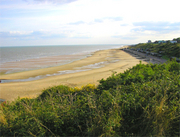
Guide books and maps are, of course, necessary if we are to get the best from our holidays. They tell us what to see and how to get there, and if we buy them early enough they can also help us choose a good hotel in a convenient location.

The best ones do provide information on a wide range of places to see, even if some guides limit their contents to the most obvious and invariably overcrowded ones. But returning from holidays it’s nice to bring back memories of places which, whilst not in the “must-see” league, speak more to us than the better known or historically and artistically more important sights. Here are my three from Vienna.

Beethoven’s house
On Mölker Bastei, perched high up above the western part of the Ring is Pasqualatihaus, one the houses where Beethoven used to live. One of several houses, because the great composer was not the easiest of tenants and frequently had to change his lodgings; he tallied up over 30 addresses in his 35 years in Vienna. Apparently cleanliness was not one of his strong points – one cannot somehow imagine a sonata in B-flat, op. whatever, “The Fairy Liquid”.

The little museum on the top floor of the house is nothing special – a piano, reproductions of some scores and letters, a few pictures, and equipment to listen to some recordings. The museum is nowhere near as interesting as the Beethovenhaus in Bonn, with its collection of the composer’s gigantic hearing aids. But two of the symphonies and a piano concerto were composed here, and that’s quite enough for me to make the place a shrine.

The house has obviously been renovated several times, but the staircase still retains its old atmosphere. One can easily imagine the great man thundering down allegro con brio, or even con fuoco, and then lumbering up the stairs back to his hovel, now only andante sostenuto.

Stalin’s Obelisk
When, after 10 years of tortuous peace negotiations, the Soviet Union finally signed the Austrian State Treaty, withdrawing from its zone of occupation and Vienna to allow the country become independent on 15th May 1955, the main condition was, of course, Austria’s political neutrality between the two Cold War blocks. But further down the list, in not-so-small print was a clause ensuring proper upkeep of monuments to the conquering Red Army.

Less than a year later, at the 20th Congress of the Communist Party of the Soviet Union, Nikita Khrushchev denounced Stalin’s dictatorship and his personality cult and soon after Uncle Joe was kicked out of the mausoleum on Red Square. His statues came tumbling down and his name was quickly erased from street names and various dedications (I witnessed much of it myself in Warsaw). But, in the now neutral Vienna, Слава Великому Сталину continued to be proclaimed in shining gold letters.

The neutrality may have vanished with Austria’s accession to the European Union, but the Russian Heroes’ Monument on Schwarzenberg Platz is still well maintained. Whilst I struggled with the Cyrillic letters to read Stalin’s proclamation to his victorious troops (the language is easy for a Pole, but the alphabet has always defeated me!), a young Russian couple visited the site; beaming with pride, yet clearly able to see the irony of it all.

Franz Joseph’s ginkgos
There must be something in Vienna’s climate or its soil which makes them particularly good for ginkgos. There’s a lovely, large one in the Rathaus Park between the Ring and the Town Hall. But the best ones are in the Burggarten. They must have been planted there when the park was still a private garden of the imperial palace of Hofburg. If you are in Vienna in the autumn, the best time for a holiday in central Europe, go and see them after a visit to the Albertina or to the palace itself. The largest one is right in the centre of the park, between the Mozart monument and the Palm House, standing at that time of the year in the middle of an amazing carpet of bright yellow leaves.

Oh, and if you want a tip where to find something more tangible to bring back with you, try the pottery shop on the northern side of Weihburggasse, between Kärtner Straße and the Franziskaner Platz. If you come back with one of those large central European tiled stoves, £2,500 or more a piece if not quite so many pounds in weight, I’ll be really envious.

During my visit I used the Borch street plan of Vienna and the Rough Guide to Vienna.

Maps and Guide books for Vienna

Author: Malgorzata Ross

A Map of Hell

Dr Peter Whitfield

Dr Peter Whitfield looks at the ghost story writer M R James and his connection with maps.

Mr Humphreys and His Inheritance

by M R James

Montagu Rhodes James (1862-1936) was a prolific British scholar, medievalist and palaeographer, who catalogued all the important manuscript collections in Cambridge, England. He became Provost of King’s College and then of Eton. He never married, but lived his entire life in the enclosed male realm of academic scholarship and college administration.

He also wrote some two dozen ghost stories which have carried his name far beyond the world of scholarship. But to call them ghost stories is misleading, for no white figures glide silently through darkened passages, or are glimpsed in the moonlight. James’s ghosts are demons, bestial and horrifying, and their power is physical, capable of stripping their victims’ flesh from their bones, after hunting them down and reducing them to terror. A typical James narrative shows this demonic thing escaping, getting out from the place where it has been imprisoned.

With a scholar’s delight in antiquarian detail, James invariably chooses a historical artefact – a picture, a piece of jewellery, a stained-glass window, a manuscript, an ancient well – as the prison, and it is invariably a curious scholar whose over-eager researches release the terror, and who pays the price. Not all the stories are successful by any means: some are wooden in their characterisation and over-fussy in detail, but when they work, the best of them distil an atmosphere that is not easily forgotten.

Given James’s typical approach – the fascination with manuscripts and with historical detail – it might be expected that an old map should form the mainspring of one of his plots, the focus of a haunting. Although James never used an identifiable historical map in quite that way, in his story Mr Humphreys and his Inheritance, the plan of a maze drawn by its owner does indeed act as the vehicle by which a demon lurking within the maze is released. There is a double cartographic interest in this story, because it transpires that the demon has been imprisoned in a decorative globe, which has been set up at the maze’s centre. It should be explained that Mr Humphreys has recently inherited an old house whose gardens contain the maze. The maze was laid out by his grandfather, a mysterious figure who died abroad and has no known grave or tomb. The maze has been locked and barred for years, and Mr. Humphreys has just penetrated it for the first time, finding the ancient bronze globe at the centre:

The column was featureless, resembling those on which sundials are usually placed. Not so the globe. I have said that it was finely engraved with figures and inscriptions, and that on first glance Mr.Humphreys had taken it for a celestial globe: but he soon found that it did not answer to his recollection of such things. One feature seemed familiar: a winged serpent – Draco – encircled about the place which on a terrestrial globe is occupied by the equator: but on the other hand, a good part of the upper hemisphere was covered by the outspread wings of a large figure whose head was concealed by a ring at the pole or summit of the whole. Around the place of the head the words “princeps tenebrarum” could be deciphered. In the lower hemisphere there was a space hatched all over with cross-lines and marked as “umbra mortis”. Near it was a range of mountains , and among them a valley with flames rising from it. This was lettered (will you be surprised to hear it ?) “vallis filiorum Hinnom”. Above and below Draco were various figures not unlike the pictures of the ordinary constellations, but not the same. Thus a nude man with a raised club was described not as Hercules but as “Cain”. Another, plunged up to his middle in earth and stretching out despairing arms, was “Chore” not Ophiucus, and a third, hung by his hair to a snaky tree was Absalom. Near the last, a man in long robes and high cap, standing in a circle and addressing two shaggy demons who hovered outside, was described as “Hostanes magus” (a character unfamiliar to Humphreys). The scheme of the whole indeed seemed to be an assemblage of the patriarchs of evil, perhaps not uninfluenced by a study of Dante. Humphreys reflected that it was an unusual exhibition of his grandfather’s taste, but reflected that he had probably picked it up in Italy.

Far from being a globe of the heavens, the writer is making it clear that Humphreys has stumbled on a globe of hell. All the characters named above are figures of evil, now damned in a Dantean inferno. Humphreys fails to realise the sinister significance of what he has seen, and plans to re-open the maze and show it to his neighbours. As a first step, he spends an afternoon drawing a plan of the maze in situ, and later that night he settles down in his library – by lamplight with bats flitting by the window – to copy it:

It was a still, stuffy evening: windows had to stand open, and he had more than one grisly encounter with a bat. These unnerving episodes made him keep the tail of his eye on the window. Once or twice it was a question whether there was – not a bat, but something more considerable – that had a mind to jolt him. How unpleasant it would be if someone had slipped noiselessly over the sill and was crouching on the floor!

The tracing of the plan was done: it remained to compare it with the original, and see whether any paths had been closed or left open. With one finger on each paper, he traced out the course that must be followed from the entrance. There were one or two slight mistakes, but here near the centre, was a bad confusion, probably due to the entry of the second or third bat. Before correcting the copy, he followed out the last turnings of the path on the original. These at least were right; they led without a hitch to the middle space. Here was a feature which need not be repeated on the copy – an ugly black spot about the size of a shilling. Ink ? No. It resembled a hole, but how should a hole be there ? He stared at it with tired eyes: the work of tracing had been very laborious, and he was drowsy and oppressed….But surely this was a very odd hole. It seemed to go not only through the paper, but through the table on which it lay. Yes, and through the floor below that, down, and still down, even into infinite depths. He craned over it, utterly bewildered. Just as, when you were a child, you may have pored over a square inch of counterpane until it became a landscape with wooded hills and perhaps even churches and houses, and you lost all thought of the size of yourself and it, so this hole seemed to Humphreys for the moment the only thing in the world. For some reason it was hateful to him from the first, but he had gazed at it for some moments before any feeling of anxiety came upon him; and then it did come, stronger and stronger – a horror lest something might emerge from it, and a really agonizing conviction that a terror was on its way, from the sight of which he would not be able to escape. Oh yes, far, far down there was a movement, and the movement was upwards – towards the surface. Nearer and nearer it came, and it was of a blackish-grey colour, with more than one dark hole. It took shape as a face – a human face – a burnt human face: and with the odious writhings of a wasp creeping out of a rotten apple, there clambered forth an appearance of a form, waving black arms prepared to clasp the head that was bending over them. With a convulsion of despair, Humphreys threw himself back, struck his head against a hanging lamp and fell.

Humphreys is in shock for some days, then recovers sufficiently to order the globe to be broken open: inside are found ashes, evidently remains of a human cremation. In some unexplained way, his ancestor’s remains had been hidden in the globe, and the drawing of the map allowed his spirit to escape out of the hell where it had been confined. The implication is that Humphreys’ ancestor was some kind of necromancer, a devotee of the occult, who had suffered the appropriate punishment. In this instance, Humphreys sustained no harm, but the other scholars in James’s stories usually suffer death – and a death so horrifying that those who see the body are haunted forever by the memory.

There is no ultimate explanation of the curse or the haunting: everything proceeds by hints and by suspicion. The pieces of the jigsaw are placed before the reader, but the author never quite puts them together for us. The intriguing thing about these stories is James’s fixed belief that a haunting requires a historical focus as its vehicle: a globe, a manuscript, a picture, or an inscription, becomes the focus of the demonic power. James seems to have seen in the artefacts of the past a concentration of old, pagan, demonic forces, which he delights in releasing into modern England. The temptation to psycho-analyse James himself is irresistible: in the composition of these stories, what was this disciplined and fastidious scholar releasing from the depths of his psyche.

Author: Peter Whitfield

USA – New England

I love the New England countryside; forested mountains, hilly pastures, red barns – postcard pictures. We decided to go there in the middle of September – which was too early for the famous autumn colours – so that we could escape the crowds which usually fill the rural roads during October, and to save some money of course as well.

After three days in Boston we headed north and that’s where, for me, the real New England begins.

My favourite New England state is Vermont, especially the Lake Champlain coast and islands. From Burlington we took US Hwy 2 north and then across the causeway, to visit tiny settlements located on the lake’s islands. From the south they are: South Hero, Grand Isle, North Hero, Birdland, Alburgh and some other tiny hamlets whose names I don’t even remember.

There you can visit country stores, art galleries or local cafés. Even when stopping for petrol you can chat with friendly locals over a cup of tea or coffee. We would have liked to stay a few days more in the area, but as it is with such road trips we had more things to see and not that much time. After crossing yet another causeway we entered New York State, specifically a town called Rouses Point. Most people associate this state with the urban craziness of New York City, but up in the north, next to the Canadian border, things couldn’t be more different; towns are small, country music rules and the sky is big.

We decided to eat at the tiny Gino’s Pizza – a place where the furniture harks back to the early ‘80s, people are friendly and the chef looked like he had just arrived from Naples, yet spoke with strong Yankee accent. When we asked for a big pizza, he said that because we are Europeans we should have a look how big the big pizza actually is. It was absolutely enormous so we took his advice and scaled down to the medium one (which was still bigger than any big pizza you can get anywhere else).

Absolutely full, we headed north again. After crossing the Canadian border without much hassle at the quiet and deserted border station we drove towards Montreal. I expected a lot from the famous city but unfortunately I was seriously disappointed. The biggest reason was due to the dreadful weather – it was raining like a hell for whole afternoon so we only had a quick walk and went back to our car completely soaked. At this point we decided to pass on Montreal sightseeing and drove west towards Toronto, hoping for a change of weather.

And what a difference a day can make. The following day was absolutely fantastic – sunny and warm but not too hot; perfect for a peaceful drive. We went off the main motorway and decided to explore the back roads. I especially recommend the Thousand Islands region, and the best way to visit it (apart from a boat of course) is to drive the 1,000 Island Parkway. It is an absolutely amazing road hugging water all the time with great views over the islands. Some of them are tiny with just one tree, on some there are houses, on others whole mansions and even a castle.

Another good way to see the varied topography of the St Lawrence waterway is a visit to the viewing tower located on the Hill Island, right next to the border crossing to the US. To get there you have to drive along a narrow and steep suspension bridge alongside massive 18-wheelers. It is a bit scary. From the top of the tower you can see how many islands and channels create the region. At the westernmost point of the region is the historic city of Kingston where you can stop for dinner or a bit of shopping.

Our next destination was Toronto. Driving from the east we used the famous (or infamous) Hwy 401. Some say it is the busiest road in the world; it has anything from12 to18 lanes and it is a weird experience to drive it. Fortunately we arrived to the Toronto area late in the evening and avoided the notorious 401 rush hours.

Toronto is actually a very nice city. If Montreal was a disappointment, Toronto was a big pleasant surprise (great weather definitely helped for a more positive experience). The day started with a visit to the CN tower. For a long time it was the tallest free-standing structure on earth but by the time of our visit it had already been overtaken by Burj Dubai. To be honest it doesn’t really matter it is not the tallest any more, it is still an amazing structure and offers stunning views from the viewing platform at 346m. Everyone brave enough should try to walk over the glass floor panels. Even I knew this was a very strong, perfectly safe floor, I still tried to step on the little metal frames joining the glass panels. I also realised that most people did the same thing.

After the tower we walked around the nice and compact Toronto downtown and visited the provincial parliament building which offers quite interesting, free, guided tours.

The best part of the whole Toronto experience was a visit to the beaches. Yes, Toronto has beaches – just a few miles east from downtown. All you have to do is to take a cool, old fashioned red tram and in 30 minutes you can enjoy the seaside-like environment. The beaches are surrounded by attractive old houses, and the main drag (Queen Street East) offers great food and shopping. There is even Kew Gardens for homesick Brits; they are a bit smaller than our Kew but it is still a nice spot. Our day in Toronto ended with a long walk along the beach at the sunset.

The following day we went towards Niagara. But before we reached the famous waterfalls we popped in to Niagara-on-the-Lake. It is a lovely small town set – as the name suggests – on the lakeshore and surrounded with wineries. It is a complete tourist trap, full of tour buses and American tourists looking for a British experience close to home. But it is still worth visiting and offers especially good shopping – locally made wine, Irish accessories, antiques, and organic food. And of course it is the perfect place for an afternoon tea.

The best way to approach Niagara Falls is to drive the Niagara Parkway – a scenic road connecting Lake Ontario with Lake Erie and follows the Niagara River for its entire 56km. Some say Niagara Falls is so commercialised, kitsch and tacky that going there it is a complete waste of time. I don’t think so. True, there are all the possible gift shops and tacky attractions you can only imagine, but the falls itself are still worth seeing. We just ignored the encroaching kitsch, and concentrated instead on the falls, which is not too difficult because they were truly amazing. I recommend going down to the base of the falls; after paying quite a hefty fee you can enter the tunnel leading to the base and it is worth every penny. As we approached, we could feel that everything was vibrating; the thousands of tonnes of falling water was making the ground shake. We stood on the platform with the falls right next to us – in fact, almost directly above us. We also went through smaller side tunnels which open right behind the curtain of water.

After the whole experience we were almost completely soaked; the plastic ponchos you get when you enter the tour don’t give much protection against the eternal mist forming behind the falls.

We continued south on the Niagara Parkway, which becomes very rural and quiet just a few miles from all the hustle and buzz of the falls. But it still offers beautiful scenery and is worth driving.

We entered back into the US at Buffalo which is completely insignificant and not worth a stop, although the countryside around it is very pleasant. We went off the main highway again to drive the back roads of upstate New York. We got a bit lost and almost ran out of fuel but saw plenty of nice towns and villages. After dinner in one of these small towns, we headed east towards the Big Apple, still a long way to go. We had to spend a night somewhere and it wasn’t easy to find motels off the main interstate highways in this rural region. We finally spotted one in the town of Warsaw. It was one of the dirtiest and dodgiest motels I have ever slept in, but it was late, we were tired and it was extremely cheap. Anyway, if you can, avoid staying in a motel in Warsaw.

The next day was spent driving the quiet highways on the New York – Pennsylvania border heading steadily towards New York City, which was our final destination. But this is the subject for a completely different story.

Author: Gregor Swiderek

Browse our collection of maps, guides and travel literature:
> USA travel guides
> USA road maps and atlases
> Travel literature inspired by the USA

Stanfords launches Geographical Information System (GIS)

Stanfords is pleased to announce the arrival of our ground-breaking Geographical Information System (GIS).

Designed primarily as a web-based asset management tool, our new GIS is a simple and efficient alternative for anyone involved in the management, maintenance or development of property portfolios. This could include landlords, housing associations, estate agents, property developers, maintenance contractors, solicitors, police, and the fire service.

The system is also useful for individuals who are responsible for maintenance or the management of records and who require to keep this information in one easy-to-access system. For example, a company managing fire extinguishers in all the local primary schools.

Set-up is straightforward and quick; the system is extremely easy to use and requires very little training or maintenance. Continue reading Stanfords launches Geographical Information System (GIS)

USA – Disney World

So why do people travel? Many hope to experience different tastes, different cultures, many aspire to an inner journey in which some internal turmoil may be resolved or expect a new life path to be revealed.

For others, and it could be a majority of the 55 million UK residents who go abroad, the desires are more basic: they want to enjoy themselves for two weeks of the year, they want the family to be happy, they want to escape the humdrum of the norm’ and they want to feel sunshine on their backs.

We were on a package deal to Disney World, Florida, which included our flight, accommodation in a Disney Resort Hotel and access to all the theme parks. We were also given a Mickey Mouse credit card that you use to pay for food and gifts. This made it very easy to spend money, especially as everything you buy is delivered to your hotel, so you don’t have to cart round your three-foot high Winnie-the-Pooh. It does also have the advantage that you do not have to carry round wads of dollar bills.

For some this sort of holiday means that you are effectively living in a Disney bubble. This need not be the case, you can easily arrange car hire and explore Orlando and the rest of Florida, but, if you are there for just seven days there is an obvious desire to get your money’s worth, and to do that leaves little time for exploring. In the spare time I had, the desire to sit round the pool and actually relax and rest my weary feet was overwhelming.

The Movies Hotel was fine, the rooms were actually fairly spacious, even if the décor gave you a headache. The swimming pool was on the small side, but there were two lifeguards on duty between 8am and midnight. The catering arrangements were good: you could eat any time of the day, but otherwise the food was grim: if you wonder why you keep reading stories about American obesity, wonder no more. In the theme parks themselves the range of food was even worse – do you really fancy eating hot food including the obligatory fries when it’s in the mid-90s?

On our penultimate evening we ate at Fulton’s Crab House at Pleasure Island. This operates aboard a replica 19th century Mississippi river boat. We were up on the third floor (deck?) and had a superb view of the sun going down on Lake Buena Vista. The food was very good indeed, we actually caught sight of our first wine list, the service was not too cheesy, and the bill was expensive.

The organisation of the whole place is very, very impressive. The Disney buses take you everywhere, we had only one bad experience of standing in line. We stayed late at the Epcot Centre to watch the firework display and there must have been 5,000 people exiting to catch buses, but within 15/20 minutes the place was clear. Somehow I just can’t see this happening back home. The firework display was awesome, by the way, and they do it every night.

So what about the theme parks? We did Magic Kingdom, Animal Kingdom, Disney-MGM and the Epcot Centre. The best advice has to be to get up and out early, and organise yourselves to take advantage of the fastpass tickets. You will save huge amounts of time and derive considerable pleasure from this. All the theme parks have a multitude of toilets, all with baby changing facilities. Parents can hire big two-seater shopping trolleys/prams at all the parks, that make life a great deal easier for transporting the kids. There are water fountains in abundance so you do not have to carry bottled water round with you, though with the temperatures in the 90s it is always advisable. Even when we managed to lose a young child during the very popular firework display in the Magic Kingdom, the Disney organisation impressed.

It is very easy to be cynical about the whole experience, but can the 32 million people who visit Disney World be wrong? Actually I do not think they are. It is pure escapism (and pure commercialism), the family will love it (or most of it), you will feel the sun on your back (unless you’re very unlucky), and yes I did enjoy it.

We took with us the Brit’s Guide to Orlando, Florida and Walt Disney World by Simon Veness. This guide is considered the best for this area and is encyclopaedic in depth. It proved very useful and is highly recommended.

See maps and guides to Orlando

Author: Andrew Steed

Browse our collection of maps, guides and travel literature:
> USA travel guides
> USA road maps and atlases
> Travel literature inspired by the USA