Visiting Kenya: Top 5 Tips

Kenya landscape

Ronny Lavie reveals her top five tips for travellers wishing to make the most of Kenya, an east African nation famed for game reserves, safaris and an idyllic coast.

Spending time in Kenya was one of the most powerful and incredible experiences of my life. There are many books and travel guides that will help in deciding where to stay and what to see, so I wanted to compile a list, from personal experience, of little things I believe will enrich your experience. Here are my top five suggestions:

1. Prone to motion sickness? Reconsider

A huge majority of Kenya’s roads are unpaved; not good in such a vast country. Add those two together and you get one extremely bumpy ride! I think the longest we travelled was seven hours in the safari car, being literally thrown about the vehicle. Rest stops are few and far between (though surprisingly well equipped). Of course when you get to the next amazing destination it’s all worth it, but I would at the very least advise stocking up on some anti-motion sickness sweets and possibly a few plastic bags.

2. Be patient

It is highly recommended to hire a local guide/driver. They’ll speak the native language and know the dos and don’ts, which in a country like Kenya is important. Also, they’ll have a mini-cab like radio system in their cars which they use to inform each other of animals’ whereabouts. Our driver got told of a tiger sighting and we drove to it, along with 15 other cars (we counted). After a while people started driving off, but my sister, who is cat mad, insisted on staying. When we were left on our own, the tiger jumped off its perch on one of the trees and started walking towards us, crossing the road right in front of our car. It had just started getting dark and we were there alone in the silence watching this magnificent animal from just a few feet away.

3. Beware of the monkeys

Monkeys are adorable, no question about that. However, they are also clever, capable and very greedy. Everywhere you go, you’ll be advised to make sure all doors and windows in your rooms and cars are locked, as otherwise you might come back to find your valuables missing and a monkey resting in a nearby tree sporting your sun hat. Do not be fooled – yes, they have cute little faces, but you are a guest at the hotel, they live there. You are invading their territory. My sister and I attempted to coo over a small monkey on our balcony, only for it to hiss at us and look set to attack. We screeched the place down and ran back inside. Consider yourselves warned!

Masai children

4. Bring toys for the Masai kids

One of the must-do experiences when in Kenya is to visit a Masai Village. My family and I had doubts as to how much of it was for the tourists’ sake, but it is fascinating regardless. By far the best thing about it is the children – they don’t really talk but they are very friendly and sweet. We brought small toys and, the kids’ favourite, balloons. Seeing them smile at you and wave goodbye as they play with their new toys is a wonderful experience and really made our trip.

5. Appreciate where you are

With the bugs, dirt roads and humidity, it is easy to forget what’s important – Kenya is absolutely stunning. Being surrounded by nature at its wildest and most primal form literally takes your breath away. We saw elephants that were several times bigger than our car, as well as ones shorter than me (and I’m not tall); lion cubs walked right by us; giraffes and hippos were in their most natural habitat right outside out hotel room door. Nothing I have ever seen compares to watching these incredible animals just going about their lives, barely even aware of our existence. It made me feel small and meek in the best possible way.

> Discover more with our range of Kenya travel guides and maps.

The Lower 48: Mission Accomplished

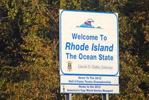
Rhode Island welcome signIt’s taken him over 11 years, but Gregor Swiderek’s crossing of the Rhode Island border meant he had completed the ultimate US road trip: visiting the 48 contiguous states south of Canada and north of Mexico.

October 14th 2012 started like most days when I’m on the road in America. I woke up in a low-cost chain motel located in one of those endless suburbs, watched a bit of the Weather Channel (which must be my favourite American cable network channel) and drove to the nearest gas station where I got myself a tea and some muffins. It was a bright and sunny but also crisp and cold morning and I was ready to clock up some more miles. Standard. Except for the fact that it was about to be a very special day for me.

The day before I’d had a great time in Manhattan – now I was leaving the NYC metropolitan area and heading towards Rhode Island, the last of the lower 48 states I had yet to visit. But more about that a bit later.

I left the strangely-named Parsippany in New Jersey and headed north. That way I avoided travelling via busy NYC (which can be a nightmare) but also gave myself a chance to see the famous Hudson River Valley. I got lost a bit while trying to avoid some toll roads but finally made my way to the Bear Mountain State Park located on the banks of the Hudson River.

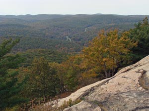
Bear MountainIt is hard to believe that this beautiful and wild spot is located only 50 miles or so from the heart of the Big Apple. Well, I say ‘wild’ – this being America, one can still drive all the way to the top of the 391 metre-tall Bear Mountain. There is a viewing tower and on a clear day the NYC skyscrapers are visible on the horizon. By the time I got there it was a bit hazy but I could still just about see them. Also clearly visible from the top is the majestic Hudson River Valley, which is actually an estuary rather than a river, but let’s not be too picky about the terminology. The views are particularly spectacular during the autumn when heavily forested hills in the region are ablaze with colours.

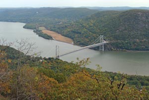
I crossed the Hudson via an impressive suspension bridge (also clearly visible from the mountain) and started heading towards the Atlantic. Being a road geek I couldn’t skip the chance of driving some bits of the Taconic State Parkway. This great highway was in fact designed by a landscape architect rather than the usual road engineer and it offers some great vistas. No surprise then that the road itself and all the structures are actually listed on the National Register of Historic Places, one of the longest roads with such recognition. But let me not get carried away with all the road stuff.

Hudson River suspension bridgeBy early afternoon I was driving across the suburban mess of Connecticut, thinking more and more about Rhode Island when somewhere east of New Haven I spotted the first sign announcing the SSN Nautilus and Submarine Force Museum. What? It sounded way too cool to be skipped so, as instructed, I followed more signs leading to the US Sub Base in Groton (don’t worry, the museum is actually outside the base so no need to go through security).

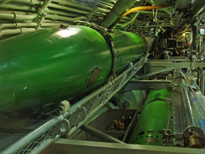
I have to say that these unexpected and unplanned stops are often some of the best experiences during my travels (like, for example, the Idaho Potato Museum), and the submarine museum was no exception. It has a real decommissioned nuclear submarine which you can enter and explore. It’s not some random sub but the world’s first nuclear-powered submarine, the USS Nautilus (SSN-571), which is also the first vessel to complete a submerged transit of the North Pole on 3rd August 1958 – a real piece of history and technological achievement. What was really surprising for me was the size of it, way smaller than I expected from something powered by a nuclear reactor. Another surprise was how ancient it looked on the inside, with all the manual switches and valves cramped into the small quarters. In the modern era of touch-screens and fast computers it really requires a leap of imagination to picture this thing going underwater in a controlled manner.

Apart from the Nautilus there are a few displays about the history of submarines as well as some hands-on exhibits for kids and adults. One of the best is a room where you can use the real working periscopes to look outside the museum building. You can for example look at your own car on the parking lot in the cross-hairs of the periscope and imagine sending torpedo into it. Pure fun.

Deadly NautilusFrom Groton I followed the interstate 95 northbound and finally, at about 5:45 pm, crossed the Rhode Island border. So, that was it, after just over 11 years since my first trip to the US I was finally visiting the last of the lower 48 states.

I have to say that Rhode Island is not a particularly exciting place. I’m sure there are some nice corners but for me it was all about completing the journey that started years earlier. After my first visit in 2001, I travelled there again and again until I realised a few years ago that I’d visited most of the states. It was only natural that my geographically-obsessed mind became fixated on the idea of visiting them all.

This brings us back to the sunny afternoon on the October 14th 2012 when I drove into Rhode Island which, as I mentioned, was the last of the lower 48 states on my list (there are still Alaska and Hawaii left, but they’re separated from the rest of the US and have to wait for my finances to improve). The moment wasn’t spectacular – no bridge crossing or anything even mildly exciting, just the usual welcome sign to the state alongside another sign stating that wearing seatbelts is required by law in Rhode Island. A bit anticlimactic to say the least.

I should have chosen some more spectacular state for the last one, but Rhode Island was just one of those corners I had missed during all my previous journeys. I mean I drove through it once, but I have never stopped there before (according to my unwritten rules, a visit to a state means stopping there for at least a few hours – simply driving through and a loo stop or two doesn’t count). I celebrated my achievement in a local motel by treating myself to my favourite chewy chocolate chip cookies and a cup of tea while watching the Sunday night football game – Green Bay Packers against Houston Texans. That was a good night (Packers won).

So, how did I feel? Of course happy but, to be honest, not too different from the day before. People ask me sometimes what I am going to do once I visit all the states. Will I start going for my holidays somewhere else? Somehow I feel that it won’t change much after I bag Alaska and Hawaii. Another common question is whether I get bored by always going to America. What can I say except that I’m already plotting yet another trip to the USA…

> Discover more with our range of Rhode Island travel guides and maps.

French Guiana: Land of Chocolate Seas and Space Rockets

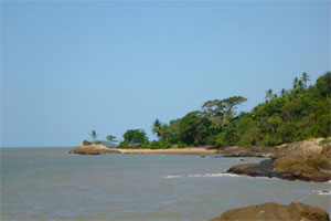
French Guiana coastLily Taylor travels to French Guiana and discovers a small slice of France in South America: one that’s home to the ‘Coca Cola’ sea and its very own space centre.

Before my friend moved here for a year abroad, I’m ashamed to say I had never heard of French Guiana – or any of the other Guianas for that matter (Suriname and British Guiana). Throughout the year I heard lots from her about what it was like but still couldn’t really imagine – so there was only one thing for it; I had to see this little-known South American destination for myself.

History and geography

So what’s it like? Well, French Guiana is about 90 per cent rainforest with the odd city cut into the middle, although the biggest settlements are on the coast. The only way of getting there from Europe is to fly from Paris Orly to Cayenne, the capital, with Air France.

French Guiana is a department of France, and it quite resembles a ‘little part of Europe’ in this small slice of South America – though I get the impression it’s almost forgotten by the motherland. In almost every way it’s different to Europe, but it does have the Euro and is run by the French government. Interestingly, although it’s in South America the region is very Caribbean in lifestyle, though its mix of people is rather unique. Many retirees have emigrated from Métropole – mainland France – while it’s impossible not to notice the sizeable Brazilian population and the influence of Haiti and the Dominican Republic.

Arguably French Guiana’s most famous attraction is away from Cayenne in a smaller town called Kourou. The reason? It’s home to the Guiana Space Centre, a facility used by the European Space Agency thanks to its proximity to the equator.

French Guiana beachAmong the region’s greatest natural attributes are its beautiful beaches, which stretch for miles and are mostly pretty deserted. Lined with palm trees and warm sand, these beaches really are stunning. Don’t be put off by the colour of the sea, which has earned the nickname ‘Nesquik Sea’ or ‘Coca Cola Sea’ – it may not be the prettiest colour, but the water is in fact lovely to swim in at all times, including the early hours of the morning

French Guiana’s history is rather interesting. Originally, it was used as a French penal colony, particularly its off islands: Iles du Salut, where it’s possible to visit and see what’s left of the prison. This is also the setting for Henri Charrière’s Papillon, the story of an island prisoner and his escape.

Food

I found the local dishes good if a little greasy; many fast food vans line the Place des Palmistes serving savoury crepes and hot dogs. Brochettes are very common here (meat on kebab sticks served with satay or other sauces). For those with a sweet tooth, ice cream is ubiquitous – my favourite was peanut flavour but there are also many exotic fruity sorbets on offer. An excellent place for ice cream in Cayenne is Joe la Glacier, where your choice of sweet treat is served on a waffle.

French Guiana rainforestFrench Guiana is big on spice, so lots of recipes are hot and seasoned with the region’s famous spice, Cayenne pepper. Often on tables there will be a pot of what appears to be breadcrumbs. This is farofa, which is eaten with almost everything to boost flavour and provide a little crunch. Farofa is made from manioc flour fried with garlic and other herbs and spices.

Getting around

The main way of getting around in French Guiana is hitching – an unusually safe way of travelling here. Obviously you have to take the normal care and precautions, but as long as you’re with at least one other person it is the most convenient way of getting from A to B. Buses are quite infrequent and walking anywhere in the heat takes quite a while.

> Find out more about French Guiana with our range of travel guides and maps.

His and Hers Guide to the Globe: A New Travel Series

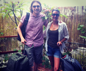
His and hers travelToday, Matt and Sharon Ward are leaving Australia for Singapore. Last month, the recently-married couple set off from their native Edinburgh on a honeymoon like no other. Having packed up and waved goodbye to their old lives, they’ll be travelling the world while writing a ‘his and hers guide to the globe’. As they begin the second leg of their adventure, Matt tells us more about the concept.

The His and Hers Guide to the Globe will offer a unique insight into some of the usual and more unusual holiday destinations across the world, from a ‘his and hers’ perspective. Whether it’s enjoying wine tasting in Perth’s Swan Valley, exploring Cambodia’s hidden temples or backpacking from San Francisco to Mexico, this series will supply a down-to-Earth assessment of what’s hot and what’s not.

Told through the eyes of a recently-married couple in their 30s, this travel guide will not only provide an open and honest opinion of what we discover and experience, it will also assist in answering any backpacking questions you may have ahead of your own adventure.

Matt and Sharon WardThis is not designed as a couples’ guide to travelling the world; rather it’s aimed at men and women who wish to travel with a partner, spouse, family member or friend. Whether you’re on a shoestring budget or have money to burn, our regular posts will give you tips and pointers on what mode of transport is best for which country and which accommodation best suits your requirements.

Having started our trip from Edinburgh last month, we’re embarking on a less-than-traditional type of honeymoon as we methodically take in all aspects of travelling the world. Having spent Christmas and New Year on the west coast of Australia, we’re departing for Singapore before experimenting with trains, boats and buses en route to Malaysia, Thailand and its islands, Cambodia and Vietnam before catching a flight to Beijing.

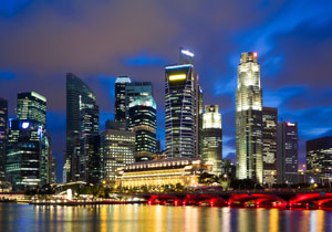
Singapore skyline

From China we’ll be flying to the east coast of Australia and New Zealand’s North and South Islands before setting off for the west coast of America. After experiencing all that California has to offer we’ll be making our way to Mexico, Cuba, South America, South Africa and Morocco before arriving in Europe.

Once back on the continent, we’ll recharge our batteries before embarking on the final leg of what promises to be an extraordinary journey: an expedition through central Europe while on the lookout for a permanent home and somewhere new to rest our hats.

There’s a lot resting on our trip, and we hope you’ll join us as we travel from country to country – we’ll be blogging from each destination, so make sure you check the Stanfords Facebook and Twitter pages for the latest updates. Bon voyage!

New York State: The Other NY

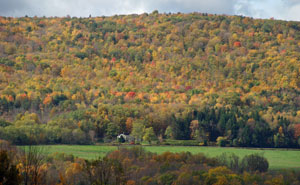
New York State coloursGregor Swiderek explores the other New York – New York State – and discovers a land of mountains, forests and lakes.

Hear the words ‘New York’ and what springs to mind? Gleaming skyscrapers? Yellow cabs? A buoyant nightlife? Probably. But let’s look at another New York – New York State. Sure, it’s home to all the Big Apple’s iconic attractions, but there’s also the ‘upstate’ region where forests, mountains, lakes, small towns and industrial heritage are the norm.

And that’s where I entered the state. Not via one of the bustling airports or traffic-choked highways of NYC, but by crossing a small bridge from Vermont across Lake Champlain. You could say it was the proverbial middle of nowhere; farms on the Vermont side of the water and forested mountains on the New York side. It was getting dark, fog had started wrapping the hills and the entire landscape was as rural as you can get.

My first stop was the town of Ticonderoga. Surprisingly, the chain hotels were all full but they directed me towards some older independent motels. The one I finally stayed at looked like it was straight from the 50s judging by its look and décor, but its owner was super-friendly. The Wi-Fi didn’t work but he was so apologetic that I just couldn’t go anywhere else. And I got a discount.

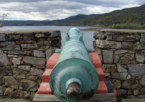
Fort Ticonderoga GunThe next day the sun was shining and I hit the streets of Ticonderoga early; or rather one short main street, just a few blocks and two sets of traffic lights. But that was enough to have a good local luncheonette where I treated myself to a truly awesome breakfast, after which I was ready to visit the main reason I was in this neck of the woods: Fort Ticonderoga.

Built by the French between 1754 and 1757, it was of strategic importance during the 18th century colonial conflicts between Britain and France. It again played a role during the American Revolutionary War as it controlled an important route between the Hudson River Valley and the Saint Lawrence River Valley.

Picturesquely located on a peninsula at a narrows near the southern end of Lake Champlain, the fort is nowadays lovingly restored (or rather reconstructed – not much is left of the original fort after it quickly fell into ruin after the Revolutionary War). Luckily it was acquired by the Pell family who started its reconstruction in 1909, making it one of the oldest preservation projects in North America. Nowadays you can wander around the fort by yourself or join one of the tours led by the period-dressed guides. I would recommend the second option as these guys are really knowledgeable but also have a good sense of humour – they also offer musket firing and other presentations.

The best way to appreciate the layout of the fort is to look at it from the nearby Mount Defiance – just a 10 to 15-minute drive away, but get a leaflet with precise directions from the museum store as it can be a tricky route. Don’t be put off when the road gets rough – it is steep, narrow and full of potholes but the view from the top is amazing. You can clearly see the fort as well as big swaths of Lake Champlain, the Green Mountains in Vermont and the Adirondacks in New York.

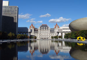
From Ticonderoga I headed south to Albany, the capital of the Empire State. That’s correct; it’s not the Big Apple. There are different explanations why this is the case (and I’m not sure which one is correct), but it doesn’t really matter. What does is the fact that Albany is a rather unique place. For a start, the state capitol has a bit of an unusual shape as it lacks a dome. Apparently there were plans for one, and even a tower, but during 32 years of construction it was discovered that the weight of the building was causing it to shift downhill, resulting in some fractures. So, no dome then. In effect the building looks like an oversized château from the Loire Valley, kind of out of place in upstate New York.

New York CapitolIf the capitol is a bit incongruous then its surroundings are absolutely bizarre. The Empire State Plaza is a complex of state government buildings located immediately south and south-west of the capitol. Built between 1959 and 1976, it was the brainchild of Governor Nelson Rockefeller – and it’s huge, consisting of various marble and steel buildings set around a row of three reflective pools. On the west side there is a row of four identical, so-called Agency towers, each 23 storeys tall. On the east side there is the 44-floor Erastus Corning Tower and The Egg performing arts venue, named for its shape (you’ll know why once you see it). On the south end (opposite to the capitol) there is the Cultural Education Center, which looks so weird that it’s hard to describe in a few words. It is also big, with 1.5 million sq ft of floor space.

To be honest the whole complex looks and feels massively oversized for a city the size of Albany. But it’s also absolutely fascinating and photogenic, especially on a sunny day. The best way to fully appreciate it, and to get an understanding of its layout, is to visit the viewing deck on the 42nd floor of the Corning Tower (which happens to be the tallest building in New York State outside NYC). From there you will be able to see all the government buildings located around the reflecting pool as well as the rest of the city (which feels dwarfed by the complex). Then there is the Hudson River and endless mountains and forest surrounding the city, stretching far into the horizon.

Albany is an easy place to visit. You can leave your car in one of the vast parking lots underneath the Empire Plaza, which are connected to the underground walkways connecting all the buildings. For anyone interested in grandiose architecture, Albany is a must-visit destination – together with cities like Brasilia or Canberra, it is one of the largest purpose-built government complexes in the world. Some compare it to buildings constructed by Fascist governments and criticise its size and cost (approximately $2 billion, and 9,000 people were displaced during its construction). There is no denying, however, that it is a unique and well-worth-visiting place.

From Albany I headed west towards the Finger Lakes region in the centre of New York state. On my way I stopped for a night in Binghamton where, by coincidence, I also stayed five years ago on my previous trip to this part of the world. It is one of those nondescript towns where I usually end up staying in cheap chain motels and eat in one of the countless fast food joints on the strip malls that stretch for miles and miles. They are not highlights of any trip, but I have seen similar towns across America and I’ve grown to like them. I can’t explain why but I find them strangely fascinating with their grittiness and anonymity. They all look the same; it doesn’t matter if they are in Michigan, Colorado or Kentucky. This is where everyone minds their own business and you can easily blend in. By and large no-one sees you as a tourist; they don’t visit places like Binghamton, but I would say that this is the real face of America rather than beaches of Santa Monica, the theme parks of Orlando or the boutiques of NYC.

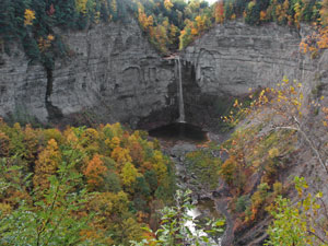
Taughannock FallsAfter Binghamton everywhere looks beautiful and fascinating, but Fingers Lakes is genuinely interesting. My time was limited so I only chose one destination to visit: Taughannock Falls State Park. Beautifully located on the banks of Lake Cayuga it’s home to one of the tallest single-drop waterfalls east of the Rocky Mountains. Its main cataract drops 66 metres, which is a full 10 metres higher than the mighty Niagara. You can hike to its base at the bottom of a long and narrow gorge (with walls reaching 120 metres tall), or you can take the rim trails that offer great views from the top of the falls. In other words, this small state park is a real gem. In fact, I suspect that in many countries in Europe it would be designated a national park.

This was the turning point of my journey. From Taughannock Falls I started heading back east, ultimately all the way to the hustle and bustle of the Big Apple. But that was still hundreds of miles away and for now I was simply enjoying a peaceful drive across the New York countryside.

I would recommend upstate New York to anyone visiting north-eastern USA. Even if you mainly come for the highlights of NYC, it is well worth sparing a day or two to tour this fascinating region.

> Discover more with our range of New York State travel guides and maps.

A Journey Through Maine

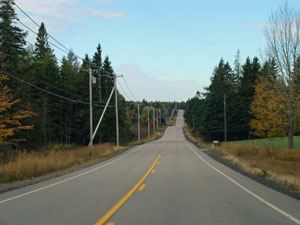
Maine New England HigwayIn his quest to complete The Lower 48, Gregor Swiderek arrived in Maine and discovered a state of pine trees, fishing villages and lighthouses.

Almost exactly five years after my first visit to New England, I landed in Boston again. Logan Airport hadn’t changed at all so I experienced a strange feeling of déjà vu. Fortunately, it quickly ended when I got my rental car and drove straight towards the beautiful state of Maine.

Why Maine? Well, it was one of the last two states among the lower 48 I hadn’t visited yet. More importantly, it’s also the state with the lowest population density east of the Mississippi, and one of the most heavily forested and wildest corners of the eastern United States (it’s called the Pine Tree State for a reason). Add a jagged coastline full of bays, rocky headlands and lighthouses, many wild rivers and lakes, small fishing towns and some of the oldest settlements in the US, and you have a recipe for a truly great holiday.

But I started my tour from the least wild southern section. My first proper stops (not counting the cheap motel on the New Hampshire border) were the lighthouses around Portland. I was heading towards the Portland Head Light (according to Maine travel guides one of the most accessible and convenient to visit lighthouses) when, totally accidentally, I came across two lighthouses at Cape Elizabeth. At first I thought I was in the right place but then one of the locals told me that Portland Head was actually located a couple more miles along the road. In the end it didn’t really matter as all three photogenic lighthouses are scenically located along the short stretch of coast. Portland Head is apparently one of the most photographed lighthouses in the world, while those at Cape Elizabeth are portrayed in several of Edward Hopper’s paintings.

Portland Head LighthousePortland itself is the largest ‘metropolis’ in Maine – a term that’s something of an exaggeration in this case. Sure, its metropolitan area is home to a third of the state population but it is still less than a half a million souls, and fewer than 70,000 of them live in the city proper. There is a nice walkable downtown, offering some good shopping, eating and drinking options but, to be brutally honest, it will never be a major attraction of New England.

Acadia National Park, on the other hand, is one of the gems of this region. Located about 160 miles north of Portland, it’s the only national park in New England. You can drive there in 3.5 hours or you can stop in countless gentrified, touristy towns and villages along the coast – in which case it might take you a week. I chose the fast straight route as I was eager to hit the trail.

The first hike I chose is called the Precipice Trail and it’s more of a climb than simply a hike. There is even a warning notice at the beginning saying a ‘non technical climbing route’ rather than a hiking trail. Whatever you call it, it is a great fun. In fact, it is one of the best trails I have done in many years. It ascends only about 300 metres but it often does it via a near vertical route, especially near the top. As I said, it is great fun but not for the faint-hearted nor those scared of heights. In many places you will scale exposed rock faces, traverse narrow ledges (luckily with the help of metal bars in the most challenging spots) or climb metal steps fixed to the vertical cliff faces. It definitely shouldn’t be tackled in bad weather or taken lightly. What it does offer, apart from thrill and adrenaline rush, is absolutely amazing views along the way and from the top. For me it is out there, together with Angels Landing trail in Zion NP and Orla Perc trail in the Polish High Tatras, with my best outdoor experiences.
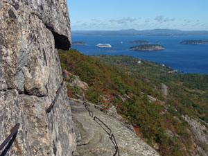
Precipice TrailAfter the climb I chilled out by simply catching some sun and getting lazy on the rocky coast of the Acadia, which is scenic, rough and beautiful.

Acadia NP is very varied and has a lot to offer. Apart from the hikes there are also great cycling routes, running mostly along the car-free carriage roads which you can also tour by the horse carriage instead of bicycle if you are feeling lazy. There are also lakes, woodlands and even a sandy beach. It is a really great national park, especially during the peak foliage season.

My time in Acadia was limited but I couldn’t leave before getting to the highest point in the park, the 470 metres-tall Cadillac Mountain. Apparently, it is also the tallest spot on the whole Atlantic coast of the US. Fortunately for those short of time, and for lazy folks as well, you can drive right to the top of it. It might be sort of cheating but the amazing panorama from the top will kill your guilt in no time.

Driving from the south to the park you will encounter many B&Bs, good restaurants, art galleries and other businesses clearly geared towards the rich folks from Boston or New York City. North of the Acadia the coast of Maine turns much wilder. Gone are the gentrified cute towns and villages as well as (more importantly) most of the cars – especially the slow-moving ones with the Massachusetts and New York plates. This is the coast of hard-working fishing communities, down to earth locals driving pick-up trucks, gas stations selling hunting gear and lobster along the fuel and even some blue collar industrial towns like Bath with its shipyards building destroyers for the US Navy. And crucially, it’s also the land of wide and empty roads running along the coast.
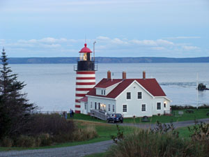
West Quoddy HeadBeing a geographer I couldn’t resist the pull of West Quoddy Head which is the easternmost point in the US mainland as well as the closet place to Europe (and Africa) in the contiguous 50 states. There is a lighthouse (one of only two in the US painted, like in Canada, in red and white stripes to be more visible in snowy conditions), but apart from that there is not much else to see or do. It didn’t matter. I just like such extreme points where you are aware of your location on the map. Usually you can look towards the distant horizon and imagine far lands on the other side of the ocean. A bit disappointingly, from West Quoddy Head you can’t stare towards the horizon as, just off the coast, there is an island blocking any romantic vistas. But that’s Canada, so it didn’t spoil my experience too much. I was still standing on the easternmost bit of Yankee soil.

Accordingly I spent the night in the easternmost town of the US, Lubec (incorporated in 1811). With a population of less than 1,400 it was a small place indeed but luckily it still had a decent motel. It was one of the small privately-run establishments which you can find all across America in places too small, or too out of the way, for the big corporate chain hotels. I could skip mentioning it altogether if not for the absolutely fantastic home-baked blueberry muffins for breakfast.
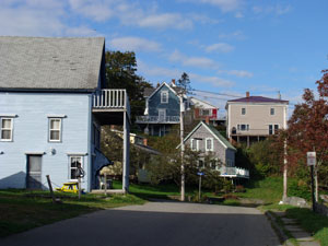
LubecObviously there was only one way from Lubec: west. This time I skipped the coast and headed inland towards the capital of Maine, Augusta. If the coastal road was already quiet it was still nothing comparing to the emptiness of inland Maine. It was almost four hours of relaxing driving, especially as the two-lane highways cutting through the endless forests were practically deserted. But even the interstate highway from Bangor to Augusta was one of the emptiest motorways I have ever driven.

Augusta is a small place but after wandering in the under-populated east of the state for a while it felt much bigger than it actually is. However, the Maine State House was a let-down. It was one of the least impressive state capitals I have seen so far; and believe me, I have visited a fair share of them. But still, I couldn’t resist even just a brief visit inside.

From Augusta I headed towards the next state, New Hampshire, where I arrived in no time via some small local roads for which my map reading skills were really helpful, as New England doesn’t really follow a grid system like other parts of the US do. No, I still don’t use sat-navs. They dumb the journey down and I’m also too stingy to pay for their rental. Besides, map reading is fun (even if you have to do it on a steering wheel) and I wouldn’t change it to listening some annoying voice leading you like a child; no way.

I might have visited Maine just because it was on my list of not yet visited states but I’m glad I did. It is a truly fascinating place and I can recommend it to anyone who likes travelling on the slightly more wild and unusual side.

> Discover more of Maine with our range of New England maps and travel guides.
Five Ways to Get to Know Minangkabau

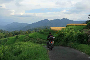
Minangkabau CountrysideVenetia Rainey spent a week getting to know the Minangkabau people, an indigenous group based in the Minangkabau Highlands of West Sumatra, Indonesia.

The world’s largest matriarchy is surprisingly elusive.

After a bit of research online, I was convinced that this Indonesian female-ruled society would instantly become apparent, yet by the end of a week spent exploring the picturesque highlands of West Sumatra, I felt as if I had barely scratched the surface. Continue reading Five Ways to Get to Know Minangkabau

Dubrovnik: A Wanderer's Paradise

Dubrovnik cityscapeCaroline Sandes continues her Balkans adventure in Dubrovnik, exploring the city’s old town, staying in rather questionable accommodation and meeting a lost puppy.

Dubrovnik is, of course, beautiful in a sort of quaint, picturesque fashion. The historic old town with its trademark red-tiled roofs is contained within its city walls, keeping it apart from the more modern town that sprawls around it. It sits on the edge of the Adriatic, and for the couple of days I was there the sea was doing what it is known best for here, radiating blueness with rippling waves twinkling in the sun. Continue reading Dubrovnik: A Wanderer's Paradise

Gangnam Style: The District Behind the Smash Hit

Gangnam Style SeoulIt’s easy to forget that the ‘Gangnam’ in PSY’s viral internet hit is a place, too. Poi-Yun Wan takes a closer look at the ‘Mayfair of Seoul’.

Unless you’ve been living under a rock for the past few weeks, you’re probably familiar with the frustratingly-catchy beat of PSY’s international hit, Gangnam Style. Like it or not, the Korean rapper’s ‘horse-galloping’ dance moves have become etched into our memories.

Ridiculous dancing aside, the tune has achieved two rather impressive feats: it’s entered the Guinness Book of World Records as the most-liked YouTube video ever, and it’s the first Korean track to reach number one not just in the UK, but in more than 30 countries around the world.

Listen to PSY’s lyrics and he’s clearly poking fun at Gangnam, an upmarket district in Seoul. Or more specifically, its residents. Outside of South Korea though, the area is largely unknown – so what exactly is all the fuss about?

Well, Gangnam wasn’t always a place of wealth and revelry. As recently as the 70s it was a district of relative obscurity occupied by farmers, who later sold their land to make way for new developments. Fast forward 40 years and voilà, welcome to South Korea’s Beverly Hills.

Step inside Gangnam today and expect to be surrounded by people dressed in branded clothing, socialites carrying designer bags worth an average South Korean’s monthly salary, chauffeurs escorting the rich around town in exclusive cars, and people with so much bling they would glow even if there was a power cut…

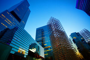
But it’s not just the residents of Gangnam that are well suited and booted – the buildings and attractions belonging to the area also play their part in adding to the decadence associated with the neighbourhood. Aside from the impressive Bongeun Temple, which is well worth a visit, the area is defined by gleaming high-rises and bright lights. Those wanting to see a more genuine side of Seoul will need to cross the river.

The regional headquarters of some of the biggest names in the business world, including Google, are based in the swanky Teheranno Street. The district is also a haven for shopoholics with an ample range of outlets located on the streets of Apujeong to Cheongdam-Dong and in the famous COEX Mall, the biggest underground shopping centre in Asia.

Of course, Gangnam wouldn’t be without the ‘style’ if not for the rows of designer shops beckoning punters in. Lavish boutiques line the streets of Garosugil coupled with an abundance of luxurious coffee shops, because drinking coffee, especially expensive coffee, is another way the rich showcase their wealth. But designer attire outside, you might just spot the odd t-shirt featuring a certain rapper.

The streets of Gangnam are lined with classy nightclubs. Famous DJs flock here to entertain the young and rich as they party, or indeed ‘gallop’, through the night. Besides being a haven of wealth, Gangnam receives publicity from annual festivals such as the Gangnam Fashion Festival. The subway stations and nearby attractions of the neighbourhood, meanwhile, featured in The Bourne Legacy starring Jeremy Renner and Rachel Weisz.

So there you have it – regardless of whether you’re taking PSY’s digs at Seoul’s wealthiest district with a pinch of salt or trying to erase the embarrassing image of the prime minister attempting the ‘horsey’ dance from your mind, Gangnam’s residents are probably sitting comfortably in their luxury cars and sipping a cup of deluxe coffee while soaking up all the fame and glory.

> Learn more about the South Korean capital with our range of Seoul travel guides and maps.

The Togean Islands: A Remote Paradise

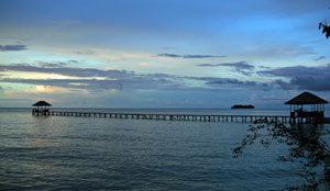
Togean IslandsLast month, Venetia Rainey travelled to the Togean Islands, an unspoiled Indonesian archipelago off the coast of the Central Sulawesi province.

As the boat sails past yet another tiny white sand beach tumbling into glassy turquoise waters, the captain taps me on the shoulder.

“Poyalisa Cottages,” he grunts, pointing past me to a distant smudge of green. I try not to get my hopes up.

Getting here has taken 30 hours: eight reclining on a luxury, air-conditioned coach with a book; 13 battling travel sickness on a rickety bus clinging to perilous mountain roads; five on the bumpy back seats of a minivan traversing a barely-built road; and now four on the ‘Farthur Star’, a wooden boat captained by a man with eight fingers and one thumb. And that’s not counting the three stopovers in towns across Indonesia‘s oft-ignored Sulawesi region.

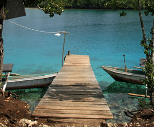
But 20 minutes later, the boat does indeed putter up to a small island made up of two immaculate coves, bamboo bungalows on stilts and palm trees. I haul myself and my backpack onto a small wooden jetty and notice a sign: ‘Poyalisa Island’. A smiling woman leads me to a lunch of freshly-grilled fish, spicy noodles and cold Coca-Cola. I’ve finally arrived on the fabled Togean Islands.

A remote paradise

Located in the north of Indonesia, the volcanic archipelago of the Togeans consists of 56 islands with scenery straight out of a Robinson Crusoe picture book. Phone reception comes (and goes) in bursts, internet is non-existent, electricity generator dependent and running water a luxury. Only a handful of resorts accept cards, making lots of cash a must.

Jellyfish Togean IslandsBomba

I started my two-week journey in Bomba, the Togeans’ southern-most point. Situated on its own island, Poyalisa Cottages charges 150,000 Rupiah (roughly £10) per person per night for a bed in a private beachfront bungalow, a private bathroom, a large porch, three delicious meals a day and afternoon cake.

Also included (as if that wasn’t enough) are daily snorkelling trips, and I soon learned that while lazing on a stunning beach is one thing, swimming in a tropical open-water aquarium is quite another.

From clownfish to lionfish, giant napolean wrasses to tiny blue damselfish, every day threw up a different underwater landscape comprised of forests, valleys and plateaus of rainbow-coloured coral growing in every shape imaginable.

The only thing I spent extra money on was Bintang, Indonesia’s ubiquitous and tasty beer, Arak, the potent locally-brewed palm wine, and soft drinks. With nothing else to do after dinner, guests hung around drinking and swapping travel stories until the generator cut off and plunged the island into darkness. Needless to say, a torch is essential.

Kadidiri Jetty TogeansKadidiri

After Bomba, it was on to Kadidiri, a much larger island close to the Togeans’ main port, Wakai. For travellers short on time, this is the best place to stay and enjoy the area. It also offers the biggest range of accommodation options and excellent scuba diving.

Three wet hours later, my boat arrived at Black Marlin, a British-run dive centre. At 200,000 Rupiah (roughly £14) per person per night, it was pricier than its two competitors, but with lovely, bright rooms, a pool table and fast boats it was worth it.

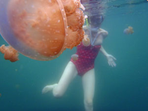
On top of snorkelling, I joined a horrific-sounding trip to go swimming in a salt-water lake swarming with jellyfish. Uniquely, however, they don’t sting, making for some fantastic photos. I also rented a sea kayak to explore the coastline’s numerous postcard-perfect deserted beaches. Dive options included a drop-off by local volcano Una-Una (rife with sea turtles) and a B-24 bomber plane wreck, both of which fellow guests raved about.

Togeans Island jettyAnother route in/out

Leaving the Togeans involved a lot of will power and a very carefully-planned schedule. Only two boats a week make the northward overnight journey between Wakai and Gorontalo city, where I went on to Manado, northern Sulawesi’s transport hub. After two weeks of living off the sea – both physically and dietarily – the mainland came as a surprisingly welcome relief.

Togean Islands Factfile

  • The Togean Islands are an Indonesian archipelago located in the Gulf of Tomini off the Central Sulawesi coast.
  • They consist of 56 islands and islets. 
  • The three largest are Batudaka, Togian, and Talatakoh. 
  • The islands are home to 37 villages. 
  • Getting there: Daily flights operate from Jakarta to Gorontalo, from where overnight ferry and speedboat services serve the islands.

> Discover more of the Togeans with the Sulawesi regional map, which features an enlargement of the islands. For further information on Indonesia, browse our collection of Indonesia travel guides and maps.