
It was the Queen’s 90th birthday and on Saturday it is Shakespeare’s 400th anniversary, but in other news….

Guess the Shakespeare play from our maps
To pay homage to the Bard on the 400th anniversary of his death, we have dug out some of our maps that show the locations of some of his plays.

In pictures: Ordnance Survey celebrates 80 years of the trig pillar
Ordnance Survey are celebrating the trig pillar’s 80th birthday by asking you to share pictures of the trig pillars you’ve seen while out and about using the hashtag #TrigPillar80 on Twitter and Instagram. Continue reading In pictures: Ordnance Survey celebrates 80 years of the trig pillar
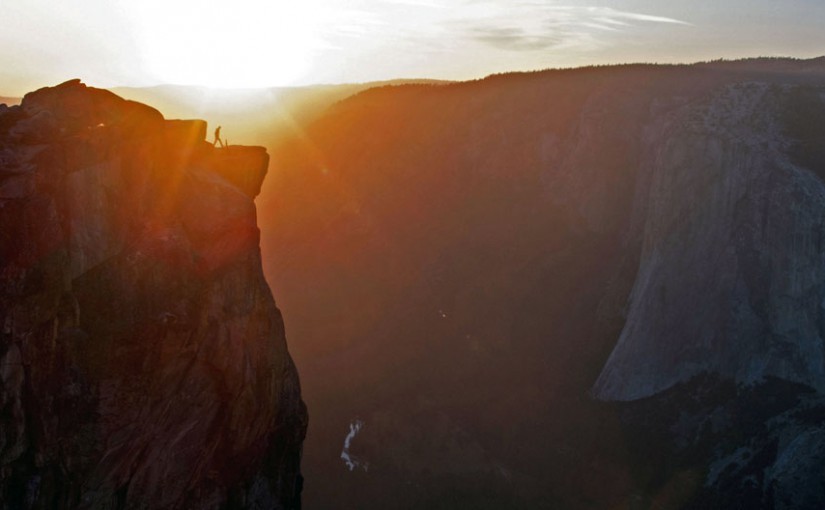
Wish we were
In the USA’s national parks.
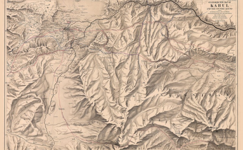
Mappy Monday- Stanford’s New Map of Kabul (1880)
It seems strange to refer to a 136 year-old map as ‘new’.
This 1880 map of Kabul is from our Edward Stanford Cartographic Collection archive. Continue reading Mappy Monday- Stanford’s New Map of Kabul (1880)

The Travel News
An escaping octopus, invisible trains, ancient Adidas and selfie benches. The travel news is in. Continue reading The Travel News

Wish we were
In London, celebrating Shakespeare Month. Oh – We are! Lucky us. Continue reading Wish we were

Mappy Monday- List of Countries by Land Area
Have you ever wanted to cut out every country on a map and organise them into size order? No? Us neither *hides scissors*. Continue reading Mappy Monday- List of Countries by Land Area
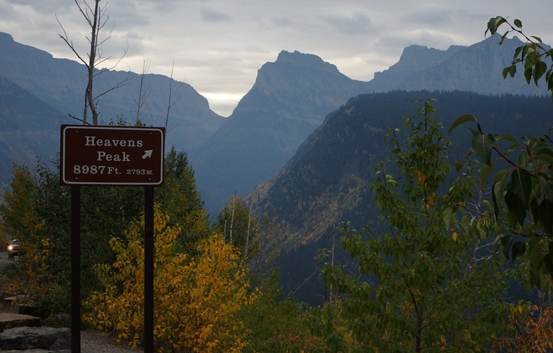
Western Montana
Montana is a state of two halves. The eastern (much larger) part of the state is dominated by the vast rolling landscapes of the great plains, more similar to the Dakotas or Kansas than to any of the states to the west. The western part is dominated by massive mountain chains, including the mighty Rockies. Continue reading Western Montana

The Travel News
Buy a meteorite, have coffee with a hedgehog and get Wi-Fi on the beach. It’s been quite a week. Continue reading The Travel News