Introducing #TravelBookChat

Travel reads chatWith thousands of us planning our 2013 break, thoughts are naturally turning to that most important of holiday ingredients: the book. But which to take? If you’re in need of some inspiration, help is at hand with #TravelBookChat!

We’ve teamed up with award-winning travel blogger Jayne Gorman (@jayneytravels) to launch a travel reads Twitter chat – the first of which will take place next Wednesday (16th January) at 19:30 GMT on the theme of India.

Why India?

Few destinations have inspired as many books as the subcontinent, from Gregory David Roberts’ epic Shantaram to Suketu Mehta’s revealing account of Mumbai in Maximum City: Bombay Lost and Found. And with the film adaptations of Life of Pi and Midnight’s Children pulling in cinema audiences, we think it’s the perfect time to discuss all things India in the world of travel literature.

How will #TravelBookChat work?

Simply log into your Twitter account at the date and time mentioned above and search for the hashtag #TravelBookChat. Jayne will be tweeting a number of questions and comments to discuss over a period of approximately 45 minutes. These will be labelled Q1, Q2 etc, so you’ll need to label your answers A1, A2 with the #TravelBookChat hashtag. Feel free to respond to other people’s answers so we can get the debate going!

Book clubWhat’s up for discussion?

Anything to do with India and travel writing, both fiction and non-fiction. Jayne will be asking the following questions to get the conversation flowing:

  • Who are your favourite fictional characters? 
  • Is there a non-fiction must-read? 
  • What’s your biggest tearjerker? 
  • What’s your most memorable read? 
  • What’s the best guidebook? 
  • What’s the best and worst film adaptation? 
  • Shantaram – yay or nay?

Win a £15 online Stanfords voucher!

We’ll be picking a #TravelBookChat participant at random to win a £15 online Stanfords voucher. To be in with a chance of winning, simply follow @StanfordsTravel and get tweeting next Wednesday evening!

The Gorillas Have Landed

With Maporilla due to settle into her new home in the coming days, we thought we’d look back at Bristol Zoo’s Wow! Gorillas public art project with the help of photographer Clive Minnitt.

Clive has published The Gorillas Have Landed – a collection of images showcasing the 61 life-size ceramic gorillas displayed across Bristol during summer 2011, including Rebecca Howard’s map-adorned creation – soon to be based at St Monica’s Trust after being displayed at Stanfords.

Available at our Bristol store for £9.99, five per cent of the book’s profits are being donated to Bristol Zoo’s gorilla conservation project, while a further five per pent is going to the Bristol Royal Hospital for Children.

Here’s a selection of Clive’s photographs – aside from the Stanfords-commissioned Maporilla (thanks to Kevin Leighton for this image), how many of the five can you name? Continue reading The Gorillas Have Landed

Jerry Brotton: A History of the World in Twelve Maps

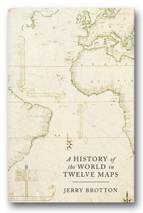
Jerry Brotton mapsJerry Brotton, Professor of Renaissance Studies at Queen Mary, University of London, delivered a talk at Stanfords on his latest book, A History Of The World In Twelve Maps.

A “massive shift” in the direction of mapping is underway, with cartography’s transformation to the digital sphere causing as profound a reaction as when maps moved from manuscripts to print – especially now the online map has become essential to web navigation and search.

This is according to A History Of The World In Twelve Maps author Jerry Brotton, who believes there are parallels between today’s anxieties surrounding online mapping and the attitudes of some in the 15th and 16th centuries, when the printing press suddenly allowed people en masse to have a visual appreciation the world around them.

But what is it about maps that touches the nerve of so many? And with maps now more ubiquitous than ever, what does the future of cartography have in store?

“People are fascinated about maps, and I want to explore why that might be by looking at a wider historical context,” Brotton explains. “What happens when you go back to the Greeks, or further, to see how maps have gone through different forms of representation? Firstly scratched on a cave wall, then moulded on clay, then drawn on papyrus, then paper, then print, then lithography, then online. I want to see what endures with mapping – what is it that makes us so fascinated?”

Babylonian World Map

This is the aim of A History Of The World In Twelve Maps, a book that takes 12 maps and asks whether there are abiding mapmaking principles that can be traced back to prehistoric times. The first, the Babylonian World Map, dates from 750 BC; the last, Google Earth, was updated in 2012.

“Interestingly, neither looks much like a map despite being at opposite ends of the historical scale,” Brotton says. “The Babylonian World Map – the first known surviving map of the entire world – has only recently been seen as an incredibly important object. When it was discovered, people didn’t know what it was. Google Earth, because it’s a sphere, doesn’t look like a map either.”

His book is about maps of the world – not local or regional maps – and how different historical cultures, from Europe to north Africa and south-east Asia, represented the planet in different ways. By looking beyond Greco, Roman and western traditions, Brotton was able to document lesser known but equally important mapping methods. He discovered that each approach was logical, consistent and coherent to its culture but that each, inevitably, had to make omissions.

“Any map of the world that attempts to transform the globe onto a flat piece of paper will also make distortions – quite simply, you cannot square the circle,” Brotton explains. “Choices and decisions will always be made about what will be put in and left out. I’m interested in what happened at this point – it opens up the possibility for prejudices, religious beliefs and political ideologies. I wanted to track how this happened.

Google Earth“Maps are a way of categorising the world – we look towards the horizon and wonder what’s out there. We want to abstract the world around us and make it understandable. We want to make it contained, and both the Babylonian World Map and Google Earth do this. While the latter is photo-real satellite imagery from above, once you click on or off the geopolitical boundaries it starts to become more abstract.

“Another striking parallel is the view of the world from above. Google Earth asks you to be 11,000 km above the Earth, as though you were in orbit. The Babylonian map does the same – by providing access to this view, you’re offered a divine perspective of the Earth. But as we all know, the first thing people do on Google Earth is find where they live and zoom straight in.”

World maps, then, have always responded to humans’ basic existential questions: Where am I? Why am I here? What am I doing here? “We ask the map to answer these questions for us,” Brotton continues. “Google is clever enough to know where you are so it will tilt the globe to make sure you’re at the centre of it. The Babylonian map does exactly the same thing – it’s the whole world, surrounded by the ocean. The idea is that the Earth is round, but it’s also flat. At its centre is Babel, or Babylon. Babylon is the centre of the world, everything beyond it is immaterial. There’s an enduring power in that image, which takes us all the way through to Google Earth.”

Between the Babylonian World Map and Google Earth, Brotton has compiled a collection of other important maps and publications, from Ptolemy’s Geographia to the Peters’ projection via the Hereford Mappa Mundi and the Mercator projection.

Jerry Brotton at StanfordsOn Ptolemy:

“What he basically concluded is that you can’t accurately map the world; that you have to make certain compromises and decide what you want on your maps. His basic grid served as a toolkit for how to take things forward. It was additive – if more land was discovered, it could simply be added in.”

On Islamic maps:

“An Islamic world map from 1086 had south at the top. Why? The Arabian Peninsula was the key inclusion – Mecca was the centre of this world. In the 10th and 11th centuries, cultures that converted to Islam were due north, so they would understand Mecca as being due absolute south. This was a theological response to how to represent the world rather than being about geometry or maps.”

On the Hereford Mappa Mundi:

“It’s a weird, amazing object made from an enormous calf skin – it’s literally a rumpled dead animal, and really the equivalent of the Islamic theological roll map. It has east at the top with the Garden of Eden. Right at the centre of the map is Jerusalem, with the idea that theological Christian time starts in the east and moves westward, with the surrounding legend describing scenes from the bible. Everything is moving westwards – this is a map about time, not space. Rather than being about finding your way from A to B, it’s about finding your way from the terrible sinful world you’re in to heaven.”

On the emergence of Chinese maps:

“In China, the emperor always faces the south. In subjection to the emperor, you look to the north. That’s why Chinese maps have traditionally had north at the top, a trend that began not long after the Islamic and Hereford theological world maps, both in China and Korea.”

On the first maps of the New World:

“Martin Waldseemüller’s map of the world from 1507 was the first to put the name ‘America’ on a separate continent surrounded by sea. Vespucci [who first demonstrated that America was a separate landmass] is seen looking down at his new continent, while Ptolemy is depicted glancing down at his old world. The map contains a weird distortion – America almost looks like a wedge of cheese with its unrealistic coastline, though what’s happened is consistent with how the world is projected. It has to be stretched and elongated to accommodate the new continent.”

On the Mercator projection:

“The distortion in Waldseemüller’s map is why you get Mercator and his very famous 1569 new projection. He called for a rectangular map to plot the spherical globe so cartography could move on from the days of Ptolemy. He knew that compromises had to be made – the image of the globe was stretched north-south until the North and South Poles were stretched to infinity. He was very open about this distortion, but because trade travelled east to west rather than north and south, it didn’t really matter.”
A History Of The World In Twelve Maps

On the Peters projection:

“Peters’ world projection from the early 1970s, which is all about equality, is the big challenge to Mercator. A socialist historian, he argued that Mercator’s map massively privileges the developed northern world as opposed to, say, Africa. He championed equality of landmass, though his map wasn’t universally welcomed. Somebody once famously said the continents resembled long, wet ragged pieces of underwear hanging off the North Pole.”

On Google:

“I was initially absolutely seduced by what they were doing. But Google’s innovative use of mapping has become about monetising geography, and this is my big concern. Over one third of all Google searches have some geographical content to them – Where is my nearest Chinese restaurant? Where is the best hotel in Madrid? – which has seen the online map become an actionable platform for selling things.”

Jerry Brotton was speaking at our Long Acre store. To keep up to date with future talks, check out our events page.

Click here to buy A History Of The World In Twelve Maps!
Interview: Michael Palin on Brazil

Michael Palin BrazilHe’s trekked to the North and South Poles, traversed the Sahara Desert and climbed the Himalayas. But despite visiting all seven continents, there was one glaring omission on Michael Palin’s visited-countries map: Brazil. So why had it slipped through the net for so long?

“I can’t think how I managed to miss the fifth-biggest country in the world,” Michael says, “and I wasn’t really planning to do another series after New Europe. We’d done all seven continents and thought that was a fair place to stop. But then everybody started talking about Brazil, partly because the World Cup is going to be there in 2014 and the Olympics in 2016, then there’s the huge economic boom that has put its economy above the UK’s.”

Brazil was fast becoming one of the most talked-about countries in the world, but what provided the spark for the comedian-turned-explorer’s latest trip, one that would inspire a book and a four-part BBC TV series? Continue reading Interview: Michael Palin on Brazil

Eastern Turkey: 'Another World' From the Package Resorts

Diana Darke StanfordsEastern Turkey, “another world” inside the Turkey of Istanbul and package holiday resorts, is an area travellers are beginning to stand up and take notice of. And if Joanna Lumley is planning a visit, it must be worthy of exploration.
This is the message of Bradt guide author Diana Darke, who said during a talk at Stanfords that more interest is being generated in this part of the world that’s long been neglected by travellers, in part thanks to laying claim to being the birthplace of religion.

“It’s astonishing what’s happened there over the last 20 years – Eastern Turkey has really lifted itself up, which is testament to the country’s stability,” Diana explained. “Turkey’s economy has steadily grown, so it’s got money to invest into tourism. This is something you really notice with the food, for example, which was nothing to write home about two decades ago. Now it’s possible to try gourmet dishes at restaurants at the top of Mesopotamia in the desert – all of which are made locally. It’s certainly not the place it used to be.”

But what about safety in a region that hasn’t enjoyed the most peaceful of reputations? “If you look at Foreign Office travel advice it starts off by describing Turkey as a stable democracy,” the travel author said. “The only areas it says you shouldn’t travel to are a handful of provinces where, in all honesty, no tourists would go anyway because there’s absolutely nothing to see there.”

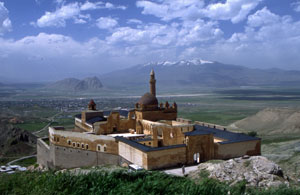
Ishak Pasa Palace

What’s exciting is just how much there is to see, which is why a national newspaper is planning to run a special Eastern Turkey feature in the coming weeks, and why Lumley and her film crew are travelling there to make a documentary on Mount Ararat and its associations with the story of Noah’s Ark.

“That will bring a lot of interest to this part of the world,” Diana added. “We all know Istanbul and the holiday resorts – that’s what most people think of when you say ‘I’m going to Turkey’, but in practice 70 per cent of the country is from Ankara eastwards – it’s like a country within a country, which is why it merits an entire book.

“It’s effectively another world – one that most people in Istanbul and the western part of the country haven’t been to, let alone travellers from overseas. Indeed, some Turkish people freely admit they think of it as another country. What people discover when they do go there though is that it’s incredibly easy to travel around, the people are friendly and that there’s so much to discover.”

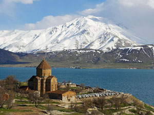
One of Eastern Turkey’s highlights is Lake Van, the country’s largest body of water and among the biggest endoheric lakes in the world. A saline soda lake, it receives water from the many small streams descending from nearby mountains – and despite sub-zero temperatures in winter, its saltiness means the vast majority of water doesn’t freeze.

Lake Van“It’s an extraordinary, surreal lake,” Diana said. “It has an almost ethereal quality to it – there’s something about the colour of the water and its texture, which feels like silk. When you swim in it your skin is so smooth and silky. The water has a particular alkaline composition to it, so fishing boats often trail dirty laundry behind them and the lake acts as a huge washing machine, making the clothes fragrant and soft.
“Lake Van is huge – seven times the size of Lake Geneva, but no matter where you are on the lake you experience its extraordinary quality. The surrounding area is completely undeveloped – there are only two hotels on its shores, one in the north and one in the south.”

While the lake is spectacular in itself, it’s surrounded by a ring of volcanoes, some of which can be conquered on one-day expeditions. Diana has trekked to the summit of Nemrut – not to be confused with the mountain of the same name – to the north-west of the lake. At its summit is a large caldera and two crater lakes – one hot and one cold, and it’s possible to swim in both.

Aside from its impressive landscape, Eastern Turkey has a fascinating cultural history. And according to Diana, the Anatolia region contains “the origins of so much of our western civilization”, despite the fact that many won’t have heard of its ancient peoples.

“Eastern Turkey is the great early mountain culture, where the Ancient Egyptians and Mesopotamia are the acknowledged first great river valley cultures,” Diana explained. “It’s a little-known fact that Hittite is the earliest-known example of an Indo-European language, from which a number of our languages have descended from.

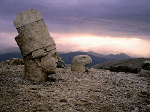
Mount Nemrut Statues“The region is home to some extraordinary cultures, most of which we are probably unfamiliar with like the Commagene Dynasty, whose power-crazed King Antiochus I Theos built a sanctuary at the summit of Mount Nemrut, the highest peak in his kingdom at 2,000 metres. It’s unlike anything else in any other part of the world, and the king’s statue, which he made sure was surrounded by gods, often gets chosen for front covers of Eastern Turkey travel guides.”
Another cultural highlight is Gobekli Tepe, where German and Turkish archaeologists have been excavating since 1994. “It dates from 9,000 BC, making it the world’s oldest temple, established 2,000 years earlier than the world’s first city,” Diana said.

“This is completely turning everything upside down about how we thought human society evolved. We understood that hunter gatherers settled in cities and then built temples – what Gobekli Tepe shows is that hunter gatherers built a place to worship before moving to the city. It’s safe to say that religion began in Eastern Turkey. Even today, there are more churches and monasteries there than there are in Istanbul and the western part of the country.”

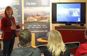
Diana Darke was speaking on behalf of Travel the Unknown, which is based at our Long Acre store’s themed area for the duration of November. Find out more about their talks by visiting our events page.

Top 6 Globes: An Expert's Guide

Stanfords isn’t only famous for maps and travel guides; our range of globes has inspired generations of explorers, adventurers and astronomers. From traditional antique-style spheres to the latest cutting edge designs, there’s a wealth of globes to consider, but which to choose?

Nadia, our Long Acre store‘s resident globe expert, reveals her top six favourite globes from the Stanfords range: Continue reading Top 6 Globes: An Expert's Guide

Simon Garfield: On The Map Interview

Simon Garfield On The MapThe backlash against digital maps is underway. Whether people are conscious of it or not, increasing numbers of us want to travel back in time to see how things were in the days before Google Maps and sat navs.

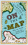
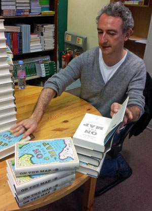
This is according to cartography enthusiast and author Simon Garfield, who visited Stanfords to sign copies of his new book On The Map; a work that explores maps’ influence in our understanding of the world.

“I think there’s a greater appreciation of the beauty of maps; a nostalgia for the way antique maps look,” he says. “And not just maps that you hang on the wall. There’s a line in the book about Stanfords, where you can buy pencils with antique maps wrapped around them. You can’t use them as maps, but they’re beautiful things to have.”

While the significance of paper maps as primary navigation tools has eroded, Garfield believes that a great love exists for old-style maps and traditional cartography. “People are absolutely devoted to them,” he explains, “not only because they help you find your way but because they’re very beautiful things.

“Cartography is a great British tradition – while the French invented nation mapping, the Ordnance Surveys are hugely important and significant in this country. The Brits have mapmaking in their hearts.”

The renewed appetite for analogue maps isn’t solely concerned with reminiscing about mapmaking’s golden age, though. Another trend emerging is the growing popularity of hand-drawn maps, which has given cartography a distinct human touch – an antidote to the uniformity of one-size-fits-all digital maps.

“I love the idea of personalising maps,” Garfield says, “There’s a whole artistic side, Grayson Perry being the leading light in terms of using maps to express his autobiography and to make political points.”

Among the Turner Prize-winning artist’s recent works is his Map of Truths and Beliefs, a large tapestry exhibited opposite a hand-crafted 1800 map based on Pilgrim’s Progress from the British Museum’s archives.

Fascinatingly, creating and utilising paper maps could be good for our brains – or so suggests Professor Richard Dawkins, who’s argued that the development of maps may have played a more important role in the evolution of the human brain than the development of language.

Antique maps“Maps enabled us to make the transition from the rest of the apes – if you wanted teamwork when you went out to kill an elk, that was the way you did it,” Garfield says. “You didn’t explain it in terms of language or latitude and longitude – you drew a map in the dust or on the cave wall.”

So will an over-reliance on digital maps negatively affect our brains?

“There’s no doubt that our spatial ability is being radically slimmed down because of digital maps,” the author explains. “You look at the experiments with London cab drivers and their ability to store the A to Z in their minds – this ability will eventually be eroded in line with the idea that the hippocampus expanded to accommodate this additional information.

“This won’t just happen to cab drivers using sat navs, but to us all. If we lose the ability to unfold a big map and look at a direction 10 miles ahead or 50 miles around – and all we’re doing is looking at 100 yards ahead on our phone – that’s really going to have an effect on our map-reading skills going forward. I think it’s a real loss and something that hasn’t been fully appreciated.”

Despite this likely side effect of digital cartography, Garfield reserves praise for Google Maps – particularly in the wake of the Apple Maps debacle.

“We take the mickey a bit out of Google Maps and its ubiquity, but I think we’ve only come to realise how great it is when people ‘upgraded’ to Apple Maps. It was extraordinary how they got it so wrong – I had a look today on my phone and I was surprised how difficult it is to use. It makes you think how much Google got right.”

The author’s own journey with maps began during his London schooldays and the iconic Tube Map. Despite travelling only one stop on the Underground each morning and afternoon, the young Garfield knew there was the potential to explore the whole of London and its suburbs.

Antique maps“It’s a bizarre thing to say you could fantasise going to Edgware or the end of the Piccadilly line,” he says, “and I began collecting the free maps that were occasionally updated – this is where it all started.

“Every day you’d see this map – it was the first one I was aware of, though I didn’t realise the significance of the Beck map, or rather the fact it was a diagram rather than a map.”

He added that his interest has always been in the stories behind maps, rather than cartography per se, and it was this passion that sparked the idea for On The Map.

“You couldn’t do anything like a definitive history of cartography so I had to be very selective, but there were certain things I needed to include.

“I wanted to go back to the Great Library of Alexandria to explore what humans knew about the world and how that was laid down in literary atlas form, and how the early maps developed and came alive again at the beginning of the Renaissance. That was the beginning, and I knew where I wanted to end – the Googleplex.

“On the Map is an accessible book for people who aren’t map experts but who want to read a new, visual account of the world’s history.”

Simon Garfield On The Mao

< Click on the book to buy a signed copy of Simon Garfield’s On The Map!

Short Walks From Bogota: A Talk by Tom Feiling

The Columbian identity is a work in progress, with the nation’s population unsure of how they should be perceived by the wider world.

Tom Feiling at Stanfords Covent Garden storeThis is according to Short Walks from Bogota: Journeys in the New Columbia author Tom Feiling, who delivered a talk at Stanfords on his recent trip to the South American country; the inspiration behind his latest work.

“There’s an idea that no-one in Colombia wants to be Colombian,” he told the audience, with the nation’s middle classes looking towards the United States and its poorer population yearning “to be Mexican”.

“Colombians still aren’t fully aware of how to pitch themselves, particularly in relation to what their strengths are vis-a-vis the rest of the world.” Continue reading Short Walks From Bogota: A Talk by Tom Feiling

Secrets of Iceland's Killer Whales Revealed

Holidaymakers travelling to Iceland are likely to see the best Northern Lights display in years thanks to the solar max period, but the aurora isn’t the only natural phenomenon to grace the Nordic island nation this winter.

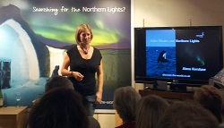
During a talk at Stanfords’ Covent Garden store on Wednesday, Cetacean expert and Discover The World tour guide Alexa Kershaw explained the intricacies and quirks of Iceland’s abundant killer whale population.

Alexa Kershaw“Whales are found in all the world’s oceans, and about a quarter of the world’s species are found in the waters around Iceland and the UK,” Ms Kershaw said.
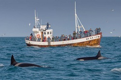
“The reason for Iceland’s abundant killer whale population is the warm waters of the gulf stream mixing with the cooler coastal currents, which means more plankton and fish.

“The Icelandic killer whales feed on herring and historically during the winter months were seen on the east coast of the island, but their location varies depending on the herrings’ activity – with more now being seen in Grundarfjörður on the western Snæfellsnes peninsula.

“The best time for sightings is between October and March, when the herrings come close to the fjords to escape the worst of the winter. Unfortunately for them, the killer whales know where they are – so they’re preyed on quite heavily. There are about two million tonnes though, so stocks recover quite well.

The Cetacean expert went on to explain that killer whales are sexually dimorphic, which means males and females can be identified just by sight.

“Females have smaller, curved dorsal fins – adult males have taller, more distinctive ones, and they’re usually more than a metre and a half tall,” Ms Kershaw told her audience.

Orca watching“Orcas are highly social creatures and they usually remain in the same family for life. Males tend to live for about 30 years and females as long as 50, though they can live much longer. Males grow to about 7.5 metres in length; females five, so they are pretty huge animals.

“A lot of what we know about killer whales comes from photo identification studies – scientists take photos of dorsal fins to be able to recognise individuals. They can then look at population structure and population size.

“We’ve been working with Icelandic researchers using holidaymakers’ photos to help them build a better picture of the whales’ behaviour.

Ms Kershaw went on to talk about Icelandic orcas’ unique feeding call, which allows them to hunt for herring more successfully.

“All whales and dolphins use sound as their primary sense because light cannot travel deep under water. In a recent study, it was discovered that Icelandic whales have a unique herding call – when they’re feeding on herring, they emit a three-second-long very low frequency sound, which can affect the fish’s swim direction and cause them to bunch together tightly.

“But contrary to popular belief, the whales don’t go in and eat a bunch of fish at the same time – they pick them off one-by-one.”

You can visit Discover the World and speak to one of their expert travel advisers on the lower floor of the Stanfords’ Covent Garden store. The tour operator will be based in the themed area until the end of September.

Browse our collection of Iceland Maps and Guide books here >

Iceland travel information >