by Gregor Swiderek
 Last time I was writing about the excellent (if a bit geeky) maps produced by the USGS. However great its series are, they might be a bit too “raw” for casual users and, most importantly, unlike OS Explorer they don’t mark walking trails (this should change with the new editions where adding trails is planned, at least in areas administered by the Bureau of Land Management, Forrest Service and National Park Service). Some old 1:24,000 quadrangles show paths but they don’t indicate if there is a right of way along it. And we all know about US gun laws.
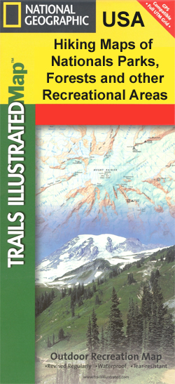
For trails you need the Trails Illustrated maps produced by the National Geographic. These are excellent walking maps with full topographic content but also marking trails, campgrounds, visitor centres, even toilets. They are also printed on waterproof plastic. Unfortunately they only cover national parks and some of the most popular national forests.
For National Forests not covered by the Trails Illustrated maps there is usually the possibility of obtaining maps produced by The United States Forest Service. Most of these maps are at a scale of 1:126,720 and many others are at scales such as 1:63,360, etc. These maps are famous for showing the numerous Forest Service back-country roads and they provide forest-wide information on attractions, facilities and services. However it is worth mentioning that many of those maps (especially the smaller scale ones) lack contour lines.
 Interestingly USDA Forest Service is also producing its own series of 1:24,000 quadrangles, called FS Topo. They are broadly similar to the US Topo series but they don’t contain the orthophoto image layer. Their advantage is that, unlike the US Topo series (at least so far), they do show trails as well as numbers for the forest roads. They can be downloaded for free as a Geo-enabled PDF file from the Forest Service website.
Now, a few words about road maps and general maps in America. There is of course a huge choice of road maps for the whole USA, its regions, states or even particular counties. There are so many of them that it is actually pointless to even try to list them here. Especially as most of them are quite average, nothing really to shout about.
One company worth mentioning is Rand McNally which publishes road atlases for the whole country, road maps for each state and city maps. It is one of the most well-known and oldest map makers in America. It produced its first map in 1872, it was published in its Railroad Guide. The first Rand McNally road map was published in 1904 and in 1917 the company was the first major publisher to embrace a system of numbered highways. In addition to creating maps with numbered roads, Rand McNally also erected many of the actual roadside highway signs. This system was subsequently adopted by state and federal highway authorities. So the pedigree is there, but its maps are no more or less accurate than any others.
 Some of my favourite road map publishers are GTR Mapping and Benchmark Maps. Both companies specialize in mapping western United States, in fact they don’t venture into the eastern half of the country at all. The best aspect of their maps is the fact that unlike most of the road maps in America they do show some topographic and landscape information.
For those for whom the road maps are not enough but who don’t want to embrace the slightly geeky world of the USGS maps there is one more option. Maine-based DeLorme produces a series of Recreational Atlases & Gazetteers for all the states. These excellent atlases feature detailed topographic maps for the entire state in handy atlas form. Each atlas features the most up-to-date road information for the state, from interstate highways to dirt logging roads (including names of the smallest lanes and numbers of the forest roads). The maps also show an abundance of geographic features and landmarks, information on places to go and things to do, all cross-referenced to the map. The scales vary depending on the state. For some of the smallest ones (likeConnecticutorRhode Island) it can be as large as 1:65,000 but most of the states fall into the 1:150,000 – 1:250,000 category. I love using them even if I don’t need all the detail they provide.
So this is US mapping in a nutshell.
All the maps I’ve mentioned can be purchased in Stanfords.
If you have any more questions feel free to email Stanfords or pop in into our London store and look for me in the basement.
Browse our full range of US Road Maps here>
 By Rachel Ricks
 Author
 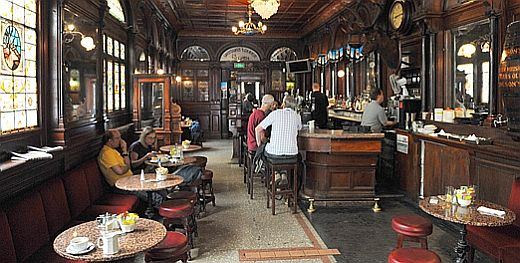 So during my recent trip to Ireland I couldn’t miss the opportunity of visiting a good Dublin pub. Our choice (based on a recommendation of one former Dubliner) was The Stags Head. Located at 1 Dame Court, it is not far from the touristy Temple Bar area but far enough to escape the worst aspects of its mass tourism. At first glance it looked like many other historic pubs; dark wood panelling, stained glass, and a real stag’s head above the bar. It could even be seen as kitschy if it wasn’t also so real at the same time. It is hard to explain what I mean but it was different than all those bland corporate pubs which try to look like the “real deal”. Surprisingly it is actually run by a pub chain.
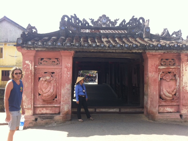 I was taken aback by the cleanliness and bright white walls of our latest accommodation. Not only was it very reasonably priced, but the staff couldn’t do enough in helping us feel at home. After a quick bite to eat in the restaurant, we headed out to see what Hoi An had to offer us. I had heard great things about the town so I was feeling very relaxed about our time here. I was delighted to see that the main shopping streets were blocked off to cars and motorbikes, which allowed us to causally walk around the streets and stalls in peace.
 Anyway, we were dropped at Minewa hotel in time for a Christmas Party Skype conversation with our London flatmates on the beautiful roof terrace, complete with cushioned alcoves. We spent a lot of time on that roof the next few days, working our ways through all the flavours of lassi on the menu.
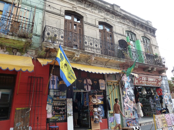
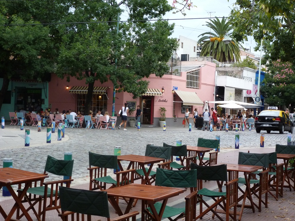 Palermo/ Villa Crespo
 Ireland, the emerald isle, one of the most popular tourist destinations in the world. After trying to organize a tour of it on a couple of separate occasions I finally succeeded just a few months ago.
 We started our trip in a car rental office in a suburb of Dublin. Nothing exciting or worth really writing about but in no time we were crossing the middle of the country on one of the new and empty Irish motorways. It was the first big surprise. Being used to busy British roads I just couldn’t believe how empty a major highway can be. There were quite long moments on our way to Cork when we couldn’t see a single car in front or behind us. Pure joy to drive.
 The second part of our Montenegro trip was almost entirely devoted to the coastal landmarks. But first of all, we were desperate to plunge ourselves in refreshing water and get a bit of a tan. Once we found ourselves by the sea in a town called Petrovac, it turned out that the coast was so popular with the locals that finding accommodation, a room at a guesthouse, was a challenge. Each of the four of us set on a journey knocking on peoples doors (in this sort of places virtually everyone offers rooms to get some extra cash), just to find that they were fully booked. After about an hour of research, one of us returned with good news – there was a track.
 It quickly turned out that we did not need to go back to the town to enjoy the beach; there was a small local one nearby. Happily, we set off with our beach gear. Even though the walk took us about 15 minutes it allowed us to familiarize ourselves with the vicinity and with the way people lived there. And it was not a posh part of the world. The path was dusty, along which modest housing or even shacks baked in the scorching sunlight. Litter scattered around, a barking dog in the distance, a lost hen looking for some lucky grain. Silence; not even one person around. It must have been that time of day, when all the locals made good use of the lazy weather at the beach. When we emerged from the arid and barren landscape, a complete change of scene welcomed us at the fresh and lively beach. Bunches of boys were jumping into the water from the rocks, children were splashing around, the bars and eateries enjoyed a good crowd of thirsty and hungry locals.