Stanfords’ award for printed mapping 2008 announced

The winner of the Stanfords Award for Printed Mapping was announced at this year’s British Cartographic Society’s (BCS) symposium, and our own shop floor manager Stephen Edwards was there to present our awards certificates.

The British Cartographic Logo Society The Stanfords Award for Printed Mapping was created to encourage any printed products to be entered, from coffee-table atlases to maps featured in leaflets or topical articles. Past entries have ranged from world map wallpaper to artistic interpretations.

Stephen said, “I really enjoyed visiting the BCS symposium and awarding the prizes. The maps entered were all of a very high standard and between them, the five winning entrants represented a diverse range of printed mapping.”

The judges decided as well as the winner, two highly commended and two commended certificates should be presented. Continue reading Stanfords’ award for printed mapping 2008 announced

Austria, Vienna

ViennaGuide books and maps are, of course, necessary if we are to get the best from our holidays. They tell us what to see and how to get there, and if we buy them early enough they can also help us choose a good hotel in a convenient location.

The best ones do provide information on a wide range of places to see, even if some guides limit their contents to the most obvious and invariably overcrowded ones. But returning from holidays it’s nice to bring back memories of places which, whilst not in the “must-see” league, speak more to us than the better known or historically and artistically more important sights. Here are my three from Vienna.

Beethoven’s house
On Mölker Bastei, perched high up above the western part of the Ring is Pasqualatihaus, one the houses where Beethoven used to live. One of several houses, because the great composer was not the easiest of tenants and frequently had to change his lodgings; he tallied up over 30 addresses in his 35 years in Vienna. Apparently cleanliness was not one of his strong points – one cannot somehow imagine a sonata in B-flat, op. whatever, “The Fairy Liquid”.

The little museum on the top floor of the house is nothing special – a piano, reproductions of some scores and letters, a few pictures, and equipment to listen to some recordings. The museum is nowhere near as interesting as the Beethovenhaus in Bonn, with its collection of the composer’s gigantic hearing aids. But two of the symphonies and a piano concerto were composed here, and that’s quite enough for me to make the place a shrine.

The house has obviously been renovated several times, but the staircase still retains its old atmosphere. One can easily imagine the great man thundering down allegro con brio, or even con fuoco, and then lumbering up the stairs back to his hovel, now only andante sostenuto.

Stalin’s Obelisk
When, after 10 years of tortuous peace negotiations, the Soviet Union finally signed the Austrian State Treaty, withdrawing from its zone of occupation and Vienna to allow the country become independent on 15th May 1955, the main condition was, of course, Austria’s political neutrality between the two Cold War blocks. But further down the list, in not-so-small print was a clause ensuring proper upkeep of monuments to the conquering Red Army.

Less than a year later, at the 20th Congress of the Communist Party of the Soviet Union, Nikita Khrushchev denounced Stalin’s dictatorship and his personality cult and soon after Uncle Joe was kicked out of the mausoleum on Red Square. His statues came tumbling down and his name was quickly erased from street names and various dedications (I witnessed much of it myself in Warsaw). But, in the now neutral Vienna, Слава Великому Сталину continued to be proclaimed in shining gold letters.

The neutrality may have vanished with Austria’s accession to the European Union, but the Russian Heroes’ Monument on Schwarzenberg Platz is still well maintained. Whilst I struggled with the Cyrillic letters to read Stalin’s proclamation to his victorious troops (the language is easy for a Pole, but the alphabet has always defeated me!), a young Russian couple visited the site; beaming with pride, yet clearly able to see the irony of it all.

Franz Joseph’s ginkgos
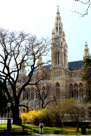
There must be something in Vienna’s climate or its soil which makes them particularly good for ginkgos. There’s a lovely, large one in the Rathaus Park between the Ring and the Town Hall. But the best ones are in the Burggarten. They must have been planted there when the park was still a private garden of the imperial palace of Hofburg. If you are in Vienna in the autumn, the best time for a holiday in central Europe, go and see them after a visit to the Albertina or to the palace itself. The largest one is right in the centre of the park, between the Mozart monument and the Palm House, standing at that time of the year in the middle of an amazing carpet of bright yellow leaves.

Oh, and if you want a tip where to find something more tangible to bring back with you, try the pottery shop on the northern side of Weihburggasse, between Kärtner Straße and the Franziskaner Platz. If you come back with one of those large central European tiled stoves, £2,500 or more a piece if not quite so many pounds in weight, I’ll be really envious.

During my visit I used the Borch street plan of Vienna and the Rough Guide to Vienna.

Maps and Guide books for Vienna

Author: Malgorzata Ross

A Map of Hell

Dr Peter Whitfield

Dr Peter Whitfield looks at the ghost story writer M R James and his connection with maps.

Mr Humphreys and His Inheritance

by M R James

Montagu Rhodes James (1862-1936) was a prolific British scholar, medievalist and palaeographer, who catalogued all the important manuscript collections in Cambridge, England. He became Provost of King’s College and then of Eton. He never married, but lived his entire life in the enclosed male realm of academic scholarship and college administration.

He also wrote some two dozen ghost stories which have carried his name far beyond the world of scholarship. But to call them ghost stories is misleading, for no white figures glide silently through darkened passages, or are glimpsed in the moonlight. James’s ghosts are demons, bestial and horrifying, and their power is physical, capable of stripping their victims’ flesh from their bones, after hunting them down and reducing them to terror. A typical James narrative shows this demonic thing escaping, getting out from the place where it has been imprisoned.

With a scholar’s delight in antiquarian detail, James invariably chooses a historical artefact – a picture, a piece of jewellery, a stained-glass window, a manuscript, an ancient well – as the prison, and it is invariably a curious scholar whose over-eager researches release the terror, and who pays the price. Not all the stories are successful by any means: some are wooden in their characterisation and over-fussy in detail, but when they work, the best of them distil an atmosphere that is not easily forgotten.

Given James’s typical approach – the fascination with manuscripts and with historical detail – it might be expected that an old map should form the mainspring of one of his plots, the focus of a haunting. Although James never used an identifiable historical map in quite that way, in his story Mr Humphreys and his Inheritance, the plan of a maze drawn by its owner does indeed act as the vehicle by which a demon lurking within the maze is released. There is a double cartographic interest in this story, because it transpires that the demon has been imprisoned in a decorative globe, which has been set up at the maze’s centre. It should be explained that Mr Humphreys has recently inherited an old house whose gardens contain the maze. The maze was laid out by his grandfather, a mysterious figure who died abroad and has no known grave or tomb. The maze has been locked and barred for years, and Mr. Humphreys has just penetrated it for the first time, finding the ancient bronze globe at the centre:

The column was featureless, resembling those on which sundials are usually placed. Not so the globe. I have said that it was finely engraved with figures and inscriptions, and that on first glance Mr.Humphreys had taken it for a celestial globe: but he soon found that it did not answer to his recollection of such things. One feature seemed familiar: a winged serpent – Draco – encircled about the place which on a terrestrial globe is occupied by the equator: but on the other hand, a good part of the upper hemisphere was covered by the outspread wings of a large figure whose head was concealed by a ring at the pole or summit of the whole. Around the place of the head the words “princeps tenebrarum” could be deciphered. In the lower hemisphere there was a space hatched all over with cross-lines and marked as “umbra mortis”. Near it was a range of mountains , and among them a valley with flames rising from it. This was lettered (will you be surprised to hear it ?) “vallis filiorum Hinnom”. Above and below Draco were various figures not unlike the pictures of the ordinary constellations, but not the same. Thus a nude man with a raised club was described not as Hercules but as “Cain”. Another, plunged up to his middle in earth and stretching out despairing arms, was “Chore” not Ophiucus, and a third, hung by his hair to a snaky tree was Absalom. Near the last, a man in long robes and high cap, standing in a circle and addressing two shaggy demons who hovered outside, was described as “Hostanes magus” (a character unfamiliar to Humphreys). The scheme of the whole indeed seemed to be an assemblage of the patriarchs of evil, perhaps not uninfluenced by a study of Dante. Humphreys reflected that it was an unusual exhibition of his grandfather’s taste, but reflected that he had probably picked it up in Italy.

Far from being a globe of the heavens, the writer is making it clear that Humphreys has stumbled on a globe of hell. All the characters named above are figures of evil, now damned in a Dantean inferno. Humphreys fails to realise the sinister significance of what he has seen, and plans to re-open the maze and show it to his neighbours. As a first step, he spends an afternoon drawing a plan of the maze in situ, and later that night he settles down in his library – by lamplight with bats flitting by the window – to copy it:

It was a still, stuffy evening: windows had to stand open, and he had more than one grisly encounter with a bat. These unnerving episodes made him keep the tail of his eye on the window. Once or twice it was a question whether there was – not a bat, but something more considerable – that had a mind to jolt him. How unpleasant it would be if someone had slipped noiselessly over the sill and was crouching on the floor!

The tracing of the plan was done: it remained to compare it with the original, and see whether any paths had been closed or left open. With one finger on each paper, he traced out the course that must be followed from the entrance. There were one or two slight mistakes, but here near the centre, was a bad confusion, probably due to the entry of the second or third bat. Before correcting the copy, he followed out the last turnings of the path on the original. These at least were right; they led without a hitch to the middle space. Here was a feature which need not be repeated on the copy – an ugly black spot about the size of a shilling. Ink ? No. It resembled a hole, but how should a hole be there ? He stared at it with tired eyes: the work of tracing had been very laborious, and he was drowsy and oppressed….But surely this was a very odd hole. It seemed to go not only through the paper, but through the table on which it lay. Yes, and through the floor below that, down, and still down, even into infinite depths. He craned over it, utterly bewildered. Just as, when you were a child, you may have pored over a square inch of counterpane until it became a landscape with wooded hills and perhaps even churches and houses, and you lost all thought of the size of yourself and it, so this hole seemed to Humphreys for the moment the only thing in the world. For some reason it was hateful to him from the first, but he had gazed at it for some moments before any feeling of anxiety came upon him; and then it did come, stronger and stronger – a horror lest something might emerge from it, and a really agonizing conviction that a terror was on its way, from the sight of which he would not be able to escape. Oh yes, far, far down there was a movement, and the movement was upwards – towards the surface. Nearer and nearer it came, and it was of a blackish-grey colour, with more than one dark hole. It took shape as a face – a human face – a burnt human face: and with the odious writhings of a wasp creeping out of a rotten apple, there clambered forth an appearance of a form, waving black arms prepared to clasp the head that was bending over them. With a convulsion of despair, Humphreys threw himself back, struck his head against a hanging lamp and fell.

Humphreys is in shock for some days, then recovers sufficiently to order the globe to be broken open: inside are found ashes, evidently remains of a human cremation. In some unexplained way, his ancestor’s remains had been hidden in the globe, and the drawing of the map allowed his spirit to escape out of the hell where it had been confined. The implication is that Humphreys’ ancestor was some kind of necromancer, a devotee of the occult, who had suffered the appropriate punishment. In this instance, Humphreys sustained no harm, but the other scholars in James’s stories usually suffer death – and a death so horrifying that those who see the body are haunted forever by the memory.

There is no ultimate explanation of the curse or the haunting: everything proceeds by hints and by suspicion. The pieces of the jigsaw are placed before the reader, but the author never quite puts them together for us. The intriguing thing about these stories is James’s fixed belief that a haunting requires a historical focus as its vehicle: a globe, a manuscript, a picture, or an inscription, becomes the focus of the demonic power. James seems to have seen in the artefacts of the past a concentration of old, pagan, demonic forces, which he delights in releasing into modern England. The temptation to psycho-analyse James himself is irresistible: in the composition of these stories, what was this disciplined and fastidious scholar releasing from the depths of his psyche.

Author: Peter Whitfield

England – The Thames Path

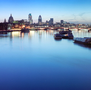
London - Thames PathOur guide was very changeable, even capricious, taking us in one direction and then another. Our guide was the River Thames and led us from the docklands of east London to the leafy settlements of Buckinghamshire.
The Thames Path is 184 miles long and you can walk it from the source, in Gloucestershire, to the Thames Barrier; or do it the other way round as we did. Some people walk the whole path in a couple of weeks; others chop it into weekend jaunts. We decided to hike half of it and save the second half for a further holiday the following spring. The Cicerone Guide to The Thames Path by Leigh Hatts proved invaluable in planning our trip and follows the path upstream. If walking downstream I would recommend The National Trail Guide to The Thames Path by David Sharp. We also used the relevant OS 1:25,000 maps.

City highlights were numerous, and we were struck by one iconic landmark after another, all illuminated by glorious May sunshine. A familiar capital presented a different face to the workaday one, and by our first evening a holiday mood was definitely upon us, as we ate by twinkly riverside lights on Butlers Wharf, close to Tower Bridge.

As we journeyed westwards from Putney, the river took on a lusher, greener aspect and meandered more lazily. Bridges punctuated it less frequently and eventually gave way to islands. Surprisingly, there are over 100 islands in the Thames from sea to source. Eel Pie island in Twickenham is perhaps the most well known, being one of the longest and not surprisingly named after the dishes served up to boating parties.

However, when you get into ‘Three Men in a Boat’ territory, past Hampton Court Palace, you will see Tagg’s Island. Here Stan Laurel and Charlie Chaplin learned how to get laughs in Fred Karno’s hotel. You can find out more in River Thames – in the footsteps of the famous, by Paul Goldsack.

Rowers glided past providing a steady rhythm and we ended our adventure in Marlow, Buckinghamshire. A sighting of the Chiltern Hills whetted our appetites for a final hike to the source next year. The following day we reluctantly bade farewell to our guide and caught a train home.

Browse our collection of maps & guides:
> England travel guides
> England road maps and atlases
> Travel literature inspired by England
> Walking map and guides of London

Author: Stephen Edwards

England – Manchester

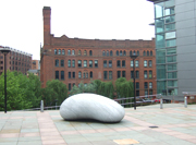
ManchesterSidestepping the clichéd comments about rain and industrial gloom, there are strong arguments for choosing Manchester as a city break destination. There is the social and cultural history of one of England’s great urban centres, the sense of vibrancy and vitality of a place in flux, and the architectural wonders of a city with one foot in the past and the other firmly marching forward into the 21st century.

Since it has a relatively compact city centre, Manchester is an ideal option for a weekend getaway. Shops, restaurants, music venues and clubs are a-plenty, especially in the areas between the Arndale Centre, Deansgate, Piccadilly and the famous Canal Street. For those with less disposable income, it is a delight to just walk the streets and soak up the atmosphere of the place. I would definitely recommend a visit to the splendid John Rylands Library and a walk around the canals and bridges in the Castlefield area of town. You could even visit the Lowry arts centre, the City Art Gallery or any of the smaller galleries to be found in the city. In Manchester, delights can be found in the most unlikely of places, where side alleys, backstreets and canal paths reveal hidden spires, public art and music venues.

My favourite area was the Northern Quarter, with its boutiques, trendy record shops, edgy pubs and classy bars. It was here that made me think most of my musical heroes who hail from Manchester: Joy Division, New Order, the Stone Roses and the Smiths all grew out of the vibrancy of this city.

For my trip, the Manchester Time Out Shortlist guide was invaluable for up-to-date practical advice and maps to find my way around. Also very useful were Clare Hartwell’s Manchester Pevsner Architecture Guide and an eccentric walking guide called Morrissey’s Manchester, which details the haunts of Manchester’s favourite miserabilist and his chums from his former band, the Smiths.

There may be rain, and Morrissey and Marr may not be everyone’s cup of tea, but Manchester is a breath of fresh air for anyone looking for a stimulating short break.

Browse our collection of maps & guides:

> England travel guides

> England road maps and atlases

> Travel literature inspired by England

> See all our maps and guides to Manchester.

Author: Tim Cleary

China – Beijing

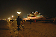
ChinaWhen I first arrived in Beijing the first thing that struck me was the pollution and the haziness of the skies. My dad and I hailed a taxi at the airport – my first chance to practice my basic Chinese. Luckily the driver seemed to understand what I was I was saying however if you can’t speak any of the language I advise you to get the hotel or a Chinese friend to write it down for you on paper because the taxi drivers know little or no English. Huge highways congested with trucks and cars waited in a long traffic jam heading towards the city centre. Our hotel was situated in an ideal location, only a five-minute walk to Tiananmen Square on a long busy road; you should pay around 120 yuan to go from the airport to central Beijing. There are many things you could say about Beijing but one thing you can’t say is that it is boring – during the summer everyone stays out late, eating at small noodle bars and cafes.
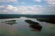
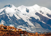
Everyone there wakes up early and often jog before work or school while the older generation do tai chi in large leafy parks – there is a dominant habit of old men in Beijing to make a huge flemmy noise and then spit every few minutes. The streets and other public places are full of life and many people spend much of their day here because the majority of the population are crammed into small rooms in massive blocks of flats. Many of the tourist attractions in Beijing are overcrowded and overrated, however, the Summer Palace and the Temple of Heaven are definitely worth your while. It is a good idea to visit the more touristy sites as early as possible as crowds become unbearable after 8 o’clock.

As I found out, if a taxi driver thinks you can speak Chinese they will speak quickly and they like to shout when they speak to foreigners, however most of them were extremely friendly and helpful. Walking from place to place is nearly impossible due to the size and the spread of the city – but you can quite easily walk if you want to find a restaurant or a park because there are restaurants on nearly every street. Good places to go for dinner or lunch are in the small hutongs (side roads) that can be found in the north of the city and in some parts of the centre. These more authentic slightly shabby narrow roads are what real Beijing is like – old men playing Chinese chess, young children playing out and very good street food without any illnesses to follow.

These areas date back hundreds of years and are far more traditional in architecture and daily life than any other part of Beijing, and are virtually tourist-free. A good place to go out after you eat is KTV, which is the Chinese version of karaoke. You hire a small room with a TV for as long as you want and you sing along to Korean and Taiwanese pop music. If, for some reason, you get bored of Chinese food – if you stay for a long period of time – go to a Hanguo kao rou restaurant where they give you a variety of very good quality meat and you roast it yourself over hot coals. It is also popular to go to one of the many tea houses in Beijing before or after a meal.

If you travel to anywhere in China take the opportunity to buy as many DVDs or any electrical things because it is far cheaper and their technology is far ahead of what we have in the West. Not just electrical equipment but everything in China, except things that they see as exotic such as coffee, are cheap, 15 renminbi to the pound.

If you don’t want to take a taxi everywhere take a bus – it is the cheapest mode of transport and is efficient. However, like any vehicle in Beijing it will get caught up in traffic a lot of the time. Do take into account that the buses are usually ridiculously crowded, as is the small subway system which would be confusing enough even if it was in English. Beijing can sometimes be a confusing city but it isn’t too hard to find your way around, however if you ask any of the locals a direction in Chinese they will always tell you North, South, East or West so be sure to ask what road to take.

Anyone who comes to Beijing almost always eats at a roast duck restaurant – there are huge duck farms outside Beijing where the animals are fattened up to be roasted until there is a perfectly crisp skin and succulent inner flesh. Beijing duck tastes completely different to the Cantonese version we have in London. If you want to go to a duck restaurant just wander around until you find one as there are restaurants everywhere – it is pretty obvious to tell a duck restaurant because they tend to have a picture of a cartoon bird.

In some restaurants they carve the duck in front of you and they are extremely hygiene conscious as they wear a plastic mask and gloves whilst touching food. When I was in Beijing I had noticed that in many restaurants they give a free bottle of mao tai which is a 53% bottle of rice-based alcohol. Drinking here is quite acceptable and many business men smoke or drink whilst chatting. The best way to take in Beijing life is to spend time in a school or college as I did, you get a completely different view of the city from the eyes of the local people but the main reason I did it was to improve my Chinese speech. But I recommend it to anyone, however the government can make it quite hard for you to do so.

Stanfords’ recommendations for a trip to Beijing are the ITMB Beijing map and Lonely Planet’s Beijing guide.

Browse our collection of China Maps and Guide books here >

Author: Angus Lee

Canada – Northwest Territories

Canada

I first came to Canada to paddle down the Nahanni River in the Northwest Territories. We flew into our starting point, just south of the Arctic Circle, in a DeHavilland Single Otter sea-plane. Landing at Moose Ponds was almost the end of the trip, however, as the pilot nearly ran out of lake…

A three-week trip takes you past glacial lakes, hot springs, and numerous rapids. Hiking opportunities are plentiful, and it’s definitely worth taking a day to climb the mountain peak at Virginia Falls – an unspoilt waterfall twice the height of Niagara.

While the pilot nearly killed me on day one, I had a go myself while clambering over Virginia Falls, but the closest we came was in the middle of the night when our river island flooded – we clambered into our canoes only once the water had reached knee-height.

Eventually you pass through Hell’s Gate whose walls tower 460m above, and then the river becomes calmer (well, ok, you do have Deadman Valley and Headless Creek to negotiate too). But it’s well worth taking the trip to spot all sorts of truly wild wildlife including moose, beaver and the odd grizzly bear if you’re (un)lucky. And you may also see the Northern Lights.

A few years later I came back to western Canada on a tour of North America. Following a quick couple of days in a rainy Vancouver we headed east to Banff National Park. So much snow set in that we could not even leave the campsite, and so spent a few days in the public sauna and around an old Space Invaders table.

Once the sun had been out long enough to free our truck we headed north to a frozen Lake Louise. The lake and its surroundings are quite magnificent, but if you want to come in from the cold you can enjoy the views from the warmth of the lavish Fairmont Chateau on the edge of the shore.

Any trip to this area requires a visit to the world’s biggest mall in Edmonton, complete with rollercoaster, ice rink, and waterslides all under one roof. If that sounds a bit tame however, head to Calgary, the host of the Winter Olympics in 1988, and, with your heart in your mouth, slide down the luge.

It’s a vast area, but to mark out my various destinations the Canada: The West road atlas by Hildebrand was indispensable, but now out-of-print, along with the North Canada Bradt Guide, which provided excellent detail on the Northwest Territories. Now instead try and the Moon. Robert Twigger’s book, Voyageur provides plenty of tales and adventure as he journeyed across the Rocky Mountains in a birchbark canoe.

Browse our collection of Canada Maps and Guide books here >

Author: James Innes Williams

I think I fell in love with Bolivia

BoliviaI think I fell in love with Bolivia as I watched the bus I’d been travelling on from Peru being ferried across Lake Titicaca on what amounted to a glorified raft. Bolivia’s landscape may initially appear harsh and its people stand-offish, but a scratch beneath the surface soon reveals these impressions untrue and this landlocked Andean country inevitably weaves its spell.
La Paz provides a good jumping off point for any Bolivian adventure. Although its traffic-choked streets may not be to everyone’s tastes, the city has a real energy about it, with its bright buses, ever-insistent street vendors and lively nightlife (check out the Sopocachi district). Make sure you take the time to look skywards after nightfall, as La Paz’s altitude and relatively low light pollution from its ramshackle street lamps combine to give a spectacular view of the stars. A trip to see one of La Paz’s football teams is well worth the entry fee, if only to contrast your altitude sickness while climbing to take a seat with the frenetic fare on the pitch… easy to see why the beach-boy Brazilians fear their visits to Bolivia!

Moving away from the capital, my personal highlight was the now legendary bike ride on, “the world’s most dangerous road.” A short bus ride from La Paz plus a bit of strenuous high altitude cycling takes you up into the clouds at just under 5,000m; from here it’s only a few hours (and 70km) in the saddle to the subtropical climes of Coroico, dropping around 3,500m on the way and giving one of the biggest legal adrenaline rushes imaginable!

If you feel you can face a tortuous overnight bone-shaking bus ride from La Paz to Uyuni, accompanied predominantly by bags of poultry, you’ll be rewarded with arguably Latin America’s most captivating landscapes. The Bolivian Altiplano is a vast high altitude plateau dotted with technicolour lakes, surreal rock shapes, giant cacti and seemingly endless salt plains. Throw a few geysers, flamingoes, llamas and volcanoes into the mix and it can feel like you’ve arrived in another world.

Whether Bolivia is your sole destination, or part of a bigger South American journey, you can’t go far wrong with a Footprint South American Handbook and a Reise Know-How map to Bolivia. For reading material, try to pick up an old copy of the now out of print Bolivian Diary by Ernesto Che Guevara, which tells the story of his ill-fated guerilla campaign of the late ’60s.

Browse all our guide books and maps of Bolivia here >

Author: Dan Weston

England – Brighton

BrightonLast summer I went to Brighton, with the wholesome intentions of going on many cultural expeditions and walking along the South Downs, saturating myself in the idyllic scenery. Unfortunately I was to find myself distracted by the allure of shots of toffee schnapps for a pound and the onset of liver failure.
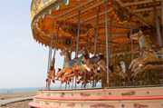
With the aid of my trusty A-Z and badly titled yet fantastic ‘Cheeky’ guide book, I had the time of my life savouring the best of British culture. Continue reading England – Brighton

Australia – Uluru – Kata Tjuta National Park

Ayers Rock/UluruThere is nothing I can do about it now. I climbed Ayers Rock (Uluru in Aboriginal) and I wish I hadn’t. The red monolith that stands today as one of the most recognisable symbols of Australia is a sacred site to the local Aboriginal people, the Anangu. The Anangu don’t like people climbing the Rock for two main reasons: firstly, because the climb to the top follows the steps of their ancestors and has strong spiritual meanings associated to it; secondly, the Anangu feel responsible for anything that happens to visitors on their land and people have fallen off the Rock and died.

My sister and I had travelled from Melbourne and got to the Ayers Rock resort, just outside the boundaries of the National Park, on the 31st December. We spent an unusual New Year’s Eve stargazing just outside the resort. The sky was packed with stars and one of our fellow backpackers had a very worn out Collins Gem Guide to Stars that got passed around a lot.

On the second day of the New Year, very early in the morning, we joined a crowd of visitors, mainly Japanese tourists who had come to Ayers Rock equipped with gloves to hold on to the chain that follows the easiest path up to the top of the Rock. From far away visitors looked like a row of black ants climbing up a big red mound. I am in no position to say “Don’t climb it” so I won’t. What I will say is that the best part of my visit to Uluru wasn’t the climb but it was standing next to this giant piece of rock, looking at the shapes the wind has moulded out of its sides and the humbling acknowledgement of the Aboriginal people’s superior understanding and respect of this inhospitable environment.

Bruce Chatwin’s The Songlines is a great introduction to the Aboriginal mythology of Dreaming.

For a very good map of the park, use the Australia Survey map of Uluru – Kata Tjuta National Park and The Red Centre: Alice Springs to Ayers Rock by Hema Maps provides good mapping of the larger area around Alice Springs.

If you are planning to do some star-gazing, the Collins Gem Guide to Stars is backpack-friendly and has all the info to identify the amazing quantity of stars you will see in the clear Austral sky above the Australian Outback.

Browse all of our Guides and Maps of Australia >

Author: Marina De Santis