Stanfords Stories

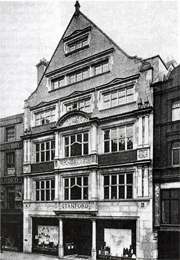
Stanfords Covent Garden.Established in 1853, Stanfords has since made and supplied maps to royalty, the military, and famous adventurers, explorers, writers, and even dolls, for over 150 years.

Here we’ll be sharing some of the many fascinating stories in our rich history, as we discover more.

Cabinet War Rooms

Stanfords’ maps played an important role in World War II – many of the maps used by Churchill and his administration in the Cabinet War Rooms in London’s Westminster were produced by Edward Stanford Ltd.

To this day, visitors to the museum of the rooms – preserved as they were left on the last day of the war – can see our map of south-east Asia on the wall of the Map Room. And there are many more – the museum curator lists no less than 28 maps published by Stanfords – all to be found in the map chests’ drawers. Continue reading Stanfords Stories

John Simpson Takes Explorers to War Zone

John Simpson is to teach adventurers Sir Ranulph Fiennes and Sir Robin Knox-Johnston how to file news reports from a war-zone in a new BBC series.

The BBC world affairs editor will take the pair to Afghanistan, as he files reports for the BBC News.

In return, the explorers will lead Simpson on the type of trips they are more familiar with, to hone the broadcaster’s adventure skills.

Sir Ranulph, whose records have included making the first surface journey around the world’s polar axis, will guide the others on a week-long journey to the Arctic Circle in temperatures as low as -50C.

Sir Robin, the first person to sail single-handedly and non-stop around the world, guides the voyage around South America’s dangerous Cape Horn. The team have just completed filming there and John Simpson kindly spared a moment to send us some photos. And here are the trio at Cape Horn (top right) and a shot of the treacherous waters they encountered (left).


The three-part series – Top Dogs: Adventures in War, Sea and Ice – will be shown on BBC2 in spring this year.

Read our interview with John Simpson.

‘True’ World Place Names Revealed in New Stanfords Maps

New maps have come into Stanfords that are truly unique – the atlases of true names around the world and Europe.

These maps are the first to use etymology – the study of the origin and history of words – to provide an unusual insight into familiar geographical names – with intriguing results.

Once the names have been taken back to their roots and translated into English, it is apparent that our world also has an affinity with Middle Earth – the mythical continent in Tolkien’s The Lord of the Rings.

The etymological world map reveals place names such as Italy to be ‘Land of Calves’; Scotland as ‘Land of the Wanderers’; the Sahara as ‘Sea of Sand’; Burma as ‘Land of the Quick and Strong Ones’ and Antarctica as ‘Opposite to the Bear’s Land’.
Continue reading ‘True’ World Place Names Revealed in New Stanfords Maps

Stanfords Supports International Development Charity

Stanfords were pleased to be able to donate nearly £125 to international development charity ActionAid after a special Christmas shopping evening.

ActionAid joined us in our London store for the Christmas shopping evening on 20 November when we offered customers 10% off their purchases, plus we pledged 10% of the evening’s proceedings to go to the charity. Continue reading Stanfords Supports International Development Charity

Strictly the River Avon

Our manager of Stanfords in Bristol appeared on TV to defend the city’s river following a gaffe made by Strictly Come Dancing judge, Len Goodman.

Goodman has become well-known on the BBC TV series for always giving every competitor 7 out of 10 for their efforts, which led to presenter Bruce Forsyth sending him up on a recent show. Forsythe grilled Goodman with questions related to the number 7, such as, “How many dwarves did Snow White have?” However, one of the questions was, “Which river runs through the centre of Bristol?” And to the horror of the West Country, Goodman answered “Severn”. As we all know, it’s in fact the Avon.

Continue reading Strictly the River Avon

Stanfords Stocks Large-Format Personalised Historical Maps

Here at Stanfords, we’re about to add another product to our range. In partnership with Cassini Publishing, we will shortly be offering Mapmaker-80 which provides site-centred historical maps of any part of England and Wales. These will match the 80x80cm format of the popular OS Select maps of the present-day landscape.

“We receive numerous requests for historical maps that match present-day OS Select maps,” says Stanfords’ Martin Greenaway, “but previously this hasn’t been possible. Present-day OS maps are available in a set of seamless tiles, but until recently historical maps were not. Fortunately, Cassini has changed all that!” Continue reading Stanfords Stocks Large-Format Personalised Historical Maps

World’s Biggest Atlas Goes on Sale

Stanfords are to be one of the few retailers in the country selling an extraordinary new atlas, making a unique Christmas gift. Only 3,000 copies are being printed of the world’s largest atlas – Earth – which stands at over half a metre (two feet) tall and, with its case, weighs 30kg (66lb).

Earth is a comprehensive world atlas, examining the physical world with new emphasis on current political, social and environmental landscapes. Produced by over 40 cartographers and an international team of over 60 geographers, the atlas even features page-spreads that unfold to 2m (6ft). Continue reading World’s Biggest Atlas Goes on Sale

Stanfords GIS sponsors Peaceful and Better Neighbourhood Award

Stanfords GIS sponsored for the first time the Peaceful and Better Neighbourhood Award, which this year went to an estate that has undergone substantial regeneration with the provision of 498 affordable homes and community facilities.

The Wychall Farm estate in Birmingham won the award for “meeting the needs of the existing community as well as providing a greater balance of tenures. Historically the area suffered defected homes, problems of social deprivation, high unemployment, and poor infrastructure with a long-standing reputation of a ‘no go area’.” Continue reading Stanfords GIS sponsors Peaceful and Better Neighbourhood Award

England – Cotswolds

The CotswoldsI was feeling frazzled and needed a quick, late-summer break, somewhere non-taxing and easy on the eye. Flicking through my England guidebook, the page fell open on the Cotswolds, and I only needed to see the words ‘lush rolling hills and picture-postcard villages’ to book a hire car and start packing my rucksack.

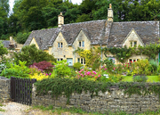
An easy two-hour drive from central London and we were sweeping into the heart of the Cotswolds. Our first stop had to be one of the most famous, and most visited of the villages: Bourton-on-the-Water. Several low bridges cross the shallow river that runs through the centre of the village, earning it the imaginative nickname: the ‘Venice of the Cotswolds’. We spent a happy morning taking photos of the picturesque river, its bridges, and the honey-hued cottages too cute to be true that line every street.

We didn’t think it could get more picture-perfect until we reached the nearby villages of Upper and Lower Slaughter. Their gruesome-sounding names belie a gorgeous pair of settlements crammed with chocolate-box cottages with rambling roses round the doorways, trickling streams and attractive churches, all with a backdrop of sheep-dotted hills.

We had brought along an impressive picnic, some of which was even in a traditional wicker hamper, so we decided we needed a great spot with a viewpoint deserving of such a feast. We headed to Broadway, from where you can walk up to its hilltop 18th century gothic tower and enjoy views over rolling meadows to no less than 13 counties – according to our leaflet. Surely there’s no better viewpoint in the Cotswolds, we thought.

After parking the car in Broadway, we loaded ourselves up with the hamper, cool box, rucksack and several blankets. I spotted the tower on top of the hill above the village; the leaflet described it as a 40-minute walk. Easy, we thought, as we headed in the general direction of the tower. However, it disappeared alarmingly quickly from sight, so we waylaid the next passer-by for directions. Luckily he was a local, and he confidently pointed us down to the end of the village’s main street. It sounded straightforward.

We reached the end of the village, and followed the only footpath we could see. Through a sewer works and passing under a major road, we headed up a very steep hill, which felt perpendicular with our baggage. And yet there was still no sign of the tower. After not very long, we collapsed with hunger in a field, which although had lovely views, we were surrounded by cow pats, and some spooky-looking horses kept eyeing us up. We quickly wolfed down some sandwiches before making a swift descent back to the car, giving up on the tower altogether.

Driving back along the main road, we saw signs pointing off to Broadway Tower. Sure enough, we could drive straight up to park just a short distance from it. At least we got those sweeping views in the end.

When I go back to the Cotswolds, which I hope is soon, I’m going to avoid picnicking in cow pats again and will take the appropriate Ordnance Survey maps. We used the Lonely Planet guide to England, with a good section on the Cotswolds.

Read Laurie Lee’s classic Cider with Rosie for a real feeling of life in the Cotswolds in the early 20th century.

Browse our whole collection of maps and guides to The Cotswolds

Browse our collection of maps & guides:
> England travel guides
> England road maps and atlases
> Travel literature inspired by England

Author: Rachel Ricks
England – Essex

Essex

I know a place that’s the best spot in Britain to avoid the rain, find unspoilt sandy beaches, eat freshly caught oysters, and walk through scenery unchanged since the early 19th century. Why, it’s beautiful Essex of course.

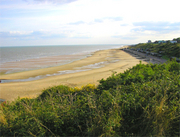
For starters, believe it or not, Essex has one of the longest coastlines in England at no less than 300 miles. And in most places it’s actually rather attractive. You don’t get any of those nasty uncomfortable stones of Brighton beach, instead there is sand – yes, soft, golden, glorious sandy sand. You can sink your toes, build castles, dig out boats, bury dad… Continue reading England – Essex