 It is a fascinating fact of cartographic history that the first world map to name the new continent of America was also the first to illustrate the existence of the Pacific Ocean. What’s more, there is a mystery surrounding the origins of this remarkable map produced by Martin Waldseemuller in 1507: how did he come to represent the Pacific on his map a full decade before any European had actually seen the ocean?
Here we are honoured to reproduce an exclusive abridged version of a lecture on this mystery given by cartographic historian Peter Whitfield at the British Library that coincided with their exhibition Lie of the Land – the secret life of maps (27 July 2001 – 7 April 2002).
The European Discovery of the Pacific – A Cartographic Mystery
Keats’ well-known poem Much have I travelled in the realms of gold ends with the lines:
“Like stout Cortes when, with eagle eyes,
He stared at the Pacific, and all his men
Looked at each other with a wild surmise,
Silent upon a peak in Darien.”
These lines commemorate a milestone in the history of exploration – the first European sighting of the Pacific Ocean. Keats had got his facts wrong of course, for it was not Hernan Cortes but another Spanish conquistador Vasco Nunez de Balboa, who saw the ocean. That moment on September 25, 1513 has certainly still entered the history books, when Balbao, in the course of his journey across the isthmus of Panama, first sighted a great sea far away to the south. Two days after the sighting, he and his men reached the coast and waded into its waters, claiming possession of it for Spain. Balboa met a bloody end in 1519, but news of his discovery had already spread to Europe, and had revived hopes of finding a westward route to the Indies. With this aim Magellan set sail in September 1519, and of course he succeeded, spending 100 terrible days sailing across some 6,000 miles of empty ocean from the Magellan Strait to make his landfall in Guam. Magellan met a tragic and unnecessary death in a brawl on one of the Philippine islands, but the survivors of his crew arrived back in Spain in September 1522 with the Pacific now firmly placed upon the world map, so named by them for its calmness and absence of storms.

So what is going on here? No other map of this period shows such an ocean, and it was universally believed that the lands discovered in the western Atlantic by Columbus and the other navigators were actually the coasts of Asia. This of course was what the navigators in the age of discovery had set out to find – a western sea-route to the Indies and China. All other maps of this period depict the American discoveries as part of Asia, and they place the names Asia, or China, or Tibet and so on upon them. No European text of this period, no geographical description of the world, mentions an ocean west of America, so what is the background to this unique map? Who was Martin Waldseemuller? Where did he get his data from, and what was his intention?
We know little more than the bare outline of Waldseemuller’s life and work. He was born near Freiburg in the southern Black Forest around 1470. By 1515 Waldseemuller had become a leading member of an intellectual circle in St Die in Lorraine. This group was particularly interested in the sciences of geography and mapmaking, and they acquired books and maps concerning the new discoveries across the Atlantic from Spain and Italy. The results of Waldseemuller’s researches were published in 1507 in four parts:
- The world map which we are discussing: a very large map (2.3 x 1.3m) printed from 12 separate woodblocks – in fact it was the largest map ever printed to that date.
- The gores (i.e. oval printed sections) of a small world globe.
- A book entitled Cosmographia Introductio, an elementary treatise on mapmaking and geography.
- An account of the four Atlantic voyages undertaken by the Italian explorer Amerigo Vespucci .

Now the mention of Vespucci brings us back to the title of the 1507 map which is printed along the bottom in bold letters: Universalis cosmographia secundum Ptolemaei traditionem et Americi Vespucci aliorumque lustrationes – “A map of the whole world according to the teaching (tradition) of Ptolemy and of Amerigo Vespucci and of other surveyors” (lustro means to go round, to traverse, to scan or to survey). Ptolemy was of course the greatest geographer of the classical period, whose description of the world, composed in the second century AD, had been rediscovered by scholars and scientists in the European Renaissance. The inset picture at the top of the map clearly symbolises the role of Ptolemy as geographer of the old world, counterbalanced by Vespucci as geographer of the new world. This very exalted view of Vespucci’s status is confirmed by a most important passage from the text of the book Cosmographia Introductio, where Waldseemuller writes:
Now these parts of the earth [i.e. the three continents Europe, Asia and Africa which he has been discussing] have been extensively explored, but now a fourth part has been discovered by Amerigo Vespucci…I see no reason why any one should justly object to calling this part Amerige, that is the land of Amerigo, or America, after Amerigo, its discoverer, a man of great and proven ability. Its position and the customs of its inhabitants may be clearly understood from the four voyages of Amerigo which are published herewith.
And we can see that Waldseemuller followed up his own suggestion by writing the word America in the middle of South America both on his large map and on the map drawn for the small globe.
This feature on the map has, of course, received massive attention, and the map has been referred to as “the birth-certificate of America”, and this historic feature has to a large extent overshadowed other aspects of the map, especially the enigma of the Pacific. Now it is clear that Waldseemuller, a scholar working in eastern France, had no personal knowledge of exploration, of the new world or of the Pacific, and that he must have been dependent on source material from outside. It is also abundantly clear that the major source, the inspiration for all these works of 1507, were the voyages of Amerigo Vespucci, accounts of which Vespucci himself had published. So in the quest for Waldseemuller’s sources, we must now turn to Vespucci.
Vespucci has long been a controversial figure in the history of exploration. Navigational experts have cast doubt on the accuracy of the locations he claimed to have reached, to the extent that of his four claimed voyages, some historians have argued that only two really took place. Our interest centres on Vespucci’s third claimed voyage (which may, in reality, have been his second), and which took place from May 1501 to July 1502 – precisely 500 years ago for those who get excited by anniversaries. On his return, Vespucci published two separate accounts of this voyage in which he claimed that he had sailed along the South American coast down to a latitude of 51 degrees south, which would have brought him to within a few hundred miles of Cape Horn, and virtually to the mouth of the Magellan Strait, through which Magellan was to sail into the Pacific in 1520. On this voyage Vespucci had reconnoitred something approaching 2,000 miles of the Brazilian coastline. It was this experience which convinced Vespucci that these lands in the western Atlantic were not merely islands, but formed a continent in their own right, an entirely new landmass in the map of the world. This was the insight, the great discovery that he publicised on his return.
One of his two publications about this voyage was a pamphlet entitled Mundus Novus – “The New World”. It should be recalled that until this moment Columbus and all his contemporaries had clung stubbornly to the belief that the lands found by the navigators in the western Atlantic were mere islands off the coast of Asia, and that sooner or later a passage through them would be found, which would lead to China and India. In overthrowing this view, Vespucci may be said to have made an intellectual as well as a geographical discovery:
These new regions which I have searched for and discovered, can be called a New World, since our ancestors had no knowledge of them…I have discovered a country in those southern regions that is inhabited by more numerous peoples and animals than in our Europe or Asia or Africa, and in addition I found a more temperate and pleasant climate than in any other region.
Among the thousands of people who read the pamphlet was Martin Waldseemuller, and he was clearly so impressed by it that he embodied Vespucci’s discoveries into his new world map, and elevated Vespucci to the status of patron saint of the New World. Now it is noticeable that neither the Mundus Novus nor any other publications by Vespucci were accompanied by any kind of map. But in that pamphlet he did address these words to his employer, Lorenzo de Medici:
I have resolved, Magnificent Lorenzo, that just as I have given you an account by letter of what happened to me, I shall send you two depictions of the world, made and ordered by my own hand and knowledge: one will be a flat rendering and the other a map of the world in spherical form.

Vespucci never kept this promise, and he never produced any map of his voyages. But these words suggest that the connection between Waldseemuller and Vespucci may have been closer than that of a writer and his distant admirer. I suggest that the two men must have had some personal contact – they may have corresponded and may even have met during the years 1503 to 1506, and that Vespucci handed over to Waldseemuller the task of making these two depictions of the world which he refers to. I suggest that the explorer gave to the mapmaker all of his memoirs, notes and sketches connected with his voyages, and that the Waldseemuller map of 1507 embodies Vespucci’s view of the world.
Does all this help us with the problem of the Pacific? It might if there was any evidence that Vespucci had communicated to Waldseemuller some exclusive and otherwise unknown information that an ocean existed west of the new world. This would be an obvious inference that we might draw if there had in fact been personal contact between the two men. Unfortunately no shred of evidence in that direction has ever been found. Every surviving document relating to Vespucci and Waldseemuller has been published and carefully studied, but they offer no clue as why the Pacific is given such a decisive form on the 1507 map.
So we have to fall back on speculation, but reasoned speculation. Since Vespucci did not personally see or at least write about a western ocean, where did Waldseemuller get the idea from? I think the clue to the whole problem must lie in the text of Mundus Novus, not in any particular detail, but in the entire character of the New World and its people as they are described. Vespucci presents to us a territory of lush jungle forest, full of parrots and leopards, inhabited by tribes so savage that their very humanity seems in doubt. To understand why this is so important for solving the Pacific mystery, we have to remember that the central impetus behind the European voyages of discovery was to find a new sea-route to India and China. The navigators and the monarchs who sent them were not looking for new lands; they were looking for new routes to lands that were already known to exist. And the great source of that knowledge, the origin and the spur to the entire age of exploration, was the description by Marco Polo of his journey to China.
Marco’ Polo’s narrative first appeared in manuscript around the year 1300, and printed editions appeared from 1477 onwards. It became one of the most popular secular texts of the middle ages, part of Europe’s collective consciousness. It was Marco Polo’s text above all which created the European idea of the east, the idea of the fabled source of spices and silks, the idea of a civilisation more magnificent than any in Europe, with huge cities boasting ornate palaces, large public works such as canals and bridges, ports crammed with shipping, the fields fully cultivated, and the whole country ruled by an all-powerful king whose word was law from the China Sea to the Caspian. This fabulous civilisation was reachable by traversing the Islamic lands of the Middle East, and the deserts of central Asia. Waldseemuller knew this, as did every literate person in Europe. In other words there was nothing here remotely resembling what Vespucci or Columbus or any of the navigators had actually found in central or southern America: there, there were no cities, no palaces, no spices, no silk trade, no Great Khan enthroned in his capital. The Caribbean islands or the Brazilian coast could not possibly be reconciled with the vision of China presented by Marco Polo.
This I think is what lies behind the depiction of the Pacific on the Waldseemuller part: it was a symbolic statement of the separate identity of America. The Brazil described by Vespucci could not possibly be a part of Asia, however remote from China, for it was so different that it had to be a separate and distinct region, and that separation is symbolised geographically by the intervening ocean. One detail on the Waldseemuller map seems to confirm this view quite strongly. Japan – named as Zipangri – was described by Marco Polo as an island whose civilisation was as remarkable as China’s, and it was said to lie about 1,000 miles east of China. Waldseemuller places Japan almost exactly where it should be, but remember that in 1507 no European had ever seen Japan or even approached anywhere near it. So this was theoretical mapmaking – constructing an image of the world from literary sources, which could not be verified, but which in this case happened to be correct. So this surely was behind Waldseemuller’s thinking: he gave in this map the cartographic equivalent to the phrase Mundus Novus. The idea of the western ocean never appeared in print, but it is exactly the kind of idea that might have been suggested in conversations or in letters between Waldseemuller and Vespucci.
The 1507 map was a very influential one, many of its features were copied by other mapmakers, and in particular the name America caught on, partly no doubt because of the similarity of the word itself to the words Asia and Africa.
We find in maps of this period – from 1500 to around 1580 – that two distinct types of world map were circulating. The first kind is the map of the whole world, the “Cosmographia Universalis” where the mapmaker is offering an image of the entire globe. There are no empty spaces, there is a grid of latitude and longitude, and some of the features of the map were inevitably purely theoretical, and not based on firm geographical knowledge. The second type was the world map based on the sea charts of the mariners. This type of map showed the coastlines of the world that had actually been discovered by the European navigators. It did not pretend to be complete, but had instead many empty spaces. It usually showed latitude, but never longitude, and it had no projection, no attempt was made to depict the shape of the globe, and it always stopped well short of both poles. Many atlases of sea-charts from this period, drawn by the same mapmaker, show these two types of world map side by side, in spite of the fairly massive differences between them. These two different images of the world were both valid and meaningful to the people who studied them. One was a conceptual image of the globe, in which ideas could be tried out, so to speak, within an agreed framework. The other was a record of what was actually known, so that on this kind of map, the continents frequently fade away into empty sea.
The mystery of the Waldseemuller world map illustrates the fragility of so much historical knowledge. We think we are sure of certain landmarks in history, such as Balboa and Magellan discovering the Pacific between them, when the Waldseemuller map appears to throw a huge question mark over the whole matter. I still have a feeling that there must be a story behind the Waldseemuller map, a human story about Waldseemuller and his contacts with Vespucci. Nothing is known about Waldseemuller after 1516 – he simply vanishes from history. We do not know where or when he died, but I like to think that before he died, he left his fellow-scholars in St Die and sailed away to find out the truth about the Pacific for himself. Perhaps he did: perhaps he joined Magellan’s fleet which left Spain in 1519, and perhaps he was among the many who perished in the course of that epic voyage across the Pacific. If so, then he would at least have realised that his map of the new world had been correct, and that the ocean that he surmised or invented by a stroke of genius in 1507 was very much a reality after all.
Peter Whitfield is the author of A Universe of Books, The Mapping of the Heavens, The Charting of the Oceans, New Found Lands – Maps in the History of Exploration, Cities of the World: A History in Maps and London: A Life in Maps.
His real claim to fame, however, is that during the 1980s he was a colleague of ours as director of Stanfords and wrote about our history in The Mapmakers – A History of Stanfords. For further information on Peter Whitfield, visit his website: www.wychwoodeditions.co.uk.
Author: Peter Whitfield
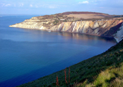 The Isle of Wight first became a popular holiday destination due to Queen Victoria. The building of Osborne House suddenly made the island the place to be seen, and the development of Cowes as a playground for international yachtsmen helped foster this image.
 The mapping of India is a tale that touches all strands of culture, history, science and politics ensuring that one cannot help but be fascinated. The feats and determination of the surveyors astounded me when I first undertook the study of cartography and their effort is entwined with our need for understanding our planet as well as the desire for ownership.
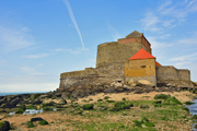 With our hemisphere spinning inexorably into winter, it was time to ‘fill the boots’. Having overspent the month already, a cheap local destination seemed prudent, with a chance to test a friend’s theory that often what is searched for far away can be found in the local. Thus the much unpublicised two-day coastal flanner from Calais to Bolougne seemed ideal.
 ITMB Publishing Ltd (International Travel Maps and Books, if you’re not in a hurry) was conceived in the early 1980s from the partnership of an Australian cartographer named Kevin Healey and Jack Joyce, a Canadian map retailer, who were both frustrated at the unimpressive range of maps of Central and South America on the market. At that time, European cartographic publishers apparently expressed little curiosity for that part of the world, as it wasn’t perceived to be of sufficient interest to their market.
 Why do you want to go to Colombia?”, asked everybody incredulously. Apart from the fact that I want to go everywhere which is reason enough for me (“because it’s there”, as they say), there are more than enough reasons to single out Colombia. Great coffee is a rather convincing one. Vast jungle, beautiful palm-lined beaches with beautiful snow-capped peaks visible in the distance, some of South America’s most beautiful Spanish colonial towns and very lively, interesting and very beautiful people are a few other reasons that come to mind. And no, not every Colombian is a drug baron. In fact, I did not meet a single one.
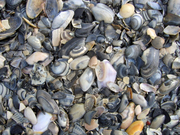 Last summer six cousins and I squeezed into a large estate car with all our camping gear and spent a few days pottering down the coast of northern France. We stayed at the many well-appointed campsites along the way (eg les Dunes at Plage St Gabriel – you can get a listing from the French Travel Centre).
 IGN is France’s national survey agency, the equivalent of Great Britain’s Ordnance Survey. As the Ordnance Survey was, and as many national Géographical institutes still are, it was originally a department of the army. It became a public institution just before the Armistice of Vichy in 1941.