The British Cartographic Society

British Cartographic SocietyMick Ashworth, as mad as us about maps and the president of the British Cartographic Society, introduces us to the society and its activity.

Nearly 40 years ago, on the 28th September 1963, a small group of cartographers founded the British Cartographic Society (BCS) with the aim of promoting the art and science of cartography. Today, this well-established and vibrant society retains its central aim, while reflecting in its activities and membership the great changes that have happened in cartography over the last forty years.

Its membership is open to anyone with an interest in maps. Members come from different paths of life and include representatives from the main governmental mapping agencies, major map and atlas publishers, freelance cartographers, map librarians, academics, specialists in Geographic Information Systems (GIS), map collectors, and people who just like maps.

The society publishes The Cartographic Journal twice a year. This is a highly respected and internationally recognised publication. Recent issues have included themes relating to military mapping and a special tribute edition to John Keates, a long-term BCS member who was considered one of the most influential figures in British cartography in the latter part of the 20th century, and who died in 1999.

The newsletter of the society Maplines, published three times a year, continues to keep the membership up to date with the deliberations of Council, reports on the annual symposium and always includes items of news and general cartographic interest.

The Annual Symposium is the society’s main event of the year. It provides the membership with an opportunity to catch up with old friends, make new ones, keep up with developments in modern cartography and view the Corporate Members’ exhibition. The Symposium is also the scene of the society’s annual awards ceremony, at which several awards are presented for excellence in cartography.

The society has three special interest groups currently active. The Map Curators’ Group which promotes the professional development of map curatorship, the Design Group which looks at all aspects of map design, and the recently formed Historical Military Mapping Group which acts as a forum for research into all aspects of military mapping. The Map Curators’ Group is particularly active and arranges lectures, visits map collections and organises training programmes in map librarianship. Its newsletter, Cartographiti, is published up to three times a year.

The Design Group can be described as a “gathering of slightly anarchistic cartographers, academics, software gurus and interested citizens who not only appreciate cartographic design, but also enjoy changing the misconceptions cartography has about itself.” The group holds a number of meetings each year at which the topics discussed range through every facet of design for the mapping process and which commonly include visualisation, perception, expert systems, web design, copyright and software.

The BCS is the UK’s adhering body to the International Cartographic Association. The United Kingdom Committee for Cartography (UKCC) is a committee of the BCS established to represent the UK cartographic community in all matters concerning the relationship of the UK with the International Cartographic Association (ICA) and other appropriate international organisations. Members of the committee are selected from all areas of cartography within the UK including commercial, government and academic.

The society has plans to establish and maintain an audit of all UK cartographic activity and it is also planning to actively promote the subject through events and publications and through generally raising the profile of cartography and cartographers within the UK. In all its activities it represents, and is supported by, its very active, enthusiastic, experienced, innovative and international membership.

Author: Mick Ashworth

Michelin: the maps they are a-changing

The Michelin ManNew maps are always awaited with great anticipation at Stanfords; many become a valuable addition to our stock, and those which fill the few remaining gaps in our coverage are particularly welcomed. Some, it has to be admitted, turn out to be disappointing, and, occasionally, one or two make us wonder why they were published at all and are consigned straight to the wastepaper bin in the buyers’ office.

Most old maps disappear from our shops quietly. Many are replaced by new, updated editions with more eye-catching covers. Others are dropped by their publishers because of lack of demand for them in the current very competitive market and are not missed much. One or two seem to disappear just to open new gaps in our stock and make our life more difficult – or at least that’s how it seems to us!

But it’s not often that a whole map series disappears, and not just any series, but one that, if not quite as old as Stanfords itself, has for decades been among our top bestsellers. Michelin’s maps of France at 1:200,000 were among the first products we had to learn to recognize when we joined Stanfords, faced with constant requests from customers for “the yellow maps of France”.

Michelin started publishing in 1900, just five years after Edouard and André Michelin drove the world’s first car fitted with tyres in a race from Paris to Bordeaux. Their first Guide Michelin, published in a print-run of 35,000 copies, a substantial figure for those days, was offered free to motorists. Hotel guides followed soon, covering various European and North African countries. In 1908 Le Bureau d’Itinéraires Michelin was opened in Paris to develop a forum for exchange of information on choice of routes, road conditions, distances, etc., between the company and motoring enthusiasts. This lead to the publication in the second decade of the last century of Michelin’s first map series at 1:200,000, in a handy concertina format specially designed for motorists, and intended to cover France in 47 maps. Following the territorial changes after World War I, a map of Alsace-Lorraine was added, and in 1921 a map of Corsica completed the series.

The changing face of Michelin - from the 1900s to present day

The success of the French series provided a springboard for expanding Michelin’s coverage to other countries. Perhaps some of our older customers still remember Michelin’s series of 31 maps covering the British Isles at 1:200,000, published in the 1920s. Switzerland, Belgium and Northern Italy came next, leading over the years to Michelin becoming a major cartographic publisher with an extensive range of maps, all of which can be found on our website.

The “yellow” maps were for years a benchmark for other publishers to follow and an indispensable aid for anyone planning to spend their holidays “motoring in France”. It was not until Institut Géographique National, France’s equivalent of the Ordnance Survey, decided to expand from providing just topographic coverage of the country to maps aimed at motorist and tourist, with the publication of Série Rouge (now the IGN Regional Series) and Série Verte (now IGN TOP 100), that a serious competitor arrived to challenge Michelin’s supremacy.

Spurred by the competition from the IGN, in the mid-1970s Michelin decided to publish a new series of regional road maps at 1:200,000, using the same cartography as the concertina maps, but covering mainland France in only 17 maps (now changed to a new Michelin Regional Series at scales between 1:250,000 and 1:300,000, and no longer retaining that old, classic Michelin style of cartography). For nearly 30 years the two formats were published side by side, until this spring the older concertina series was withdrawn from sale and replaced by new Michelin Local Maps.

We wish the new Local series success, but many of us here are very sad to see the old concertina maps disappear – they played an important part both in the history of cartographic publishing and in the expansion of tourism in France.

Find out more about the iconic Michelin Man.

Author: Margaret Ross

The story of Gizi Maps

Gizimap

Since 1992 GiziMap seem to have been able to predict exactly what maps the current political affairs required. Read about GiziMap and the maps they produce in the words of the founder herself, Gizella Bassa.

I finished my degree in cartography in 1969 and I have been working in mapmaking ever since. For 17 years I worked for Cartographia Budapest as an editor on map projects for different parts of the world and for five years after that I was team leader on various projects.

Following the political changes I decided to set up a private map publishing company. Until then Hungary had only had a state-owned cartographic survey and setting up a commercial enterprise was a new experience for me and my fellow cartographers.

In 1993 a map of Estonia, the first GiziMap map, was published. Bartholomew in Edinburgh and MapLink in Santa Barbara bought this map and included it in their map series. I had done plenty of surveying and cartographic work but I needed more familiarity with publishing and marketing the products. Among the most educational experiences were the three months I spent at Oregon State University on a scholarship sponsored by the Soros Foundation in 1991 and working with Christian Legind of Folia, Denmark, on the project for a map of Norway which has been reprinted many times.

Following the first edition of our Central Asia map in 1999, we have been dedicating more and more of our time and energies to Asian countries. There is a traditional interest in Asia within Hungarian cartography and geography. While working on our map of Northwest China we studied the maps of Aurel Stein and during the preparation of the Tibet map we rediscovered the work of Sándor Körösi Csoma. Of course we keep up to date with the work of foreign cartographers and read all contemporary travel guides and travel-related literature and spend a large amount of time travelling in the countries and regions we are mapping.

The idea behind my maps is to create accurate and attractive maps, “pictures” of the world

GiziMap is a small group of cartographers but we invite contributions and advice from linguists, geographers, geologists, travel writers and generally people who have travelled extensively around the countries we are working on.

Every year we have a stand at the Frankfurt Book Fair and there we show our new maps and meet our customers. Among them Stanfords plays a very important role. I like the atmosphere of the Stanfords shop and I am always impressed by the large variety of maps it stocks. I am proud to be able to add to this range.

Author: Gizella Bassa

England – Devon – Barnstaple

DevonFor some 10 years or more our group of friends have escaped the crush and inflated prices of a London New Year’s Eve to meet up with the Bristol mob in the West Country. This has allowed us to wreak havoc and mayhem in the coastal resorts of Devon and Cornwall and then party till we drop back at the cottages we have rented in the middle of nowhere away from the attention of neighbours and police.

This year offered a somewhat more challenging/unnerving/certifiable prospect. The last few years have seen an explosion in offspring and though we had gone away a couple of years previously with a few of the little darlings with mixed success, we wondered if our years of hedonistic pleasure were coming to an end. So how did 12 ‘grown ups’ and nine children under four years old cope with a week in converted barn cottages on a remote Devon farm?

Well, the weather helped. A whole week of clear blue skies by day and clear starry skies by night accompanied by a thick carpet of frost was a wonderful backdrop to our activities… and what an energetic and outward-bound time of it we had! From the top of our winding wooded valley our view enticed us down to the coast west and north of Barnstaple from the expanse of Saunton Sands past the surfing Meccas of Croyde and Putsbourough and the climbing cliffs of Baggy Point to the Exmoor coast of Lynton and Lynmouth. The whole of this stretch offers wonderful beach combing and scrambling around rock pools with the spectacular Valley of Rocks just west of Lynmouth, one to savour for the more energetic.

As if this wasn’t enough, we added pony trekking and cycling on the wonderfully flat Tarka Trail into the bargain. The older of the children thrilled to their first trot around the paddock and with a combination of baby trailers, child seats and tag-along mini bikes we managed a good four miles to the pub and back along the Taw estuary with its prolific bird life.

The indoor swimming pool attached to our cottages provided the final sleeping draught to our tired but happy brood at the end of their day and, with occasional blips, meant they slept soundly most evenings, leaving us to recreate in our accustomed manner.

On New Year’s Eve, armed with a battery of radio-controlled child listening devices alongside the normal cans of lager, the ‘grown ups’ descended on the pool and crammed ourselves into the Jacuzzi. The popping of champagne corks rang in to the still midnight air and we toasted the continuing success of our New Year adventures!

You may also want to take the Pathfinder Guide – Exmoor and the Quantocks Walks, OS/ AA Leisure Guide – Devon and Exmoor, OS Outdoor Leisure 9 Exmoor and OS Explorer map 139 Bideford, Ilfracombe and Barnstaple.

Browse our collection of maps & guides:
> England travel guides
> England road maps and atlases
> Travel literature inspired by England
> Maps and guides to Devon

Author: Martyn Bearfoot

Brazil – Rio de Janeiro

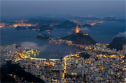
Rio de JaneiroRio de Janeiro has long exercised a magnetic lure for travellers. Escaping to Rio is a travel fantasy – unless you happen to be a Great Train Robber. The city is photogenic, passionate and exuberant. Its vibrancy is matched only by its inhabitants’ lust for life. The locals, known as “Cariocas”, are as romantic as Parisians, as animated as Italians and as nocturnal as the residents of Spain’s 24-hour cities. They personify the phrase “carpe diem”, embracing the present.

Continue reading Brazil – Rio de Janeiro

Bolivia

BoliviaThere is a certain appeal in entering a country by the backdoor. Especially if that backdoor is a wide open vast desert with nearly 6,000m-high peaks. The Bolivian border post, was just that, a post with a sign showing only two words on opposing sides – “Bolivia”, where we were going, and if you turned round you could see “Chile”. The passport stamp came only four days later in the first proper town.

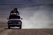
The four days unaccounted for in my passport were spent in a jeep with two Bolivians and three fellow foreign travellers in one of the driest and highest deserts on Earth. Harsh nature at its best. The guide/driver did a great impression of one my favourite scenes from the classic film “The English Patient” where a desert tour is described – endless desert stretches are negotiated without a word spoken before coming to an abrupt stop and the driver pointing out some remote feature and exclaiming with pride “Laguna Verde” (green lake) or “Arboles de Piedra” (trees of rock) – the actual line has Ralph Fiennes’ character, Count Laszlo de Almásy, say, “I once travelled with a guide, who was taking me to Faya. He didn’t speak for nine hours. At the end of it he pointed at the horizon and said, ‘Faya!’ That was a good day”. Otherwise the desert speaks for itself. The drive goes to well over 4,000m altitude, necessitating the traditional remedy for altitude sickness – coca-leaf tea. Some locals like to point out that, supposedly, even Pope John Paul II has tried it on his visit to the Andes highlands.

From here it is on to another high point – the world’s highest city in fact – called Potosi. The other attraction of Potosi, apart from superb Spanish colonial architecture, is to sink into the depths of the family-run hand-worked silver mines. You slide down rather narrow tunnels for a chat with the coca-leaf chewing miners – after all, even in the deepest tunnels you are pretty high up – some of whom are frighteningly young, like our assistant guide. One can only hope that enough of this tourism income does filter through to where it is really needed.

The world’s highest capital is La Paz (rival city Sucre is also worth visiting for its old Spanish flair and it remains the judicial capital). La Paz should not be missed while you are up here – that’s unlikely anyway as it’s a major transport hub. It is the only city that I have ever been to where the poorest part of the population has the best view – from the Altiplano plateau into a spectacular city centre valley – while the rich live right at the bottom, where you don’t lose your breath within seconds. La Paz has endless markets brimming with fruit and vegetables, livestock and souvenirs (some are brand-new, others antique and some just antique-looking). The famous witches’ market has everything you could possibly never need – from colourful herb offerings to llama foetuses.

From La Paz it is not far to the beach of Copacabana. No, the altitude is not finally getting to me. There is indeed a town sharing a name with Rio’s main beach on the shores of, you guessed it, the world’s highest lake, Titicaca, where many of the fishermen still ply their trade in traditional reed boats. Isla del Sol in the lake is one of those places people come to for a day but end up staying several more – just relax in ancient Inca surroundings and watch the sun go down.

Still having not had enough of those heights, I decided to climb an Andes 6,000-metre-er – all right, I admit, since you start so high up, this is not the world’s highest climb, but it certainly felt like it. I had met this French mountain guide who would take me up on the cheap. So cheap in fact that the crampons did not fit the boots properly on day one, and at 5,500m on the morning of day two not at all. Needless to say we did not reach the top. I console myself with the rumour that this peak is incorrectly surveyed and in fact a few metres short of that mythical 6,000 anyway. Well, that leaves me with an unfulfilled ambition, next time to be attempted with top-class equipment only!

Enough of heights, time for some lowland. The lesser-known part of Bolivia is the north-east with vast rivers eventually flowing into the Amazon, brimming with river dolphins, caimans and anacondas. Rurrenabaque has such a nice ring to it, I just had to visit. This also happens to be the perfect base for touring the jungle and pampas (lowlands). We sat many hours of the evening with torches ready to spot a tapir or jaguar, but they would not show themselves. Yet the next morning tapir prints awaited us in the river sand – another reason to come back and try again.

The best way of exploring Bolivia is with the Footprint Bolivia Handbook suitable for all budgets with great background information – or the Bolivia Lonely Planet – especially if you are looking for spots where backpackers congregate, their town maps are always pretty good in one hand, with the Nelles Bolivia/Paraguay map in the other. And I will also recommend Bradt’s Peru & Bolivia: Backpacking & Trekking (now out of print) that guided me securely on numerous other walks and the 1:50000 Alpenverein maps Cordillera Real North: Illampu and Cordillera Real South: Illimani.

Browse our collection of Bolivia Maps and Guide books here >

Bolivia travel information >

Author: Gerhard Buttner

England – Norfolk

NorfolkBeing a mountain goat and a lover of rollercoaster rocky cliffs and coves, my brother’s choice of a farmhouse in mid-Norfolk for this year’s break did not fill me with the immediate enthusiasm my dear brother conveyed on the phone.

For the past couple of years, parents and siblings together with assorted partners and offspring have re-acquainted ourselves with the half-remembered art of the family holiday. With the experience of our ‘Somerset Sojourn’ in Easter 2000 to inform this year’s choice, the remit for Chris in his internet trawl was as follows: somewhere near-ish to London that offered comfortable, child-friendly accommodation with easy access to good pubs, walks, beaches, castles, old and interesting-to-potter-about-in towns and villages, steam railways and other fascinating curiosities with which to while away a wet and windy English June day – quite a tall order for a week’s break!

Well, I’m pleased to report that Norfolk turned out to be a pretty near perfect host for the rather exacting and wide-ranging demands of a family with such diverse interests and hopes yet still wanting to “do things together”.

Our home for the holiday was an expansive 16th-century farmhouse, lovingly restored from a roofless wreck, with flagstoned floors, ship’s timber beams, ox-sized fireplaces, an oversized kitchen table for family feasts and the all-important dishwasher. The sprawling outbuildings included a former microbrewery (now relocated to a local hostelry) plus loads of farmyard and garden space for roaming micro-people to explore. The cost compared extremely favourably with other areas of Britain and included the regular entertainment of Charlie the Cockerel who would, humorously, sound his alarm call at the thoughtful hour of two or three in the morning!

The nearby village of Hingham, with its own grumpy teashop, grand but ordinary inn and ‘Harrods of Hingham’ provided a morning’s meander and the fresh fish van direct from Lowestoft on Thursdays offered excellent value skate wings for the barbie!

Only half an hour’s drive to the east lay the attractive and ancient city of Norwich with more pre-Reformation churches than any other in Europe, the Colman’s Mustard factory and museum and the rivers Wensum and Yare offering a gateway to the Norfolk Broads. Most of the goodies are contained within the central old city and so allowed us all to wander at will but meet up easily in the cathedral grounds for a picnic and riverside stroll. I did, however, have one extra-curricular visit on my “must” list to make, just outside the inner ring road, the infamous Fat Cat boozer par excellence. This is somewhat of a mecca to real ale enthusiasts, serving 28(!) perfectly kept traditional beers, real ciders and a limited but tasty range of pub grub. We sat outside at 4.30pm on a sunny afternoon and sampled a few halves before wending our merry way marvelling at how such an enterprise could flourish tucked away on a back street corner. In these times of difficulty and closures for the traditional local, the dedication to quality service and atmosphere shone through. The take-away four-pint jug of Norfolk Nog gave a certain luminescence to the evening too!

The inevitable strains of a large family outing with small children of varying ages can often be smoothed somewhat by providing one or two focus points for the day. Wells-next-the-Sea is a traditional English seaside town. Once a busy commercial port, it offers a relaxed charm and plenty of those focal points. We all enjoyed the miniature steam train to the beach and the wide views over the sweep of Holkham Bay, famous for its birdlife, as we constructed odd-shaped sandcastles and I was dragged screaming into the icy water by my insistent three-year-old. The village green behind the winding streets of shops and Georgian/Victorian dwellings was alive with an early Summer Fayre. Throngs of revellers stood around dutifully taking the mickey out of the Morris dancers and there was a bouncy castle to entertain my daughter Bethan while the rest of us enjoyed ice creams, beers from the surrounding hostelries or both. We had considered riding the steam train to the famous remains of Walsingham Abbey but cramming too much into one day just would not have worked!

The pretty village of Castle Acre has much to recommend – two ancient priories and an even more ancient Iron Age hill fort – yes, that’s right, hill fort – with excellent views over the gently undulating landscape below.

The Ostrich Pub was shut so for refreshment we turned to an attractive little teashop with tables on the main street. I could have ordered Scone with Jam and Butter but opted for the Full Cream Tea with Earl Grey. My scone was spread with margarine. I pointed this out. “Vitalite actually. We always serve it with the Full Cream Tea”. Odd. Health conscious? I got my butter anyway.

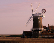
No holiday in the area would quite be complete without a trip on the Broads. The Sutton Windmill & Broads Museum is one of those typically British, small-scale museums that one finds advertised in local Things to Do booklets. Nevertheless, it allows an entirely fascinating if somewhat under-labelled look at how the Broads were created and the everyday lives of people who worked on and near them in days gone by. You also get the chance to scale the inside of a 200ft- (60m-) high windmill via a series of wooden ladders and steps emerging on a dodgy-looking platform next to the sails. Bethan demonstrated just how much energy a three-year-old has that we grown-ups like to pretend we have by scooting up and down three times with various adult members of the family, acting as experienced climbing guide by the time I ascended the heights – “Mind that gap, Daddy!” From Wroxham we took an hour’s round trip on the large steamboat-style cruiser. There are much quieter and more independent means of travel on the Broads but the cruise suited the family fine for a taster.

And what of my love of walking I hear you ask? Sarah, Bethan and I did break off from the main pack for one more visit to the acclaimed coastline to sample a section of the Norfolk Coast Path National Trail. I had hoped to experience some East Anglian ‘Big Sky’, as an alternative to my normal desires for pointy, jagged scenery and this is where I got it. The vast expanses of sand, marsh and sea open the mind in an infinite space kind of way. The coastline is one of the most important birdlife sites in Europe and as such is protected and unspoilt in the main.

We started our jaunt from the fine Jolly Sailors pub in Brancaster Staithe. Then we headed up over a gorse-cloaked common, sweet with that wonderful coconut scent, descended with views over the Scolt Head Island Bird Reserve, past the earthworks of the Roman fort of Branodunum and along the duckboards of the marsh behind the sands of Brancaster Bay. We rounded off the afternoon sitting on the harbour wall munching happily on pots of local crayfish and Cromer crab at pleasingly low prices.

We finished our holiday with a superb lunch at the 15th-century Chequers at Thompson. Children’s meals were wolfed down before the delights of the garden, supplied with bikes, climbing frames, toy lawnmowers and real rabbits took over. The thoughtful approach to the whole family seemed to fit in with our overall experience of Norfolk.

The county offers the visitor a wealth of history, largely unspoilt villages with a touch of the timeless and a real working agricultural community alongside the leisure and tourist industry. Flat landscape, yes, but plenty of relief from stress and the mundane, and plenty to lift the spirit if not the feet.

took with me the Pathfinder Guide to Norfolk Walks and the relevant OS maps, including the map of The Broads.

Browse our collection of maps & guides:
> England travel guides
> England road maps and atlases
> Travel literature inspired by England
> Maps and guides to Norfolk

Author: Martyn Bearfoot

Bangladesh

Bangladesh

Not that I came only to drink their tea for free, but tea invitations are common in Bangladesh and no payment is allowed by the “guest to my country”. The staccato questions might be repetitive: “Your country?”, “Your name?”, “Your job?”, “You married?”, “Why not?”, “How many brothers and sisters?”, “You like cricket?”, but the gratitude and pleasure on the faces for friendly replies, return questions and idle chit-chat – and the free tea – is more than enough for me and for them.

Wander the markets especially beyond the big cities and all and sundry will come to shake your hand. Stop for tea and you will soon have a small crowd and many addresses of new friends. You might be shown around and be formally introduced to some of the biggest shopkeepers, their lively assistants and even to the few shy young ladies working in the more upmarket shops. Ever wanted to feel like a film star? Bangladesh is your chance!

In the capital Dhaka my day starts with some excitement. In the leafy Gulshan suburb, a group of young men wielding axes and knives run towards a smart car with a slick-looking occupant, who bizarrely steps out to meet them. Then they all stop with axes in mid-air and look at the cameraman. I am witnessing a scene from a brand-new Bengali film and the smooth dude with the flowing long hair and shades is a well-known film star. Yet some locals tell me that he is not quite as popular as his rivals from India’s Bollywood film-making fraternity.

The rest of the day I get lost in the chaotic streets and markets of the old city near the river (actually nearly everywhere in Bangladesh is near a river). I have to ask directions five times in a few hundred metres simply to find a small but beautiful mosque – ancient alleyways are hard to navigate even if your map is good. I need help! But even the rickshaw gets lost on the way back to the hotel, and after endless detouring I can eventually show him the way.

Visiting Bangladesh is less about specific highlights, than about enjoying your way to them. You have several methods – a “rickshaw” is like a large tricycle with a back seat and a poor man who speaks no English pedalling. Velo-traffic jams abound! A “baby-taxi” is the same with an engine and space to squeeze extra passengers in next to the driver. A “normal” taxi? Very rare beyond the Sheraton Hotel, Dhaka. A “minibus” is a three-quarter length big bus built for 30, usually seating 40 with 20 more standing. A “direct” bus leaves when all seats are full and then spends half the journey shouting “direct Khulna” (or wherever we are going) to fill up the aisle, and the last half of the journey disgorging passengers that bluffed their way onto the “direct” bus. Between stops the driver speeds along on roads filled by endless numbers of the previous modes of transport. Rickshaws especially are scarily overtaken as there are other, oncoming, buses.

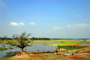
Possibly the bus journey ends at a ferry before the town – there is always water in the way. There are numerous river-crossing ferries for cars and passengers and other boats of all shapes and sizes that follow rivers along. For three hours I enjoyed one with no seats apart from the boat’s edge. Endless buckets of water were being thrown overboard yet were constantly refilling from below…

The “rocket” is a real Bangladesh highlight. You take 24 hours – much faster than the small craft – on this Mississippi-style steamer for a roundabout journey that would take only six hours by direct bus. Yet the choice between them is easy once you have seen the comfortable cabins – in the Bangladesh context – of 1st class or even at half price 2nd class on the back deck, with the world passing by leisurely rather than with a maniac bus driver. You could try lower deck class for less comfort but more life, with live chickens and dead fish being traded on this floating bazaar.

Next destination is Chittagong – what a lovely name – for a 5am arrival. I find a hotel for a few hours’ sleep and then venture out into the hot 9am sun. An eerie silence greets me as shops are barred closed and just a few beggars stare at me from the gutter. I turn into a sidestreet where a shock awaits: flies and a pervasive stench everywhere, blood flows down the street, the crows fight over intestines, a fly-covered severed head stares at me from a pool of blood. Men with bloody shirts are brandishing long knives. Don’t worry, this is not Armageddon, only Eid-ul-Azha – the Islamic Festival of Sacrifice. All families that can afford it slaughter a cow or at least a goat for themselves and the poor. The result is a whole city covered in blood.

Time to find a more relaxed place: Cox’s Bazaar is the local favourite beach resort. Not quite as relaxed as I hoped. Thousands gather daily to enjoy the sunset with a drink of coconut or cola on the longest beach in the world. In spite of many insistent Bangladeshi requests there is no real way of capturing this proud fact adequately on my small camera.

I head off pretty soon for even less hectic waters to the southernmost tip of the country to catch the morning “ferry” – a wooden boat with a very noisy engine and too many passengers – to St Martins Island. This coral reef island is in fact the start of south-east Asia nearer to Myanmar (Burma) than Bangladesh. The only real beach stop on my journey is a bit of paradise at a relaxed pace. This is where a select few of the more adventurous urban crowd let their hair (or is it their beards?) down. I choose the local peak season by chance, making life here not quite as laid-back as the other 50 weeks of the year. But this gives me a chance to watch the local city slickers walking the beach in Nike caps and brand-name shirts, drinking tea, smuggled Myanmar beer and cheap whiskey. Then it’s off to a fish meal in one of the restaurant shacks on the beach. The wallpaper is made of calendars featuring Islamic leaders interspersed with traditionally dressed ladies with just a tiny hint of something seductive. Welcome to tourism Bangladeshi style!

The only guidebook entirely dedicated to the country is the surprisingly detailed and extensive Lonely Planet guide to Bangladesh. The Bangladesh/North-Eastern India map by Nelles at 1:1,500,000 gives a good feel for topography of this water-rich country and is detailed enough for travelling. The colourful Bangladesh map at 1:1,000,000 by The Mappa shows towns and administrative boundaries very clearly. The Mappa Dhaka city guide map rivals any of the Indian subcontinent. The Gulshan area which houses embassies and larger formal businesses is particularly clearly mapped.

Planning a trip to Bangladesh, browse our travel guides and maps here >

Author: Gerhard Buttner

Cuba

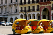
CubaOn the outskirts of the sleepy little beach town of Baracoa, in semi-tropical eastern Cuba, there is a chocolate factory. The local delicacy, somewhat bizarrely called Peter’s, is produced there – as all the guidebooks will inform you. What most of them don’t say is that this factory was inaugurated by none other than ‘El Che’ himself during his time as Minster of Industry (1961). There’s a great photo opportunity outside where a large billboard advertises the fact. Most taxi drivers will want to hurry you past with only a cursory glance but it is possible to arrange an impromptu tour – given the right relationship between dollars and palms! In town there’s a wonderful, shabby café that only serves chocolate, either in slabs with a knife and fork or as a rather glutinous hot or cold drink. My companion thought it was salty, I thought it was great – one thing’s for sure, it’s not Cadburys!

Baracoa pulsates at night with the sound of drums and serious partying floats over the tin roofs and palm trees. There are places to go dancing all over town – just head for the main plaza as a starting point where you’ll find La Casa de la Trova – if that doesn’t get you going just keep on walking. The cinema – also in the main triangle – is a fascinating experience for a quiet afternoon, low-budget kung fu movies dubbed into Spanish shown on a battered old TV in the foyer.

Relaxing by the pool of El Castillo hotel overlooking the bay and the tabletop mountain El Yunque is certainly another late-afternoon pleasure. In fact, if your dollars stretch that far, spend a few days in staying at El Castillo. Just be careful while you’re sitting on the thick stone walls of the fort soaking up the rays, sipping a mojito and watching lizards, that you don’t fall off – it’s a long way down onto that avocado tree at the foot of the cliff! Another interesting hotel in town is La Rusa – an ochre building on the rather drab, prefabricated Malecón. Alternatively, Baracoa has a wealth of casas particulares (one really good one we stayed in was Ykira Mahiquez).

Though not the only way, perhaps the best way to explore the eastern end of the island is by car or motorbike. You can hire your preferred transport from the ubiquitous Havanautos based at the airfield. Given the state of the roads we encountered, a 4WD is definitely a good option, albeit more expensive. A 20-minute drive west from Baracoa is Villa Maguana – a splendid little motel-type affair with its own white sand beach literally on the doorstep and local lads who will offer to cook you a variety of seafood for $4 per head. You can even snorkel out to the reef with them, if you want to watch your supper being caught! The lagoon is brilliant but don’t expect much in the way of marine life, I spent three days snorkelling without seeing much of interest beyond a few small barracuda and a strangely shaped purple and white crab!

Going east along the coast is highly recommendable. The driving is pretty tough – the dirt tracks are more pothole than road! There are few places to get petrol and few places to stop for food. One exception is a fruit juice stand about 10km outside Baracoa itself. You can buy a limited range of sweet, delicious fruit drinks, as well as tiny red bananas that taste of apples. Further on, expect a warm reception at Boca de Yumurí where the limestone gorge is definitely worth a visit, especially during the rainy season. Unfortunately the village itself has been really spoiled by irresponsible tourism. The degree of ‘pestering’ there has become quite OTT – for example, coconuts were dropped onto the car to force us to stop.

The brightly coloured snails called polimitas are for sale everywhere – most guidebooks are quite strict in pointing out not to accept these but they are pushed into your hand constantly. A far, far better village to stop off at is Bariguá, which overlooks a small lagoon ringed by palm trees. The tiny, little Jose Martí plaza there is simply brilliant. Continuing down the coast the verdant mountains gradually drop away and one finally ends up at the most easterly point of the island – the arid, cactus-riddled countryside round Maisí. The view from the top of the lighthouse here is spectacular whether the day is clear – when you can see Haiti on the horizon – or stormy when you can watch the natural show from the top! If you really enjoy being in the back of beyond, negotiate to stay in the village and you’ll be pretty much as off the beaten track as you can get.

Getting to Baracoa:

While the journey over La Farola – the highest road in Cuba – is not exactly alpine, it is a great experience – make sure your camera is to hand and that you have a few single dollar bills if you like real coffee beans for your grinder. For the quickest journey, take Víazul from Santiago de Cuba via Guantánamo. Their convoy of minibuses leaves at 6am ($14 single approx.), so you need to get up early! Alternatively, you can go in one of the Astro buses – a real must if you have the time and want to experience travel Cuban-style! One final option is to go round the back of the bus station in Santiago and negotiate a lift in one of the lorries or private cars – but this should only really be considered by serious travellers.

Working at Stanfords, I took seven guidebooks to compare! The Rough Guide to Cuba was by far the best for practical purposes. If you want a basic road map for pre-departure planning, the Cuba Nelles is by far the best.

Browse our collection of Cuba Maps and Guide books here >

Cuba travel information >

Author: Matt Godfrey

Harvey Maps

Harvey MapsHarvey Map Services have been established for 25 years. They have gained a reputation for creating high quality maps for adventurous recreation. Popular walking and climbing areas throughout the UK are covered in ranges of sheet and route maps at varying scales according to the terrain of the area covered.

Harvey Maps are compiled from original aerial surveys and then field checked by experienced surveyors, hill walkers themselves. All their maps are printed on waterproof paper. The maps are clear and easy to read as well as being a manageable size. Continue reading Harvey Maps