
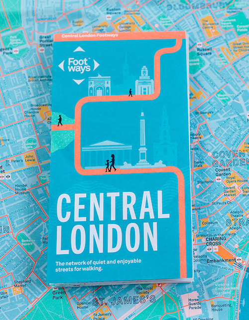
Our Map of the Month for November 2022 is the Central London Footways: the network of quiet and enjoyable streets for walking.
This beautiful printed map is designed to help people plan enjoyable A-to-B walks in central London. The Footways team spent more than three years plotting and testing the walking routes, connecting London’s stations and key destinations with the capital’s most interesting, quiet and enjoyable streets.

The map’s striking design is by Applied, it is printed in five special Pantone inks and folded to 198mm × 105mm × 5mm. The print unfolds to an A1 sheet and is available separately as a flat copy to put on your wall. Special graphics and diagrams are printed on the reverse of the map, alongside sample routes and features to tick off as you explore.
Map users can also scan a QR code on their phones to pull up a digital copy of the map, or sample routes with interesting facts about the hidden features that can be discovered along the way.

So why not walk to Stanfords to get your hands on a copy? We are a quick walk from Covent Garden, Leicester Square or Charing Cross underground stations, and only 20 minutes from Waterloo or 30 minutes from King’s Cross as part of a longer walk through London’s historic centre. Check out the Footways feature-filled route from King’s Cross to Covent Garden here.
Note – we use the term ‘walking’ as a catch-all for all uses of the footway – that’s feet, wheelchairs, mobility scooters and kids on bikes. The network favours step-free access and uses crossings on main roads. Where steps have sneaked in, they’ve been marked on the map.
Central London Footways Map is available now for £5.