
Guest Blog Post by Jack Cornish
In my recently published book, The Lost Paths, I explore the paths which reach into – and connect – communities across England and Wales. A network of paths which reveal how our ancestors have interacted with and shaped their surroundings over millennia. On the paths I discovered hundreds of stories – tales of love, commerce, death, graft and communication.
There are over 140,000 miles of recorded public rights of way in England and Wales, which started to be proactively and legally recorded from the early 1950s onwards. But tens of thousands more are missing from the maps, lying unclaimed and unprotected. So, as well as a celebration of an ancient network, I hope The Lost Paths will serve as a call to arms to reclaim and save our old paths – to preserve our history on foot. Below are some of my top tips for finding lost paths along with some of the paths that captivated me when writing The Lost Paths.
Look out for old stiles, bridges and fords – Often paths leave an impression, they are physical objects in the landscape. They are perhaps at their most tangible when they cross boundaries, natural and manmade. In The Lost Paths, I write about a lost path I walked in Lancashire, well used but not recorded as a public right of way. A wide track, with grass banks which merge into the surrounding hedges, with trees standing alongside as sentinels which mark the gentle drifts and curves of the lane. At its southern end, the path crosses a river – a quietly enchanting, almost hidden spot. In the riverbed can be seen the cobbles of an old ford and above the water, a beautiful, hunched packhorse bridge. These are tell-tale signs that the public have been coming this way for hundreds of years. Just some of the physical clues, alongside objects like old worn stiles buried in a hedge, that you may be looking at a lost public path.
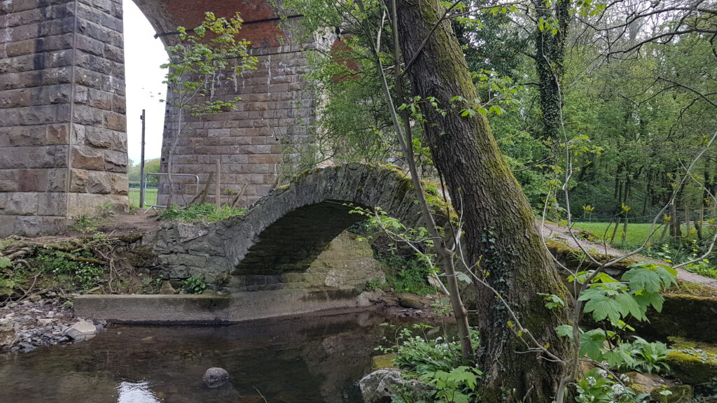
Packhorse bridge on a lost path
Continue reading Ways to spot a lost path