
The Challenger Expedition: Exploring the Ocean’s Depths by Dr Erika Jones

This article is an edited introduction from The Challenger Expedition: Exploring the Ocean’s Depths by Dr Erika Jones, Curator of Navigation at Royal Museums Greenwich.

The book was published to mark the 150th anniversary of the expedition’s launch.

On the 21 December 1872, HMS Challenger set sail from Portsmouth, England, to begin a global voyage of deep-sea exploration. A landmark endeavour, the findings and the legacy shaped the development of ocean science as we know it and are still influential in our understanding of the planet today.

With technological and scientific developments of the time, supported by extensive international cooperation and a team of research and naval officers, the expedition was part of the concerted nineteenth-century drive to map the ocean floors and search for life in the abyss.

When the ship returned to Britain in 1876, the scientific team on board had amassed the then largest collection of examples of life from the deep sea. Over the next two decades, a global network of researchers prepared the results for publication culminating in a series of works that is considered the intellectual foundation of modern oceanography.
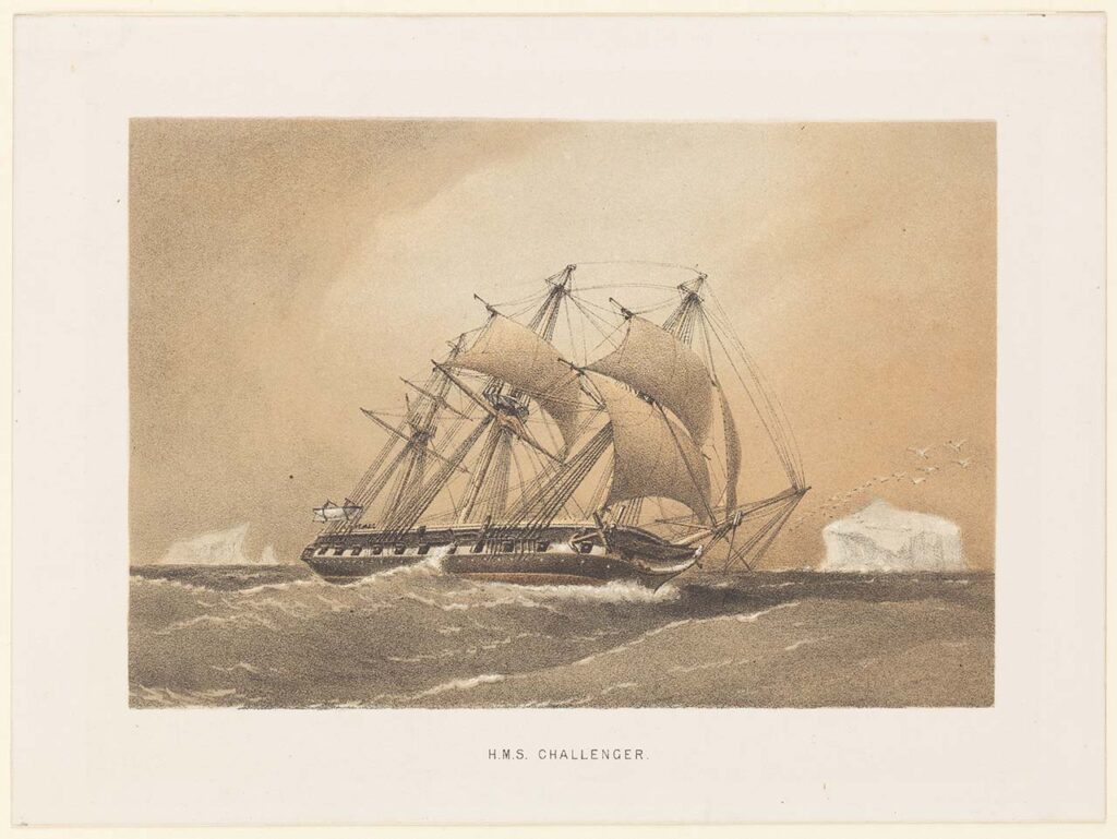
HMS Challenger under sail passing ice bergs during the oceanographic expedition’s visit to Antarctica, attributed to William Frederick Mitchell, 1880
© National Maritime Museum, Greenwich, London
Continue reading The Challenger Expedition: Exploring the Ocean’s Depths by Dr Erika Jones

A is for Atlas by Megan Barford

-by Megan Barford, Curator of Cartography at Royal Museums Greenwich and author of A is for Atlas: Wonders of Maps and Mapping.

As a map curator, I often get asked about my favourite map and it’s terribly difficult to choose. In the collection of Royal Museums Greenwich there are near-pristine sixteenth-century maps illuminated with gold and maps reduced to scraps through use at sea. There are maps that show the involvement of women in the book and print trades in eighteenth-century London, alongside maps that came out of trade union activity during the Second World War. Luckily, in my new book, A is for Atlas, I’ve been able to pick 104 favourites, organised according to alphabetical themes in a treasury of stories about map making and use, and about materials and techniques, from the thirteenth century to the present day. Here, D is for display, E is for Engraving, F is for Fake. Together the themes help us to interrogate maps and mapping in different ways, and understand the rich human stories that can be found throughout the collection of Royal Museums Greenwich.

Continue reading A is for Atlas by Megan Barford