 Northern Europe as we knew it was left behind on the chilly evening of 1st April as Stockholm Station platform rolled out of sight, leaving us on the overnight Express train to the Arctic Circle. This was a good time to head north as there were already 12 hours of daylight, yet plenty of snow and sub-zero temperatures! Two expedition-sized rucksacks, various kit bags and the all important snowshoes comfortably filled a six berth cabin. Central-heated sleep was followed by coffee in the Panorama Cabin, a ’50s-designed, all-angular-glass-and-brass-struts raised dining coach, a fine place to watch the endless snow-covered pine forests and frozen lakes flash past. After 17 hours the monstrous slag heaps of Kiruna rise out of the pine forests, home of the world’s largest mine, the only reason for the train line and our last stop. The severity of the air temperature 150 miles north of the Arctic Circle hit us as we stepped out of the heated carriage.
As if to compensate for the bleakness and cold, the heating in every building was on a tropical setting. From here a bus heads west for two hours towards the mountains. Roads aren’t cleared of snow Alps-style – the drivers just have tyres with studs and learn to slide. An old Sami boy from the indigenous reindeer herding population boarded, wearing red, blue and yellow striped clothing and clog boots and carrying strange luggage. He left at a koti (traditional grassed-hut) village.
Nikkaloukta, the coldest place in Sweden and the end of the road. Just a Sami trailer park, and some reindeer pens. From here on skidoos and helicopters are the only way forward by motor, but we were to use snowshoes underfoot and carry all our gear on our backs – not the normal mode of travel. After three hours ploughing through birch forests, the rounded granite heads of the mountains emerge. Digging into the snow we made camp at the end of a vast frozen lake, over which came freezing blasts of wind from the mountains, taking it down to -15ºC. As night fell our technical tops, down jackets and comedy-sized mittens proved their worth, allowing us to comfortably watch the unfolding of a true northern lights extravaganza, indescribably weird, like some encounter with the numinous and something the special effects guys at Dreamworks would have difficulty concocting.
A calmer morning followed, with concentrated snow-melting for coffee and a long, agonising haul up Laddjujuhka. This is an increasingly impressive valley leading into the heart of the Kebnekaise Mountain range, itself an extension of the Caledonian range that starts in Scotland, sweeping under the north sea to Scandinavia. Twenty painful kilometres further, perched on the valley walls is the well equipped Kebnekaise Fjallstation. Carrying this much gear even over the hardened snow of previous tracks was proving very testing! In the hut we met some wizened travellers who had the local solution to travel in this environment: all gear encased in a pulka (sledge), pulled by a husky and tethered to the human behind on skis, the classic mode of travel in the Arctic. There being no spare pulkas lying about and no stray dogs we were to do things the hard way.
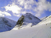
After a day playing on a small mountain with crampons and axes we made our first attempt at Kebnekaise peak up a long snaking coloir around the back of menacing Doulbagourni (in the picture above), a thrusting conical peak with what looks like a crater blown out of the top. Behind this a steeper climb to a cloud encased pass, half way up which we found ominous avalanche debris and worrying instability in the snow. Three tests to see if a block would slide away with a little push proved frighteningly positive, and we rushed to get to the side of what was now clearly an avalanche waiting to happen. Meanwhile the cloud swallowed us, intermittently moving with unbelievable speed in apocalyptic gusts, instantly sending the temperature from a balmy -11ºC to below -30ºC. We retreated back into the barely visible shoot, sending us back into the valley at the base of Doulbagourni, a freezing cauldron of swirling cloud and spindrift stirred by shafts of sunlight, attended by squatting peaks. Exhausted but energised by such a show of natural forces, we retreated to the hut.
The next day we packed as many rations as possible and headed up Laddjuvaggi valley, towards the rear of Kebnekaise. Snowshoe crampons meant we could crunch over vast tracks of blue ice without fear of slipping. As we gained altitude predictably the weather worsened and a ghostly figure skied past in the cloud quizzically muttering: “How is it with the snowshoes?” as we entered the prehistoric-looking Skarttacohkka-massif, reminiscent of the foreheads and arched backs of slumbering dinosaurs. The valley narrowed and rose, to a pass at 979m, at the other side of which lay the magnificent Tjaktjavagge valley, the glaciated artery of the area. We dropped into a col at 840m and exhausted we dug the tent in and started the process of melting enough snow to re-hydrate. One pan of snow takes 5 minutes to melt and yields one small cup, so this takes much time and valuable fuel. Thirst quenched, and standing back from the tent, we realised we were in the direct avalanche firing line of a vast gully high up on Singicohkka, at whose base we were camped. Ah well, too tired to move the tent, I slept half expecting to be woken by the booming sound of cascading snow. The temperature inside the tent was -19ºC at the beginning of the night. It would be colder later on but the thermometer died so we never got a reading.
This base camp allowed us various lightweight trips. From higher up the tent was a tiny orange dot lost in a vast crumpled white sheet. Lower are deserted Sami summer encampments. Here were big hairy guys on big skidoos, often seen chasing errant reindeer at high speeds across the wastes. Again some skiers, bemused by our footwear, stopped to say that from a distance we looked like goblins. But we had lost our sense of humour – the effect of heavily rationing our dwindling supplies. Even with snowshoes, you still sink in to the snow losing valuable energy with each step. You need at least 5,000 calories daily for these activities in this environment, and any less leaves you easily drained and humourless.
So we arrived at our final summit assault, ate as much as we could afford and set off. Snowshoe technique perfected, we ‘goblined’ past some skiers without difficulty. Survival rations meant a quick lunch of a Snickers bar below the cloud base!!! Ignoring another tired and defeated group descending and claiming that the weather was too bad, we emerged above the clouds. A vista opened out to what apparently takes in nine-tenths of Sweden as we approached the solid ice pinnacle which marks the peak. It sits on a knife edge ridge, where glaciers cut back the slither of rock that divides them. To the east there’s a sheer 1,000m drop onto the Bjorling glacier. Swirling cloud came from the south-west, occasionally revealing the Sarek range in the south, whilst the most frightening throat of a sheer gully gaped in the west, the bottom of which was just black cloud. We kept our balance, took photos, realised how late it was and re-entered the impermeable looking cloud. Now we were to pay for not having skis/snowboards, and what should have been one hour’s blissful sliding was the most gruesome endless slog through deep snow. By the end we had walked/climbed for 10 hours with only three 10-minute stops and hardly any food.
Next day we sunbathed at -10º in down jackets, before a small evening excursion up Tjaktjvagge valley to Drakrygen ridge, neglecting to take the usual precaution of slowing down at the end to cool off and evaporating sweat – after stopping the sweat froze and my body temperature plummeted. Lying in my sleeping bag for an hour with all my clothes on I was still shivering. The only answer was to remove all the cold/damp clothes, generate some body heat and then get back into the bag. Finally I was warm again.
With food all finished we headed back to the food supplies at Kebnekaise Fjallstation, an agonising trawl through deep snow. Amazingly they could hire me a snowboard, so with this on my back – and with crampons and an ice-axe – I could reach the top of some spectacular powder runs. This culminated in a determined attempt on Kebnetjakka, despite forecasted and evident white out conditions and multiple avalanche risks on the steeper slopes. Having cross-examined the local guides, we dodged crevasses strangely achieving incredible speed whilst traversing avalanche slopes! Soon we were in a complete white-out but gripped by summit fever we took bearings and picked our way up. Somehow we arrived only 15m to the right of the peak! It was -15ºC. I dug a snowhole and sat in it for two hours hoping for the cloud to clear, but it got worse. We had to return soon so, with almost zero visibility we began the descent. Once we hit the steep glacier and found our original steps I strapped on the snowboard and dived into the cloud. The steepness and ice meant at times I was slipping unstoppably down into thick cloud and the unknown. Nonetheless, somehow managing to regroup, we came out of the cloud and I could achieve some speed down vast natural half-pipes, past 100ft ice walls, and into the main valley.
After these exhilarating last days, our thirst for long distance snow-plodding sated, we caught a skidoo next evening back out to Nikkaloukta for our return to Stockholm. Already the sun was setting over an hour later than when we arrived two weeks before…
For an overall country map try Sweden map by Freytag & Berndt at 1:600,000 or Sweden map by Kummerly and Frey at 1:800,000.
For detailed maps of the area you need the Swedish Survey map series – the most detailed map series, which for the northern highlands is 1:100,000. These are excellent maps, just remember that a few centimeters on one of these represents twice as much walking than on a 1:50 000 (OS Landranger) map. The one for this area is the Swedish Survey BD 8 Kebnekaise-Saltoluokta. As for books Rough Guide to Sweden and Lonely Planet guide to Sweden are both good guides for Sweden which cover the area.
Browse our collection of Sweden Maps and Guide books here >
Sweden travel information
Author: Alex Webb
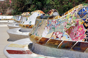 The famous attractions of Barcelona are well known. My three personal favourites are: the interior of the church of Santa Maria del Mar in the Barri Gotic. It’s stunningly beautiful, the simple lines and soaring light appealing to our contemporary aesthetic values. I was lucky enough to visit when a family wedding was in progress – moving and exhilarating.
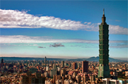 We’ve all got something with “Made in Taiwan” on it, but what about the country? You may be surprised by the modern, hi-tech society, fast catching up with Japan, and the rich, sophisticated Chinese culture, unaffected by the Cultural Revolution.
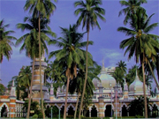 First of all, let me reassure you that my gran’s ideas about what visiting a country like Malaysia would be like turned out to be entirely unfounded.
 As the cold and damp seeped into every aspect of my being and the rain permeated through my seemingly less than waterproof pack, I felt as if I’d made a terrible mistake. It seemed really unfair. It was supposed to be summer for god’s sake! Actually I wasn’t that surprised by the weather. I was in New Zealand, where the climate is best described as changeable. Yup, that sums it up. Changeable. I’d been spoilt rotten by the glorious weather over the preceding couple of months and had grown to expect nothing less than sublime sunshine. But I guess that you can’t have everything you hope for.
 Tramping is the best way to explore the country and the most intimate way of experiencing the diverse range of landscapes found in New Zealand. The Great Walks, New Zealand’s premier walking tracks, traverse some of the most spectacular stretches of this part of the world. The routes capture different aspects of the country and offer a superb range of tramps for people of all levels of ability and experience. Among them there’s tramping the eerie forests surrounding Lake Waikaremoana or forging across the lunar landscape of the Central Volcanic Plateau. Or if that doesn’t appeal, there’s canoeing down the legendary Whanganui River, the only Great Walk on water. Or you could meander along the golden sands of the Abel Tasman Coastal Track or follow the Heaphy Track in the footsteps of early Maori in search of greenstone. How about tracking kiwi and wallowing in mud on Stewart Island? Or you could always try exploring Fiordland, or tramping the Kepler Track, or the legendary Milford Track, not forgetting of course the Routeburn Track through some of the most stunning mountain scenery in New Zealand.
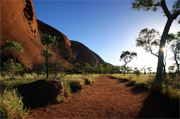 There is nothing I can do about it now. I climbed Ayers Rock (Uluru in Aboriginal) and I wish I hadn’t. The red monolith that stands today as one of the most recognisable symbols of Australia is a sacred site to the local Aboriginal people, the Anangu. The Anangu don’t like people climbing the Rock for two main reasons: firstly, because the climb to the top follows the steps of their ancestors and has strong spiritual meanings associated to it; secondly, the Anangu feel responsible for anything that happens to visitors on their land and people have fallen off the Rock and died.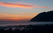
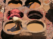 I had never been to Africa before, and the prospect of arriving in Marrakech, at night, after a brief stop at Casablanca, was thrilling. The airport is hardly luxurious, and before long the dry heat began to make itself felt as we waited in line to have our passport stamped. We were almost the last of our party to leave the airport, and it seemed to shut down around us, the frenetic activity caused by the plane load of tourists dissipating away.
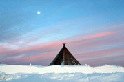 It was late September when I boarded the train from Stockholm to Kiruna in Swedish Lapland. Not quite Christmas, although the tinsel and crackers filling the shelves of the London department stores were trying to convince me otherwise, but I was conscious of the fact that I was moving into the alleged homeland of Father Christmas. I wasn’t looking for him however, having cruelly learnt the truth behind the myth at an early age. I was rather hoping to catch sight of some of the other big beasts that still roamed this Arctic outpost of Europe.