Walk the Lines: A Mark Mason interview

What can walking the London Underground network above-ground actually tell us about the capital city? To celebrate the release of Walk the Lines, Mark Mason’s new book on London as portrayed by the mapping of its tube lines, Stanfords had a few questions to ask…


1.Walk the Lines offers the reader a different perspective on London and it’s a refreshing addition to the shelves of travel literature on the capital. What inspired you to embark on such a venture?

I’d always loved walking round London – it’s the only way to really get to know a city. (One of the reasons Los Angeles, for instance, can never really be called a city – you have to drive everywhere.) I wanted a project that would ‘capture’ the city, let me examine its appeal – I wanted to cover all of it without having to walk every street, which would clearly be impossible. Looking at the Tube map one day I realised that was the answer – walk the whole network, overground. The book relates what happened – one line per chapter, reporting what I saw and felt, plus lots of history and trivia about the areas I passed through. Also the thoughts that occurred to me as I tried to understand why people love London so much. Continue reading Walk the Lines: A Mark Mason interview

Walk of the month: Tarr Steps, Exmoor

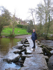
A dawn start on West Anstey Common, watching a magnificent red deer stag roaring rivals away from his harem of hinds. How to follow that? A pint and a sandwich at Tarr Farm Inn didn’t hurt at all, and we strode out across Tarr Steps among the gold and green oaks of the Barle Valley just as if the western sky were not heaping with ominously slaty clouds.

No-one really knows how long the ancient clapper bridge of Tarr Steps has spanned the nut-brown River Barle in its narrow combe. Saurian in shape, resistant to flood waters yet built to allow them free passage, this subtle old bridge might have been placed across the river by medieval monks, or it could have been carrying travellers dry-shod over the Barle for as long as 3,000 years. Its flagstone decking rang underfoot, and the swollen river rushed through the rough piers in curling trails of bubbles.

High above the valley an enthusiastic dog came to meet us at Parsonage Farm, drawing his black lip back from his teeth in an ingratiating grin.Christopher Somerville and wet boot, after crossing flooded ford over Dane’s Brook, Exmoor on his walk of the month At Hill Farm it was the hens that greeted us with fat volleys of clucks; at Cloggs Farm, a sweet smell of hay from the barn. From farm to farm we pursued the path, dipping to cross Dane’s Brook among rushes and thorn hedges, climbing to Lyshwell Farm and sight of a scattered herd of hinds on the canter. Some Exmoor farmers detest the red deer for the damage they do; others, such as Raymond and Sarah Davey of Lyshwell, rejoice in the sight and sound of them.

   On Anstey Rhiney Moor the weather caught us a smack. There were smells of wet bracken and turf, sodden grass and sedges. The rain-slick path fell away to a flooded ford over Dane’s Brook. Take the detour to Slade Bridge and forgo the pleasure of splashing across? Not on your nelly. The brook came up to our knees, and sent impertinent scouting parties higher still. On the far bank we tipped a good pint of peat-stained water out of each boot, and squelched on up past Zeals Farm, up the lane and field slopes to Hawkridge on its crest.

A mile or so along the heights, then a final plunge down through dripping trees to walk up to Tarr Steps against the brown tides of the Barle; a beauty of a walk, all in all.


Route map

Tarr Steps - walk of the month map. Due to licensing restrictions in place on Ordnance Survey mapping the mapping extract must be removed prior to printing, or all printing must be limited to 10 paper copies or less and used for personal use only

~Due to licensing restrictions in place on Ordnance Survey mapping the mapping extract must be removed prior to printing, or all printing must be limited to 10 paper copies or less and used for personal use only.~

Route profile

Christopher Somerville on Tarr Steps, Exmoor
Start & finish

Tarr Farm Inn, Tarr Steps, Dulverton TA22 9PY (OS ref SS 869322).

Getting there

Bus: service 401, summer only

Road: M5 Jct 27, A361 to Tiverton; A396, B3222 to Dulverton; B3223 towards Exford; Tarr Steps signposted in 5 miles; minor road to car park (872323).

Walk

7.5 miles, moderate, OS Explorer OL9

From car park, down path to cross Tarr Steps (868321); bear right off road up Two Moors Way/2MW (‘Withypool Hill, Hawkridge’). In 50yds at private gateway, keep ahead uphill on stony lane which doglegs right. In field above, left along hedge, and on with hedges on your left. At end of 3rd field, through gate; follow yellow squares through farmyard of Parsonage Farm (857320). On down lane (2MW) to sharp left bend; right (854318) across stile, diagonally left up slope, aiming for 3rd telegraph pole to left. Follow hedge up to top corner of field; through gate; on to gate above. Don’t go through, but turn left with hedge on your right. Through left-hand of 2 gates close together; in 50yds, right through gate; left along hedge; through next gate. Skirt below Hill Farm (847320); through another gate, and on to road. Left to Withypool Cross (845315); right (‘Molland’), then left (‘Bridleway, Shircombe Drive’) to Cloggs Farm (840310). By barn, left through gate (‘Anstey Gate’); down to cross stream (841311); through gate, right along fence above stream for a few yards, then left up bank (‘Anstey Gate’ fingerpost at top). Descend to cross Dane’s Brook footbridge (840308); right up stony track, then field slopes, aiming for line of trees on skyline. Through gate (fingerpost), on past Lyshwell Farm (837306); farm drive to road at Anstey Gate (835298). Left across cattle grid; then diagonally left across Anstey Rhiney Moor (left-hand of 2 diverging tracks) for 1 mile, descending to cross ford (850300; NB – Deep, maybe up to knees! Detour via Slade Bridge signposted!). Up track to pass below Zeals Farm house (853300); through white gate; right between barns, out of farmyard gate. Bear half left off drive (bridleway fingerpost) on grassy field track to gate; continue to Slade Lane (855303). Left to next corner; right (bridleway fingerpost) across field to road. Right through Hawkridge. At crossroads in village, left (‘Withypool’) for 100yds; right to follow 2MW through fields for 0.75 mile. Right (856317) through Row Down Wood, down to road at Penny Bridge (860316); left to Tarr Steps.

Lunch: Tarr Farm Inn (01643 851507; www.tarrfarm.co.uk)

Accommodation: The Bark House, Oakfordbridge, Devon EX16 9HZ (01398 351236; www.thebarkhouse.co.uk)

More info: Exmoor National Park Visitor Centre, Dulverton (01398 323841; www.exmoor-nationalpark.gov.uk; www.exmoor.com); www.ramblers.org.uk

~A version of this article first appeared in The Times, 21/11/2009.~

Author: Christopher Somerville

Walk Of The Month: Portesham and Hardy's Monument, Dorset

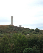
A blackbird was singing on the garden wall of Portesham House, where stone lions couchant guarded the porch. Thomas Masterman Hardy, who lived here in the Dorset downs as a young boy in 1778, was destined for fame as a much-loved sailor and man of action. Horatio Nelson’s close friend and trusted Flag Captain died loaded with honours in September 1839. In that month his namesake, the future novelist and poet Thomas Hardy, became the tiniest of twinkles in his mother’s eye at Higher Bockhampton, a few miles over the hills to the east. It’s not the great writer who is commemorated by the tall stone Hardy’s Monument on the downs, but the fighting admiral from little Portesham village.

Near the path to Hardy’s Monument crouches the Hell Stone, a Neolithic tomb resembling a heavily armoured giant crab, whose nine massive stone legs support a huge capstone of flint-studded conglomerate. The Devil, playing a game of quoits, hurled the Hell Stone here from the Isle of Portland 10 miles away, so local stories say.

Up in a cold wind by the monument, Jane and I savoured that fabulous tale along with an equally fabulous burger of local beef, cooked and served with a relish of friendly banter by the pony-tailed man in the Hobo Catering van. Hobo the Canadian Inuit dog (who has kindly lent her name to the admirable fast-food business run by her master) followed every mouthful with the soulful gaze of true cupboard love.

Christopher Somerville at Hobo's, Dorset Truth to tell, Hardy’s Monument looks more like a factory chimney than a memorial to a national hero. But the views over Dorset are sensational. Even more stunning is the prospect from the steep ridge above Waddon House, where we paused on the way back to Portesham. Downs and farmlands, the shingle bar of Chesil Beach, St Catherine’s Chapel on its knoll of strip lynchets, the Devil’s quoits pitch of Portland lying like the Gibraltar of Wessex on a bay of molten silver – if any view could entice an adventurous lad to sea, it would be this.

Route map

See the route map for this walk.

~Due to licensing restrictions in place on Ordnance Survey mapping the mapping extract must be removed prior to printing, or all printing must be limited to 10 paper copies or less and used for personal use only.~

Route profile

Portesham - walk of the month route profile


Use this GPX file: [FILE:175] for importing the route into digital mapping products, such as Memory Map and Anquet or drop it straight onto your GPS unit. Check the instructions for your particular model to see how this is done.

Start & finish

King’s Arms, Portesham, Dorset DT3 4ET (OS ref SY 603857).

Getting there

Train (www.thetrainline.com; www.railcard.co.uk) to Upwey (6 miles); bus service 61 from Dorchester (www.surelinebuses.co.uk); road – Portesham signed off A35 Dorchester-Bridport at Winterbourne Abbas.


Walk

7½ miles, moderate grade, OS Explorer OL15

From King’s Arms, cross street; up Church Lane; right up Back Street; left opposite Manor Close (602860). Follow ‘Portesham Withy Beds, White Hill, Abbotsbury Round Walk/ARW’ signs/waymark arrows. Pass withy beds; through gate at end of trees (592860). Sharp right up steep bank; follow fence (fingerpost, ARW) for 1/3 mile. Right over stile (592865) by ‘South Dorset Ridgeway, Hardy’s Monument/HM’ marker stone. Follow ‘Inland Coast Path/ICP’ for 2/3 mile to road (601869). Left (great care!) for 30yd; right (HM fingerpost) down fence for two fields. Detour right (605869; ‘Hell Stone only’) over stone stile to Hell Stone (605867); return to path; follow ICP through wood to Hardy’s Monument (613876). Cross road; follow ICP to recross road (616877; ‘ICP, Jubilee Trail/JT’). In 1/3 mile (620874), right off ICP, following JT for 1¼ miles past Bench farm ruins (624864) to road (630857). Right; in 100yd, right (’Portesham’); in 200yd, right over stile (yellow arrow/YA). Diagonally right to ridge top; follow fence (stiles, YAs) for 1 mile. Through gate by Portesham Farm (612861); left down drive; right along lane into Portesham.

Lunch: Hobo’s Catering van at Hardy’s Monument (presence likely, not guaranteed); King’s Arms, Portesham (tel: 01305 871342; www.kingsarmsportesham.com; B&B available)

More info: Dorchester TIC (tel: 01305 267992) www.westdorset.com; www.ramblers.org.uk.

See books by Christopher Somerville.

Online map and more walks: www.christophersomerville.co.uk. Author: Christopher Somerville

Walk Of The Month: Scorriton and Huntingdon Warren, Dartmoor

Our June Walk of the Month finds writer and journalist Christopher Somerville bombing across Dartmoor…

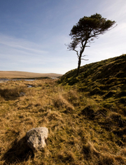
Whatever the Tradesman’s Arms put in their beef jalfrezi on curry night, it revved me right up for a brilliant walk the following day. The hamlet of Scorriton, sitting tight under the eastern rim of Dartmoor, almost lost its pub a few years back, and the shock of that threat galvanised the Tradesman’s Arms into a whole sparky new life. The food’s good, the beer’s excellent, and the social life that revolves around the little inn, from poetry nights to quizzes and singsongs to story-telling, is just amazing. If only all rural communities could respond like tiny Scorriton to the gradual sapping of their resources!

I strode up the stony lane to Chalk Ford like a man on a mission. Misty weather was forecast for later in the day, and though I had my trusty Satmap GPS device in my pack, I didn’t particularly want to find myself in a Dartmoor pea-souper. Continue reading Walk Of The Month: Scorriton and Huntingdon Warren, Dartmoor

Walk Of the Month: Purton and Sharpness, Gloucestershire

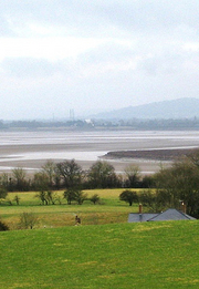
There’s definitely something strange about the river country along the Severn Estuary. Whether it’s the influence of the mile-wide tideway, the big overarching skies, or the highly idiosyncratic dwellings and their occupants down the twisty lanes that end abruptly at the river, to walk here is to step away from the everyday into some parallel, Severn-centred universe.

Setting out from Brookend, a few miles north of Bristol on the ‘English bank’, Jane and I found ourselves straight away in a tangle of wide old green lanes. You feel that the landscape must be flat, so close to such a big river, so it comes as a shock to top a rise of ground and find a 20-mile view unrolling. To the east the long South Cotswold ridge, May Hill and the heavy tree cover of the Forest of Dean swelling in the west, and between them the Severn hurrying seaward in a muscular double bend of low-tide tan and silver – we halted to gaze our fill before hurrying down the slope into Purton.

In the early 19th century a 16-mile-long canal was dug from Gloucester down to Sharpness on the lower Severn, cutting out some of the dangerous river bends. Purton, right beside the canal, became a busy little place. Nowadays it’s a sleepy waterside hamlet once more, full of charm and possessed of a true classic of a never-changing pub. No food, no late opening and no nonsense at the Berkeley Arms under the admirable guidance of Mrs Wendy Lord – just a huge fire, stone floors, comfortable old settles, and beer so good it sits up and begs to be drunk. Resistance is useless.

Just down the river path we found an extraordinary elephant’s graveyard of redundant boats – dozens of concrete barges and wooden Severn colliers, rammed into the mud during the late years of the 20th century to stabilise the tide-burrowed bank between river and canal. Lovingly labelled by the ‘Friends of Purton’, they cluster the margins of Severn in death as in life – Orby, Abbey, Huntley and Harriett, their timbers shivered, their sides split, tillers and hawseholes still bravely held aloft, a poignant gathering.

Beached barge - 'Harriet' - at Purton, Gloucestershire. Photo: Christopher Somerville  On down the canal, and through the abutments of a mighty railway bridge that once spanned the Severn. On the night of 25 October 1960, in a thick autumn fog and pitch darkness, two tankers – one loaded with oil, the other with petrol – collided with the bridge piers and exploded, sheeting the river in flame and killing five of the eight crewmen. The damaged bridge was eventually demolished, but the remnants of the tankers are still seen on the riverbed at low tide, and plenty of people around the river port of Sharpness retain vivid memories of that awful night.

Sharpness itself is a rare survival, a working port handling cement, fertiliser and scrap metal far up the tidal Severn. We stopped to watch the cranes swinging bags of fertiliser out of the hold of Shetland Trader, then crossed the canal and made for the field path to Brookend with a sharp appetite apiece. ‘Try the antelope and ginger sauce,’ suggested cheery Dan in the Lammastide Inn. I thought he was pulling my leg, till I looked at the menu board. You’re not in Kansas any more, Toto.

Route map

Walk of the month - May - annotated route map - Purton and Sharpness, Gloucestershire. Due to licensing restrictions in place on Ordnance Survey mapping the mapping extract must be removed prior to printing, or all printing must be limited to 10 paper copies or less and used for personal use only

Due to licensing restrictions in place on Ordnance Survey mapping the mapping extract must be removed prior to printing, or all printing must be limited to 10 paper copies or less and used for personal use only.

Chris’s map annotations:
1 – Lammastide Inn (START)
2 – Lip Lane
3 – Gloucester & Sharpness Canal
4 – Swing Bridge
5 – Berkeley Arms PH
6 – Boat ‘graveyard’
7 – Severn Railway Bridge Abutments
8 – Dockers’ Club
9 – Docks
10 – Swing Bridge
11 – Village Hall


Route profile

Purton and Sharpness, Gloucestershire walk route profile

Use this GPX file: [FILE:137] for importing the route into digital mapping products, such as Memory Map and Anquet or drop it straight onto your GPS unit. Check the instructions for your particular model to see how this is done.

Use this KML file: [FILE:138] to see the route in Google Maps (under My maps) and Google Earth.

Start & finish

Lammastide PH, Brookend, Sharpness GL13 9SF (OS ref SO 684021).

Getting there

Train to Cam & Dursley (7 miles); several buses to Sharpness.

Road: M5 (Jct 14); A38 (‘Gloucester’); B4066 (‘Sharpness’); right to Brookend. Park at Lammastide PH (please ask permission, and give the pub your custom!)

Walk

6½ miles, easy grade, OS Explorer OL14
From pub, right past phone box; left on bend (‘bridleway’). In 100 yards at gate, keep left on green lane. At T-jct, right (686023 – blue arrow). In 300 yards, opposite gate, left (689022 – ‘footpath’ stone) across fields (gates, yellow arrows/YAs) for 1 mile to Purton. Reach road left of church. (682042). Ahead across canal; left to next bridge (691044); right past Berkeley Arms PH. Riverside path joins canal towpath (687044). NB To see beached boats, detour right here.

Towpath into Sharpness; cross canal (670030). Up steps (‘Severn Way’); ahead past bungalows; right past Dockers’ Club (671029) to road. Left across more seaward of 2 swing bridges (673029). Ahead to road (677026); right (‘Sharpness’). Left beside Village Hall (674021 – fingerpost); cross stile; left to cross stile in hedge (678021); up hedge, through gate at top; YAs to Brookend.

Lunch: Lammastide Inn (friendly and handy), tel: 01453 811337.

Drink: Berkeley Arms (open Wed-Sun,7-10pm; Sat-Sun 12-2pm).

More info:Stroud Tourist Information Centre, tel: 01453 760960.

See books by Christopher Somerville.

More walks: www.christophersomerville.co.uk.

A version of this article first appeared in The Times, 13/03/2010.

Author: Christopher Somerville

Walk of the month: Blagdon Lake, Somerset

Ranulph FiennesOur second Walk of the Month from writer and journalist Christopher Somerville, who lives and loves the Bristol area…

A male blackbird, yellow bill a-tremble, was making tentative inquiries of a drab brown female on a bough in the New Inn’s garden as I started down the hill towards Blagdon Lake. The celandines were still curled tight and green along the high-banked lane, but there was a breath of warmth in the low sun, more than Somerset had felt for the past three months.

For well over a century Blagdon Lake water has been piped to Bristol’s taps, ten miles over the hills to the north. Crossing the broad dam of the lake, I heard the subdued roar of the flood-engorged weir where snowmelt and swollen streams were sending their waters surging down the spillway. I followed the fishermen’s path through the trees along the north bank of the lake, then struck out across fields thick with the winter’s mud to reach the lane by Bellevue Farm – well named for its prospect of water and hills.

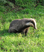
A little way up the lane I was pulled up short by the sight of a large badger squatting on its haunches in a cottage garden. It shouldn’t have been out of its sett this early in the year, and it certainly should have fled at sight of me, instead of fixing me with a sleepy stare. It was I who walked away, leaving the badger master of the place.

Blagdon Lake SomersetThe southward views grew better and better as the lane rose, until at the top of Awkward Hill I looked down over fields patchworked with green grass and red ploughland, out across the whole expanse of Blagdon Lake to the steep wall of the Mendip Hills beyond in early afternoon shadow.

The late winter light, already beginning to diminish, lay softly on the lake with a blurred sheen more like watered silk than the hard mirrored effect of a summer day’s sunshine.

Down by the lake once more, I squelched towards Blagdon over boggy meadows where wild geese went lumbering into the air at my approach, trumpeting reprovingly. It was almost time for them to be off to their mating and brood-rearing, 2,000 miles north of these green Somerset fields.

Back at the New Inn, sitting on the terrace with a cheddar ploughman’s and a kingly view over the lake, I heard the love-struck blackbird – or possibly another like him – still singing for spring.

Route map

Blagdon Annotated Map
Due to licensing restrictions in place on Ordnance Survey mapping the mapping extract must be removed prior to printing, or all printing must be limited to 10 paper copies or less and used for personal use only.

Chris’s map annotations:

1 – A368
2 – New Inn
3 – Park Lane
4 – Dam
5 – Awkward Hill
6 – Industrial Chimney
7 – Holt Farm

Route profile

Blagdon Route Profile
Use this GPX file: Bladgon Lake Walk (8 KB) for importing the route into digital mapping products, such as Memory Map and Anquet or drop it straight onto your GPS unit. Check the instructions for your particular model to see how this is done.
Use this KML file: Bladgon Lake Walk (46 KB) to see the route in Google Maps (under My maps) and Google Earth.

Start & finish

New Inn, Blagdon BS40 7SB (OS ref ST 505589)

Getting there

Road: M5 Jct 21; A 371, A368; left in Blagdon opposite Live & Let Live PH to New Inn.

Walk

5 miles, easy grade, OS Explorers 141, 154

From New Inn, walk down Park Lane, along the reservoir dam wall. On the far side, go right (504603) beside reservoir for half a mile, then forward (511608) to Bellevue Farm at West Town (517604). Left for 10 yards to road, right for three quarters of a mile; 300 yards past the top of Awkward Hill (nameplate), right over stile (527600), following path over stiles, down across fields to road (529593). Left for 250 yards; just before industrial chimney, right (531591 – footpath sign) into damp fields. Follow the footpath close to the reservoir for 1 miles; 500 yards past Holt Farm, bear left (510591) on an uphill path back to Blagdon.

Lunch: New Inn (tel: 01761 462 475), superb lake views from garden; NB no children indoors.

More info: Wells Tourist Information,tel: 01749 672 552; www.visitsomerset.co.uk.

See books by Christopher Somerville.
See his website: www.christophersomerville.co.uk.

Author: Christopher Somerville

Five minutes; five questions with… Simon Calder

It’s been a while since our last interview with Simon Calder, so we caught up with the intrepid travel editor and broadcaster while he was shooting his latest travel film in our Covent Garden store.

What are you working on at the moment?

We’re filming for the One Show, we’re asking the question, do we really need British Airways in a time when the traveller has never had so many opportunities and where BA is going through some difficult time? We’re basically saying, well, do we still need you? Continue reading Five minutes; five questions with… Simon Calder

Bear Grylls comes to Stanfords

Acclaimed adventurer, survival expert, Chief Scout and TV personality Bear Grylls came to Stanfords for a special book signing event and to promote the opening of the new Craghoppers store at Stanfords, which currently stocks Bear’s exclusive range of outdoor clothing.

Bear braved the wilds of London to greet the queue of admiring fans that awaited him. He enthusiastically signed copies of his latest books, posed for photographs, and even signed his range of Craghopper T-shirts!

Daniel du Plessis, sales advisor at Craghoppers in Stanfords, said, “It was great to see Bear come down and support the opening of the new Craghoppers store at Stanfords, especially as it’s proving to be a successful partnership”.

Intrepid adventurer Bear was one of the youngest climbers to have successfully completed an ascent of Everest, documented in his book Facing Up, and has since accomplished other ground-breaking expeditions. Facing the Frozen Ocean tells the story of Bear’s adventures across the infamous Labrador Sea in a small inflatable boat. In 2007, he became the first man to fly a powered paraglider above Mount Everest, whilst he has also featured in the Channel Four series ‘Born Survivor: Bear Grylls’, where Bear is parachuted into some of the most inhospitable places on earth. The book accompanying the series – Born Survivor – stayed for 10 weeks in the Sunday Times Bestseller List. 

News at Stanfords - Bear Grylls at Stanfords, © Carolyne LocherHis latest book Great Outdoor Adventures sees Bear sharing his experience of the world’s most extreme terrain to help you get the most of the great outdoors. Bear has recently been appointed Chief Scout, the figurehead for 28 million Scouts worldwide.

Author: Gareth Brereton


John Simpson Takes Explorers to War Zone

John Simpson is to teach adventurers Sir Ranulph Fiennes and Sir Robin Knox-Johnston how to file news reports from a war-zone in a new BBC series.

The BBC world affairs editor will take the pair to Afghanistan, as he files reports for the BBC News.

In return, the explorers will lead Simpson on the type of trips they are more familiar with, to hone the broadcaster’s adventure skills.

Sir Ranulph, whose records have included making the first surface journey around the world’s polar axis, will guide the others on a week-long journey to the Arctic Circle in temperatures as low as -50C.

Sir Robin, the first person to sail single-handedly and non-stop around the world, guides the voyage around South America’s dangerous Cape Horn. The team have just completed filming there and John Simpson kindly spared a moment to send us some photos. And here are the trio at Cape Horn (top right) and a shot of the treacherous waters they encountered (left).


The three-part series – Top Dogs: Adventures in War, Sea and Ice – will be shown on BBC2 in spring this year.

Read our interview with John Simpson.

What Stephen Fry Did & Saw In America

Stephen Fry, the much-loved comedian, actor and writer, embarked on an epic journey across the USA for his TV series and book – Stephen Fry in America.

Visiting each of America’s 50 states, Fry sets out to discover how such a huge diversity of people, cultures, languages, beliefs and landscapes combine to create such a remarkable nation. Here is his list of some of the things he got up to in the US…

1. Lobster fishing in Maine.

2. Electioneering with Mitt Romney for the New Hampshire primaries.

3. Went to a real witches’ ball at Salem, Massachusetts, on Halloween.

4. Sailed an Admiral Cup winning yacht in Rhode Island.

5. Went down into a nuclear submarine in Connecticut.

6. Mixed my own Ben and Jerry’s flavour in Vermont.

7. Hung out with ancient toothless wise guys from the old days in the borough of Queen’s, New York; drove Sting down Broadway.

8. Learned to deal Blackjack in the Trump Taj Mahal casino in Atlantic City, New Jersey.

9. Zoomed round Washington DC in a Segway.

10. Went to the Veteran’s Day ceremony in Arlington, Virginia with VP Dick Cheney.

11. Sold a thoroughbred yearling and got insanely ratted in a bourbon distillery in Kentucky.

Stephen Fry Lobster Fishing
Stephen Fry lobster fishing in Maine, USA. Copyright: Stephen Fry and West Park Pictures Ltd 2008
12. Picked with Bluegrass hillbillies and found myself in a garden full of dead bodies in Tennessee. Was appointed an official duckmaster in Memphis, an honour I share with Kevin Bacon and Oprah Winfrey.

13. Went ballooning over the Smoky Mountains in North Carolina.

14. Went to a gay bar in Georgia and watched a drag act … “Honey, there’s more of us than you’d believe.”

15. Watched a college football game in Alabama that was bigger than the FA Cup final. 100,000 in the stadium, two hundred thousand crowded outside it.

16. Sat in court in Montgomery as families pleaded for their children’s parole.

17. Swam with dolphins and danced with snowbirds in Florida.

18. Marched with the Zulus on Mardi Gras in New Orleans, was blessed at a voodoo ceremony (or possibly cursed). Witnessed the horrors of Hurricane Katrina in the Lower Ninth Ward.

19. Went oystering down in the gulf of Mexico and farmed with murderers and lifers at the Angola state penitentiary in the rest of Louisiana.

20. Canoed along the Mississippi in Arkansas.

21. Sat and talked about the blues with Morgan Freeman in Clarksdale, Mississippi.

22. Hung out in the ice and snow amongst the homeless in St Louis, Missouri.

23. Had my brain examined by a Maharishi psychologist at the Maharishi University in Iowa. Went nuts trying to find alcohol in Vedic City, Iowa, a city founded by followers of the Maharishi.

24. Rode with the fire brigade in Elkhart, Indiana. Looked a dick in the uniform. Breathing apparatus got stuck on me.

25. Rode a Model T-Ford around Henry Ford’s Greenfield Village, Michigan.

26. Discovered the South Side of Chicago with blues legend Buddy Guy.

27. Cast and buffed and dipped and polished a genuine Oscar at the factory where they are made in Chicago.

28. Milked sheep in Wisconsin and was pulled in an Amish sled.

29. Went ice-fishing in Minnesota and caught a fish.

30. Strode around with Ted Turner on his Montana ranch and inspected his herd of buffalo.

31. Helicoptered over the Canadian border with the National Border Patrol.

32. Poured water over Idaho to demonstrate the nature of the continental divide.

33. Was pulled by huskies in Wyoming.

34. Ate German food at a diner in Bismarck, North Dakota.

35. Stayed on the Lakota Sioux reservation in South Dakota and drummed with the young braves.

36. Went trucking in Nebraska.

37. Went down a missile bunker in Kansas.

38. To a rodeo in Oklahoma.

39. Attended an Indian Pow Pow in Denver and caused an explosion on the slopes at Aspen, Colorado.

40. Drove along the Rio Grande with Border Patrol in El Paso, Texas and watched Mexicans trying to smuggle themselves over the border.

41. In New Mexico went to Los Alamos where the first Atom bomb was made; ballooned along a canyon and went inside an earth ship.

42. Barbecued with the Navajo deep inside Monument Valley and had a Navajo weaving lesson.

43. In Nevada played a spy game in Las Vegas and found myself in a legal brothel outside Reno talking to well breasted women.

44. Flew in a WW2 B17 bomber from Phoenix to Tucson, Arizona and played a scene in a western in the old Tucson studios. Got shot. Death scene lasted 12 minutes, nearly a Tucson record. Beaten by Deforest Kelley, later Dr McCoy, in a B western.

45. Drank wine in California’s Napa Valley, chewed the fat with Jony Ive, designer of the iMac, iPod and iPhone. Shot a .44 magnum in Ukiah, California, guest of the sheriff.

46. Raided a marijuana farm in Mendocino County.

47. Camped out in a place known to be frequented by Big Foot, the Sasquatch in Grant’s Pass, Oregon.

48. Swam with sea otters and seals in Seattle, Washington. Said goodbye to the taxi.


Buy your copy of Stephen Fry in America
49. Went fishing in and looking for bears in Kodiak, Alaska. Went north to the Arctic Circle and skidoo-ed with some Eskimos.

50. Went to an observatory in the tallest mountain in the world in Hawaii. Canoed like in the title sequence of Hawaii 5 O. Flew over lava field and watched new bits of America, five acres a week, being made as the molten lava hit the sea. Swam with sharks, flew a microlite around the islands.

And more, so so so much more you wouldn’t believe.

Get your copy of Stephen Fry in America.

Images: Copyright: Stephen Fry and West Park Pictures Ltd 2008; photographs by Vanda Vucicevic; map and artwork collages West Park Pictures and Sarah Hanson 2008

Author: Stephen Fry

Browse our collection of maps, guides and travel literature:
> USA travel guides
> USA road maps and atlases
> Travel literature inspired by the USA