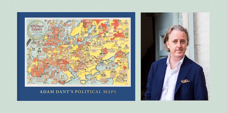
Adam Dant’s Political Maps is an all-new collection of intricate, absorbing and beautiful maps, focused on the world of politics. Informed by his experiences as the official artist of the UK general election in 2015, these glorious works of art are amusing and subversive, hugely imaginative and packed with eye-catching detail.
Here, the artist and cartographer Adam Dant tells us what makes a map political:
Traditionally a ‘political map’ as opposed to a physical map refers to the world according to its territorial borders.
In an age where the word ‘political’ connotes concepts diametrically opposite to its original meaning i.e bad things not good things, the maps in Adam Dant’s Political Maps expand the criteria as to what constitutes a ‘political map’ to some of the farthest reaches of the milieu.
So, when is a map ‘political’?
1. When it shows you where politicians hang out.
Credit: Adam Dant’s Political Maps by Adam Dant is published by Batsford. Limited edition prints available www.tagfinearts.com.
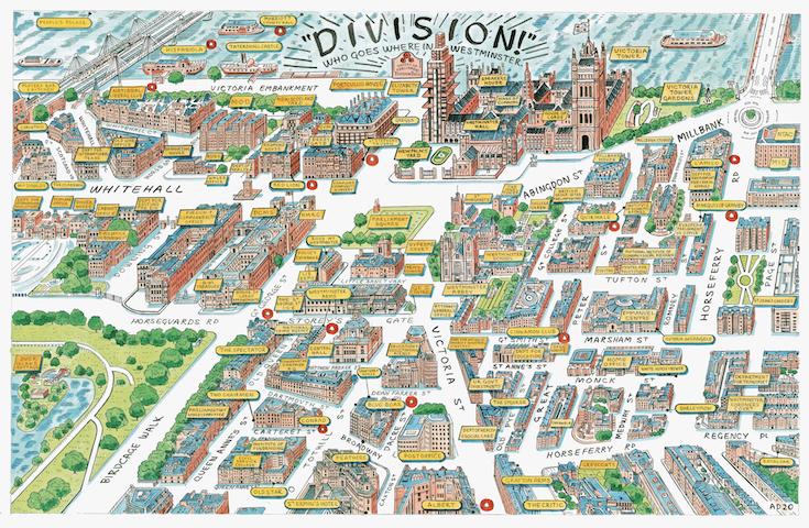
‘Division’ is a pictorial map of Westminster depicted according to the extra-mural hangouts of sitting M.P’s. Before the Palace of Westminster was so well served by a glut of canteens, fancy dining and subsidised bars, politicians would have had to have taken luncheon at the hostelries in the wider Westminster village. To ensure M.Ps could get back to the chamber in time to vote, off site ‘division bells’ were installed in these places to inform them that they had 8 minutes in which to return to the chamber. The division bell in the lobby of the St Ermin hotel also informs the doorman that the chap scuttling off has probably been dining with spies, the place being well known as a hangout for said.
2. When it describes a utopia
Credit: Adam Dant’s Political Maps by Adam Dant is published by Batsford. Limited edition prints available www.tagfinearts.com.
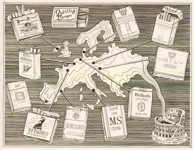
‘Quitting Europe’ depicts the continent according to its charming though long ago sanctioned cigarette box designs, with a personal anecdote to accompany each.
Credit: Adam Dant’s Political Maps by Adam Dant is published by Batsford. Limited edition prints available
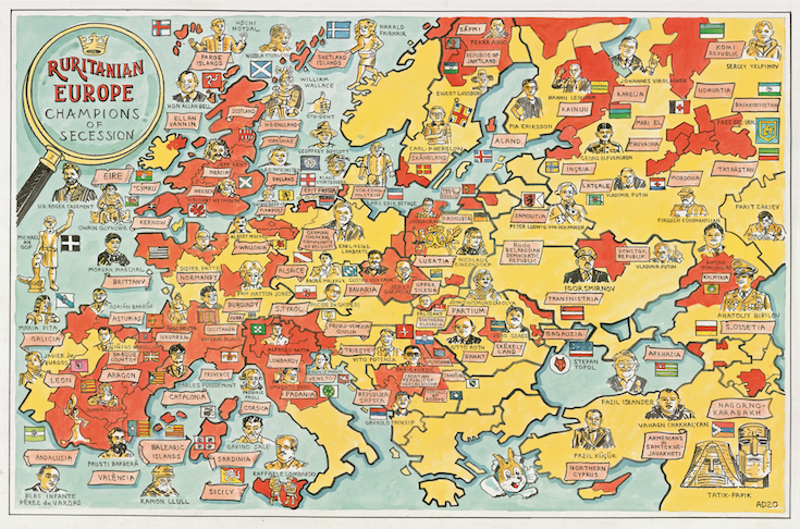
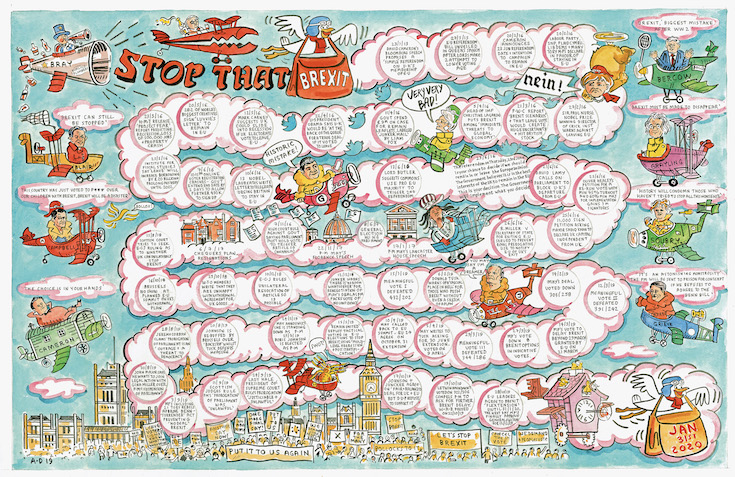
‘Ruritanian Europe’ shows the many secessionist regions whose long held claims for independence still stoke serious dreams and grievances. And ‘Stop that Brexit’ is a vapour trail timeline of bill blocking which wafts throughout a WW1 style dogfight in the skies over Europe describing the UK’s journey out of the E.U.
Credit: Adam Dant’s Political Maps by Adam Dant is published by Batsford. Limited edition prints available www.tagfinearts.com.
Each of these maps is underpinned by similar political themes. The struggle for autonomy and for less big government interference, nostalgia for a perceived ‘golden age’ or premising of ‘conservative’ or ‘nationalist’ values and a fantasy that one can travel back in time to a moment when puffing away on a high-tar black tobacco ‘gasper’ looked really really cool as opposed to really stupid.
3. When it’s just downright sleazy
Credit: Adam Dant’s Political Maps by Adam Dant is published by Batsford. Limited edition prints available www.tagfinearts.com.
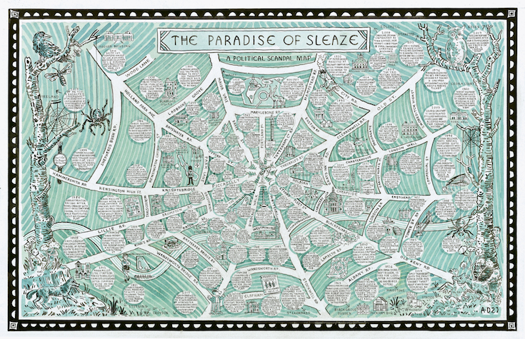
It is undoubtedly the behaviour of politicians that has led to the tainting of the word ‘politics’, aided in no small part by the appetite of a jaded electorate to be fed a diet of lurid tales of filth and fornication from the corridors of power by a snickering and cretinous media. The proverbial ‘tangled web’ of this map of ‘the paradise of sleaze’ forms the sticky matrix across which are strewn the flesh pots, rent by the hour hotel suites, cottages, dead letter boxes, late night badger watching areas and inevitably the odd cop-shop and magistrates court.
4. When it works in practice but not in theory
Credit: Adam Dant’s Political Maps by Adam Dant is published by Batsford. Limited edition prints available www.tagfinearts.com.
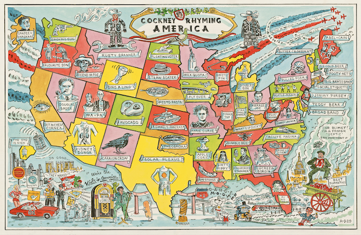
The map of cockney rhyming America is of no use to anyone despite its functioning in a perfectly efficient manner according to the pointless concept that determined its creation, being the transposition of an arcane and irrelevant form of argot (that of the East London costermonger who never travel outside of Bethnal Green) onto a terrain whose peoples will never ever encounter such. To the armchair traveller of the Henry Higgins persuasion some amusement may be had in attempting to come up with a better bit of Cockney rhyming slang for Alaska than ‘Sanjeev Bhaskar’.
5. When it’s subversive.
Credit: Adam Dant’s Political Maps by Adam Dant is published by Batsford. Limited edition prints available www.tagfinearts.com.
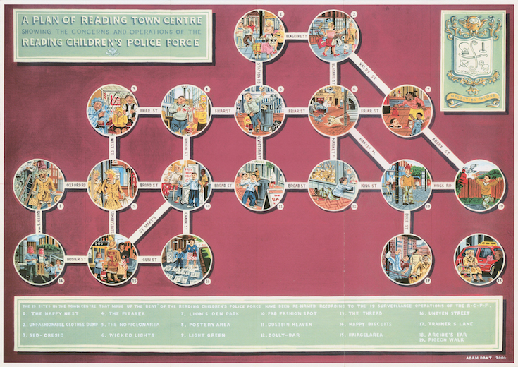
‘The Reading Children’s Police Force’ (being the town as opposed to the edifying activity) was born out of a new street signage scheme which relegated the ‘art’ bit to panels 3ft from the ground i.e child height.
Every year 10 child in Reading was given a workbook which introduced them to the concept of the Ancient Greek ‘polis’ city state, asked them to dismantle the rules and regulations which governed their current environs and to replace them with new laws enforced by a new police force. This ‘matrix’ map of the town represents the children’s rather chaotic attempts to construct a human CCTV type network of ‘little watchers’ through which to impose their often extremely draconian new order of things.
6. When it concerns a politician
Credit: Adam Dant’s Political Maps by Adam Dant is published by Batsford. Limited edition prints available www.tagfinearts.com.
Politicians represent places, the names of which define their identities as elected public servants in the ‘isn’t he / she North Norfolk ‘? fashion.
A sympathetic and knowledgeable understanding of their particular constituency is essential and is no doubt ‘mappable’ as a political ‘stomping ground’.
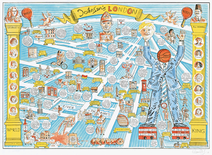
Despite his American birth Boris Johnson’s political show ground has always been London. On this map of ‘Johnson’s London‘ are shown all the homes, haunts, and highways that have emboldened him to be confident enough in the metropolis to give his wife a ‘backie’ on his bicycle ( he got booked by the police) up a busy Barlby Rd.
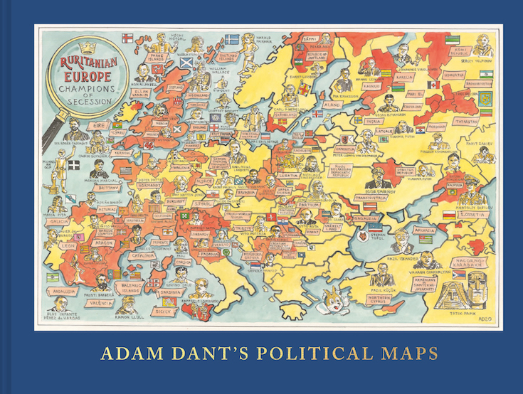
Adam Dant’s Political Maps is published by Batsford and is available for £30.
All our copies are signed by the author (while stocks last).