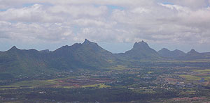
 It’s true; Mauritius is not usually thought to be a destination for hikers and mountaineers. Consider the tourist brochures depicting luxury hotels, fine white sands and blue lagoons. Think of the boredom of hearing that yet another couple is planning to take their honeymoon on a little bit of paradise in the Indian Ocean. Go on, you could even confuse Mauritius with the Maldives, and assume there are no mountains at all and that the country will soon be the first casualty of rising sea levels.
Picturesque toy peaks
This dot on the map in the middle of a vast ocean has nothing to match the Alps, the Himalayas, Aconcagua or Kilimanjaro in terms of danger or drama (take your pick, mountain snobs) all because the mountains here are minute, manageable and simply sublime. After a brief visit en route to the Far East, Mark Twain stated quite accurately that they were miniature, “picturesque groups of toy peaks“. Other writers have gone much further, such as Robert V.R. Marsh, who wrote a whole book about climbing them in the 1970s. Sadly, Mountains of Mauritius is no longer in print and I have never been able to get hold of a copy, so I cannot comment any further on the content. Franco-Mauritian artist and intellectual Malcolm de Chazal, however, filled in gaps in my knowledge with a 500-page tome about the mystical, timeless quality of these odd-shaped remnants of an ancient volcanic eruption. If you can’t read French, don’t worry – the essence of his argument in Petrusmok (1951) is that these strange shapes are examples of the dexterity of a race of giants or the intriguing work of a divine sculptor at work on the landscape.
Moulded by a divine sculptor
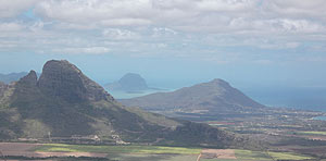 Indeed, many of the peaks you see as you traverse the Mauritian landscape would lead you to believe that you were wandering through a heavenly sculpture gallery: you can gaze at the majestic feline sitting by the sea at Montagne du Lion (“Lion Mountain“, 480m), scramble to the protruding top of Le Pouce (“The Thumb“, 812m) that overlooks the capital Port Louis and react in whichever way you see fit to the oddity of Trois Mamelles (“Three Breasts“, at around 629m – depending on which of the three peaks you choose). From atop many of these mountains you may feel like the sculptor herself, looking down proudly at all the other green shapes she has moulded from the volcanic rock at her disposal. Look out from Corps de Garde (720m) and you’ll see Le Morne Brabant (556m) in the distance at the south-western corner of the island. Fugitive slaves are said to have once jumped to their deaths from the precipice of this UNESCO World Heritage site. Turn around and look north to see miles upon miles of fields of sugar cane punctuated by green blobs emerging from the surface. There is definitely an ethereal quality to these views.
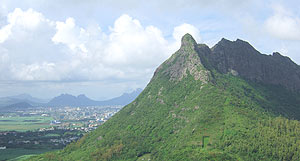 Yet many Mauritians remain rather fearful and in denial about the central importance of the mountains of their country. They have often been seen as the hideouts of bandits and assassins (a relic of the colonial fear of maroon slaves), symbols of death and doom (as at Le Morne, a perilous fall or a jump from up high recurs in local history and mythology), rather than something positive and life-affirming. Climbing and trekking are largely avoided by islanders who – like the tourists – often prefer the soothing comfort of the island’s beautiful coastline that is protected by a near seamless coral reef. Go hiking in the mountains of Mauritius and you will meet very few people, which may be a welcome relief for some who hike in other countries and who may be used to meeting other human beings who are more than ready to steal your vain sense of glory by getting to the top before you and by bragging about their list of mountain conquests. The topography of this island does not really lend itself well to the competitive streak found in all of us, but more to quiet, contemplative thoughts about how we are comfortingly subordinate to that landscape.
- Maps
- If you are looking for maps for this beautiful island, try the following (but be aware that more detailed survey-style maps are not widely available):
- Mauritius, Réunion, Rodrigues (Reise Know-How) – waterproof and tear-resistant.
- Mauritius, Réunion, Rodrigues (Freytag & Berndt) – clear relief shading.
- Mauritius (Institut Géographique National) – includes administrative boundaries, history of the island, climate map, and street plans of Port Louis and Curepipe.
- Books
- For an insight into the culture and history of the island, read one of the following:
- Mauritius (Culture Smart! series by Kuperard, written by Tim Cleary)
- Mauritius (Culture Shock! series by Marshall Cavendish, written by Roseline Ngcheong-Lum)
> Browse our collection of travel guides and maps to Mauritius
Author: Tim Cleary