 Before you go to the USA it makes sense to do a bit of homework and planning. Remember, it is a huge country: for example the distance from New York City to Los Angeles is 500km greater than the one from Lisbon to Moscow. So you should know what your priorities and also your limits are.
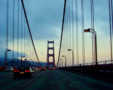
Are you interested in nature or maybe in the cities? Do you like big, cosmopolitan places like New York, Los Angeles, San Francisco and Chicago, or maybe small charming colonial towns like Charlestown and Savannah? Do you prefer lying on the beach or maybe hiking in the mountains? The tropics or the Arctic? America has it all.
First thing you have to decide is how much time you have and what your budget is. If you only have a week and a few hundred bucks, it doesn’t really make sense to drive from coast to coast. It is of course perfectly doable but you will feel more like a long distance truck driver than a tourist. Also, as you will have to stick to the main highways, your experience will be limited to the fast food chains, and gas stations. Is it really what you want? In my opinion, 10 days, or even better 2 weeks, is the absolute minimum for a cross country trip.
Let’s say your choice is a cross-country trip. The planning doesn’t end here, however. There are of course countless routes you can choose. Many people do the classic cross-country trip from NYC to LA or San Fran. That way you can experience the big cities of both coasts as well as the American hinterland. You can for example travel from NYC to Chicago and then follow the famous (if a bit overrated) route 66. Or you can head in the direction of Denver and cross the magnificent Rocky Mountains in Colorado. Another option is heading even further north towards Montana or Wyoming to visit the Yellowstone National Park. While planning you should also consider the weather. If you travel in the winter, choosing a southern route, from Florida to southern California, might be the best option. That way you avoid the risk of being stuck in cold and miserable weather further north and you might even experience New Orleans during the Mardi Gras. However, if you happen to go during the heat of summer the northern route from New England towards Seattle might be a more tempting idea. Myself, I would always avoid the sweltering humid south in the summer.
Crossing the continent is obviously a fantastic idea. But by no means is this the only option for the great American experience. There are a few other fascinating routes, most obviously the coasts. The west coast offers absolutely amazing scenery and it is probably one of the most scenic drives on earth. And not only the famous Big Sur in California but also most of the Californian coast north of San Francisco as well as, my favourite, the Oregon coast. East coast might be not as spectacular (apart from Maine) but it offers a rich colonial history. Think of Boston, NYC, Philadelphia, Savannah, Charleston and many more historic places. One more interesting north-south route is obviously the Mississippi River. It offers a great mix of spectacular scenery (especially in its northern half) and cultural sites. Big cities like Minneapolis, Saint Louis, Memphis and New Orleans as well as small interesting towns like Vicksburg, Natchez or Hannibal all line the river.
All the routes mentioned above require flying in and out of the different airports or lengthy backtracking. For those who don’t want to do either, choosing a particular region of the US and doing a loop around it might be a better option. It simplifies logistics as well as makes the trip significantly cheaper (avoiding drop-off fees on your car rental). There are few distinctive regions begging for a specific trip. The most obvious ones are Florida, California, South-western USA and New England. My other favourite options include the Carolinas with Georgia, the Great Lakes, the Great Plains or the Pacific Northwest, which is probably my absolute favourite part of the USA.
Once you choose where to go, do a bit of researching what you really want to see there and how much time you need for it. I usually do the region-specific trips. In such cases, I choose some highlights and use online route planners to check how long it will take me just to drive between them. That way I know that I won’t overstretch myself trying to cover too much ground and that I won’t be budgeting too much time for some closely located sites. Google Maps or Map Quest are the most obvious route planners but there are many more. At this point I usually start looking for flights. Each of the regions mentioned above has at least one large hub airport which offers cheaper fares and sometimes even direct routes from Europe. But this is a subject for another chapter.
- Browse our collection of maps, guides and travel literature:
- > USA travel guides
- > USA road maps and atlases
- > Travel literature inspired by the USA
Author: Gregor Swiderek
Ukrainian roads are not very good, that is why you should not go there on your own car. Good idea is to hire a car and travel throughout Ukraine on it. Even in case of traffic accident you won’t pay money because of car insurance.