
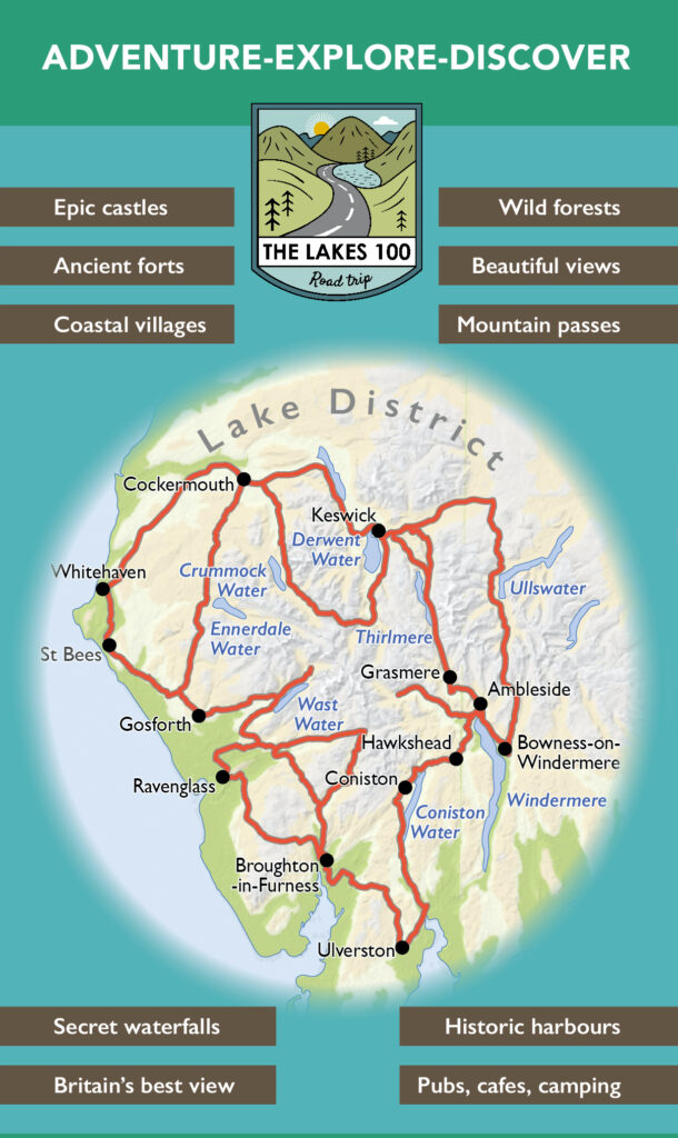
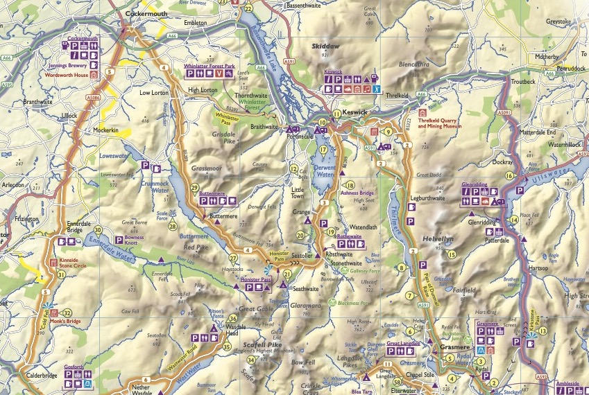
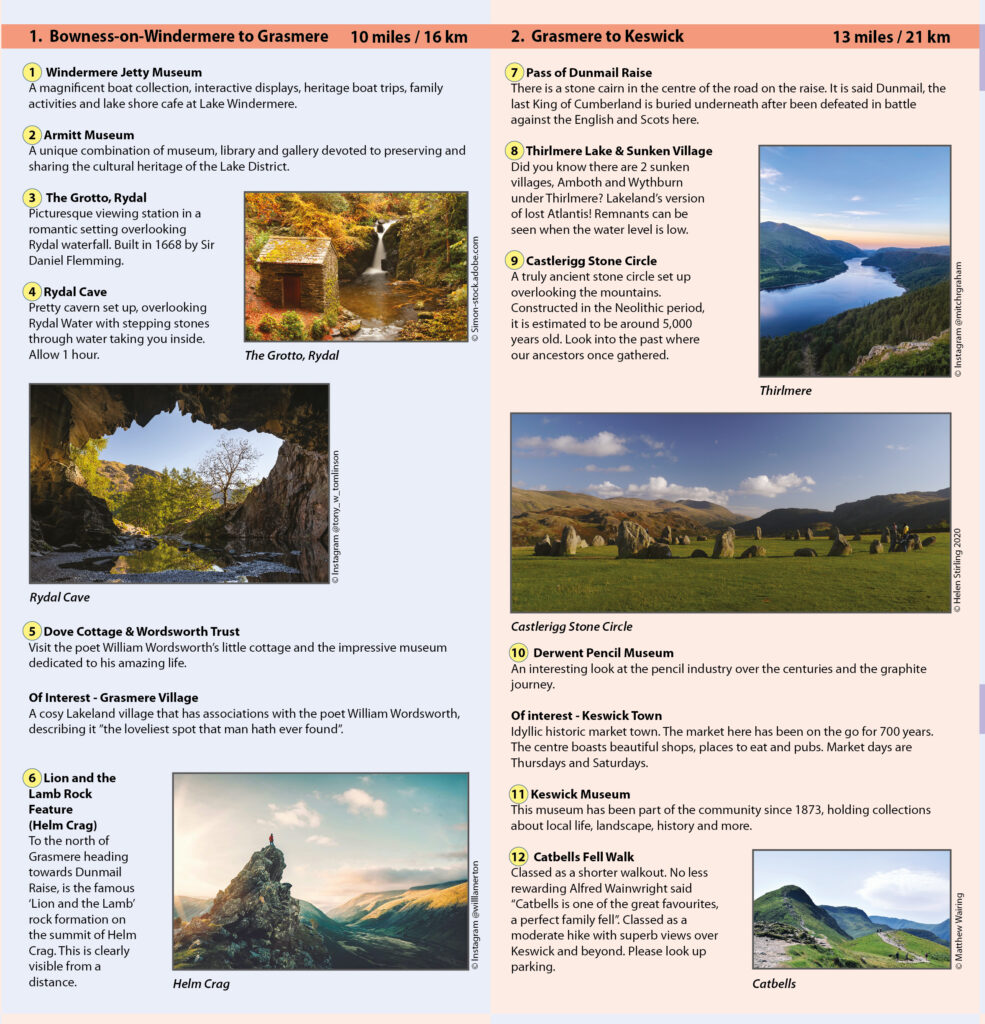
Our Map of the Month for April is The Lakes 100 Map . The Lakes 100 is a circular journey uniquely tailored for you to get the most out of the Lake District and beyond. There are over 150 miles to explore with boundless gems to discover along the way that will quench any thirsty adventurous soul.
Being a family run business ourselves, we love hearing about other family run enterprises. The team behind the Lakes 100 are Cumbrian brothers Peter and Aaron who came up with the idea for this road trip. They initially did the road trip together with a group of friends so they could share the experience and get some feedback. Now you can follow the trip yourself with their map.
Here is a bit of history behind this map in three chapters from Peter from Lakes 100:
Chapter 1- Discovering
The inspiration that went into creating the map came from growing up in the Lake District and having a sense of exploration and thirst to discover all the amazing places that lay just around the corner.
Here in Cumbria, there is such a diverse range of things to do to satisfy everybody’s tastes and interests: from hiking, wild swimming, canoeing, camping, cafes, cosy pubs, amazing historic monuments, quaint villages, forgotten beaches, traditional rural life and much more.
Over the years of enjoying what the Lake District has to offer, we decided in 2019 to connect the dots between these beautiful places and make a map for others to appreciate its richness and unleash their adventurous spirit.
Chapter 2- Gaining Inspiration
We came up with the idea one evening and decided to set out a rough road trip along the most scenic routes that went to the best places along the way with some of the lesser visited unexplored gems. We booked the best campsites to stay at on our highlighted route and penned in what we would like to see and do. On our road trip, we included some detours to coastal towns and along the way we worked and drew up a picture of the map and places of interest that would go on it.
The following week, we got together around a campfire and reflected on what a great time we had and how we would proceed.
Chapter 3- The Making of the map
None of us had any experience with cartography, so the initial idea was to hand draw the map using graphic design software that we had access to. After toying around and experimenting, we had a basic design, but something was missing, so we decided to contact a professional cartographer and get some insight and advice. The Cartographer Helen Stirling, was very fond of the Lake District herself, visiting every year and having a wealth of knowledge on the area. We all had something in common and decided to work with Helen to make our vision come true.
After a number of draughts, we were able to finalise the design and hand it over to the printer for production.
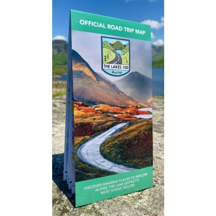
The Lakes 100 Map is available now for £7.99