
Seven years ago, a group of intrepid Ukrainians set out to explore their home country with the aim to document its nature, people and customs. And so, the volunteer-led multimedia project Ukraïner was born. The product of several years and 100,000 km of travel is showcased in their newly published book Inside Ukraine: A Portrait of a country and its people.
‘Ukraïner began as an attempt to express what characterized Ukraine to the people I met as I travelled around the world’ explains Bogdan Logvynenko, one of the founding members of Ukraïner. He continues: ‘I found myself describing my country and hometown … After I returned home from my journeys around the world, I wanted to find a description of this modern-day country; a short but eloquent answer to the question, ‘Where are you from?’’
‘In June 2016, a group of other like-minded people and I set off on an adventure, or as we decided to call it, an expedition. We announced our idea to explore Ukraine and unveil it to the world on social media. Within a few days we received hundreds of messages and several thousand subscribers. With this, our multimedia project Ukraïner was launched.’
Inside Ukraine: A portrait of a country and its people is only one part of the larger multimedia project available at ukrainer.net. The book contains over 350 photographs and stories collected from all over Ukraine, often with QR codes to extra content on the Ukraïner platform. Read on to discover seven amazing places in this vast and wonderful country that the Ukraïner would like you to know about.
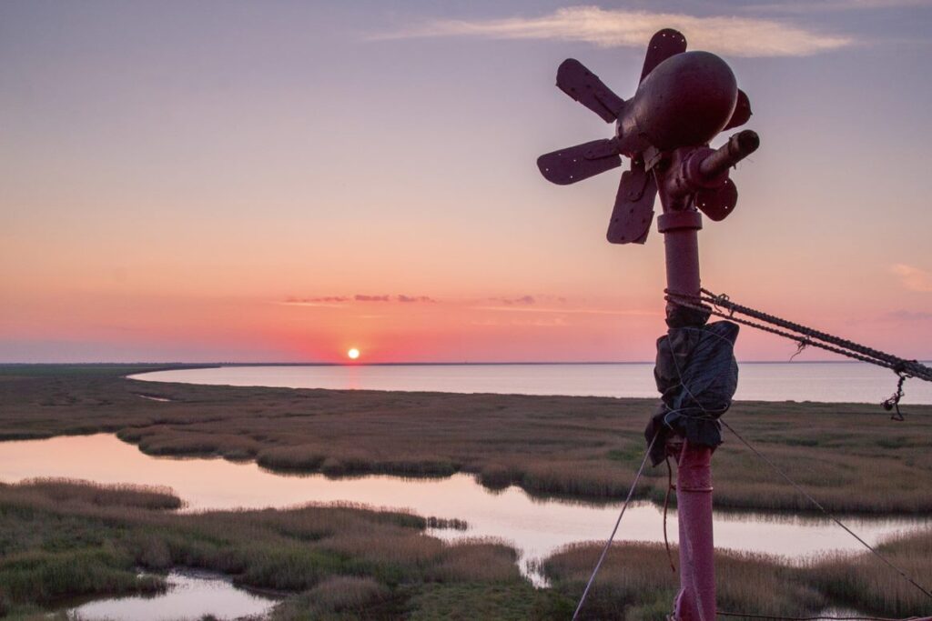
The Tuzly Estuaries
The Tuzly Estuaries National Nature Park is a chain of 13 estuaries at the confluence of the rivers Danube and Dnister. The core of the park comprises the salty estuaries of Shahany, Alibey, Burnas and some other smaller lagoons. The estuaries are separated from the Black Sea by a 36-kilometre spit of land. The territory of the park includes the full variety of local flora and fauna – you can see more than 300 species of birds and 40 types of animals, while the waters contain around 60 kinds of fish.
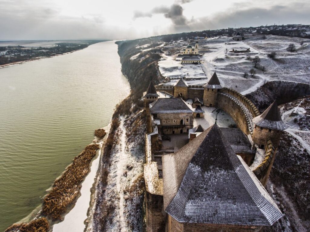
The fortress of Khotyn
The fortress of Khotyn is one of the oldest strongholds in Ukraine. Rising above the Dnister, it used to protect the crucially important water trade route. Even though the stone walls date back to the 13th century, building continued up until the 18th century. The outpost’s 40-metre-high walls have withstood multiple attacks over the years. However, military assaults would always fail unless the attackers undertook a long-lasting siege. Today, it is a historical and architectural conservation area, used as a venue for medieval tournaments.
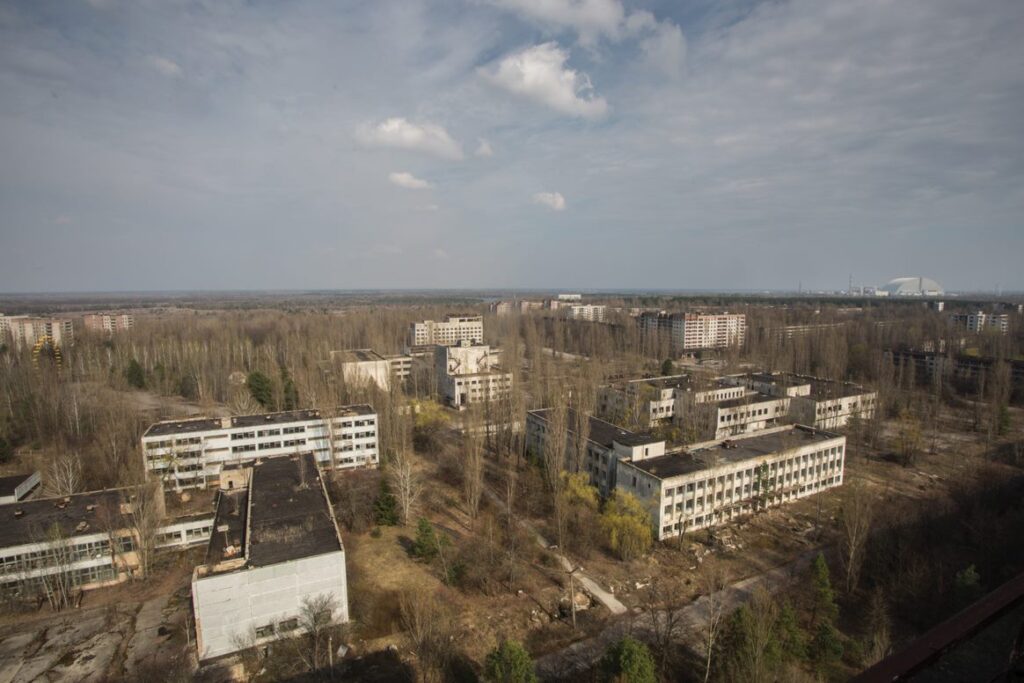
The Chornobyl Exclusion Zone
The Exclusion Zone emerged after the Chornobyl Nuclear Power Plant disaster. At first, it was a totally restricted area, even for those who lived there. Nowadays, it is a popular tourist destination.
The town of Prypiat, located just 2 kilometres away from the plant, is a monument to human neglect. It is abandoned and contaminated by radiation. In the absence of human activity, the forest took over the area. It is now inhabited by wild animals and their population is constantly growing. At the same time, it is a town-museum of international importance, a monument to this enormous technological catastrophe.
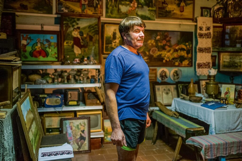
Yurii Dakhno’s Museum in Moskali
In the village of Moskali, near Chernihiv, less than 20 houses remain. The main street, 1 kilometre in length, has neither a school nor a medical centre. However, there is a museum. A local resident, Yurii Dakhno, created his own Skansen here: he bought some of the old houses and a shop and turned them into museums. The exhibits include household items from the 19th and 20th centuries, together with artwork from local artists. In the former shop there are paintings on the walls and glass bottles and mugs on the shelves, wooden barrels, straw hats hanging on pegs, a gramophone, an old radio and shoes hidden behind the drawers.
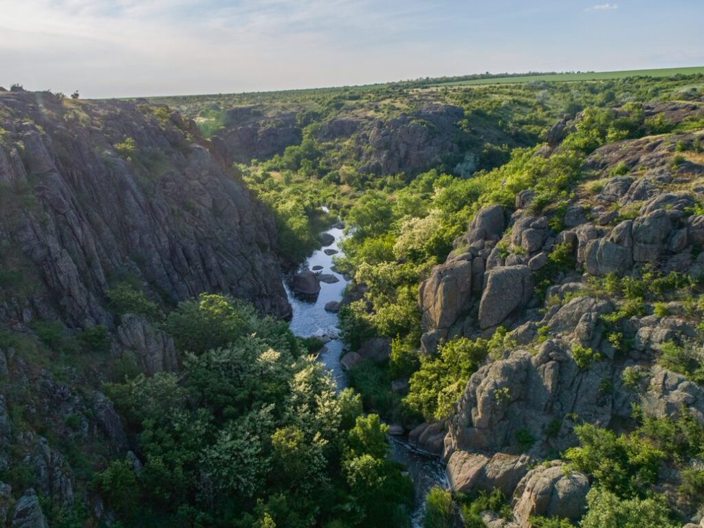
The Aktove Canyon
The Aktove Canyon is a ravine in the steppe more than 50 metres deep formed by the River Mertvovod in the granite rocks near the village of Aktove. Navigable up until the 20th century, the Mertvovod River is now shallow and silty. Dams constructed during the Soviet era significantly reduced water levels. The canyon is a part of the Buzkyi Hard National Nature Park.
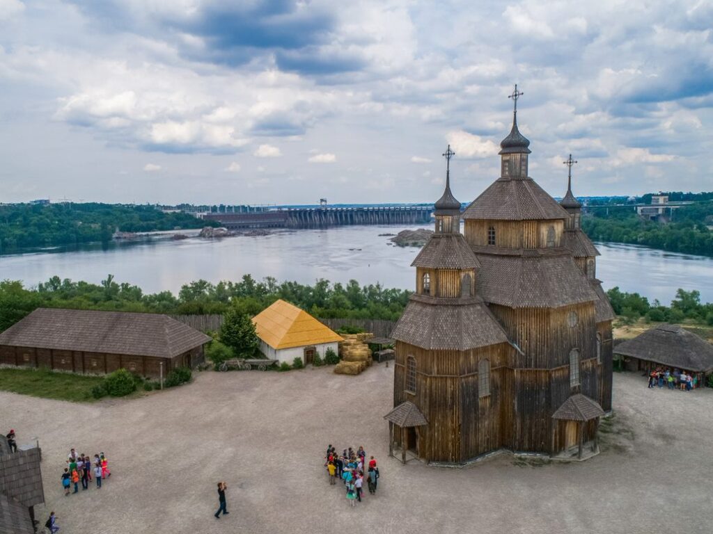
Khortytsia
Khortytsia is the largest island in Dnipro, down the river from the Dnipro Hydroelectric Station in Zaporizhzhia. This is where Ukrainian history comes to life. Khortytsia has been known for a long time because of the Dnipro rapids – rock formations in the Dnipro River between the modern cities of Dnipro and Zaporizhzhia. However, almost a century ago, concrete dams at the Dnipro Hydroelectric Station raised the water level by 40 metres, the rapids disappeared under the water and the river became navigable. Today, the Zaporizhian Sich historical complex, a reconstruction of a Cossack Sich (armed camp), is located on Khortytsia.
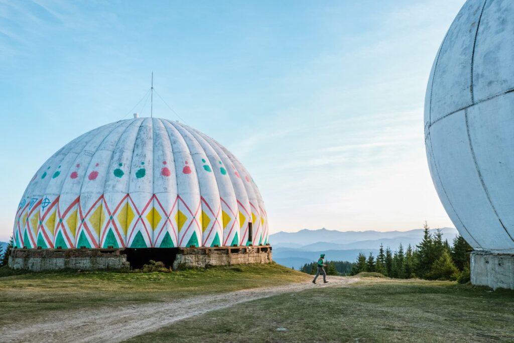
The Pamir Radar Station
Pamir, an abandoned radar station in Bukovyna, used to be a high-security facility established on Mount Tomnatyk, not far from the Romanian border. Five antenna domes, 1,565 metres high, are what remain of the surveillance system. The multidirectional antennas provided continuous monitoring for about 30 years from 1960. Today, this area is surrounded by tourist trails, and is popular with travellers as an overnight stop.
Discover more in Inside Ukraine: A Portrait of a Country and its People by Ukraïner, published by Batsford.