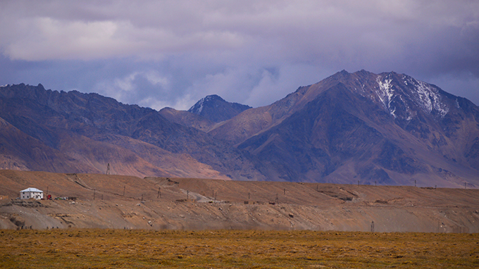
Jon and Ania from the HitchHikersHandbook.com shed light on the beauty of this path through the Pamir Mountains.
What is the Pamir Highway?
The Pamir Highway, or the M41, to give it its less poetic name, is the only continuous road crossing the Pamir Mountains. Its start point is somewhat contentious with some arguing that it begins in Mazari Shariz in Afghanistan, passing through Uzbekistan before it meets its more commonly quoted startline of Dushanbe, the capital of Tajikistan. Its end point is the southern Kyrgyz city of Osh.
The road was first built by Russian engineers during the Great Game era of the 1890s but it was expanded during the 1930s, by the then Soviet authorities, to help facilitate the movement of troops and provisions. The highway is the second highest route in the world reaching an altitude of 4,655m over the Ak-Baital Pass.
The road is generally in very poor state with only some sections of it paved. Due to its remoteness and altitude the road is very prone to weather damage, earthquakes and landslides so don’t expect progress to be fast.
What is there to see?
After leaving Dushanbe the Pamir Highway heads east. This is probably the most difficult part to travel across because it is often closed due to impenetrable snow on the mountain passes. Instead, you will have to go an alternative route (like we did) via Kulob. Travelling alongside the Panj River, which marks the border between Afghanistan and Tajikistan, offers some of the most spectacular views but also the prospect of watching armed men on the Afghan side practising with their machine guns. The major town in the western Pamirs is Khorog and a great place to get your breath back. Surrounded by soaring hills and lush green plains, it is certainly one of the most attractive parts of the journey.
Heading eastwards again and the landscape develops a coarse perspective. The trees and grass wither and die as you climb higher, green replaced by brown, vegetation by desolation. The towns become sparser, more remote and the weather turns chilly. After crossing the Koi-Tezez pass the landscape seems almost lunar, devoid of life and warmth before reaching the largest settlement in the eastern Pamirs, Murgab. Murgab was the highest settlement in the old Soviet Union and temperatures here are bracing. It is certainly not luscious but the views here are breathtaking and photographers will be in their element.
Heading north this time, towards Kyrgyzstan and lower climes, the Ak-Baital Pass blocks your path. Its surrounds are almost entirely deserted with neither hide nor hair of civilisation until reaching Lake Karakul. From here, it is another 70km or so north to the Kyrgyz-Tajik border post. Another pass, the Kyrzl-Art, is all that stands between you and freedom from the imposing Pamir peaks. At this point be sure to look back for stunning vistas of white walls rising from the green to the clouds.
Hitch-hiking experience
Hitch-hiking along the Pamir Highway is a richly rewarding experience but can at times be a tiring test of patience. Cars are scarce, waits are long and supplies are few and far between. In general, hitchhiking to Khorog is doable. We had an interesting, and not wholly pleasant time, with a Chinese truck driver (link) but we’re sure that others could have more luck. Between Khorog and Murgab we were extremely lucky and managed to do the journey across the bumpy road in a day. After Murgab is where the problems start. Travel is almost non-existent and if you do attempt the hitchhike you will need luck, time and a tent.
Read more about Jon and Ania’s hitchhiking adventures on their website – HitchikersHandbook.com