
Our Map of the Month for December 2022 is the Peters World Map Political Wall Map.
The Peters World Map shows countries in proportion to their relative sizes. It is based upon Arno Peters’ 1970s decimal grid which divides the surface of the earth into 100 longitudinal fields of equal width and 100 latitudinal fields of equal height; it treats the rectangles around the equator as squares and builds the other rectangles onto these in proportion to the areas they represent. the zero meridian on this system is combined with a proposed new international date line.

This decimal grid is only indicated, however, on the outer border of the map, the grid marked on the map itself is based on the traditional 180 degree division and the present dateline is indicated with a dotted line
Traditional maps, of which the Mercator illustrated below in black and white is one example, have tended to show countries incorrectly in proportion to one another, to the advantage of the European colonial powers, while the southern continents (Africa, South America, Australia) are shown far too small.
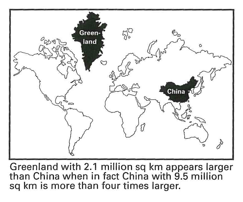
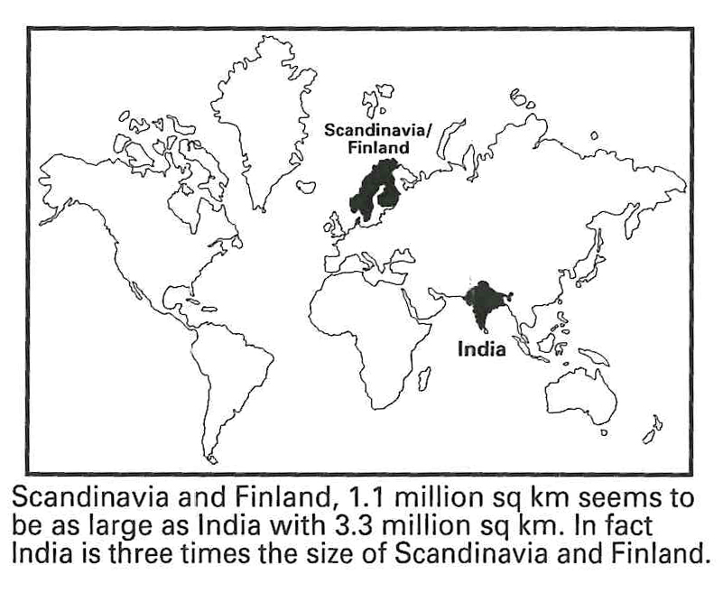
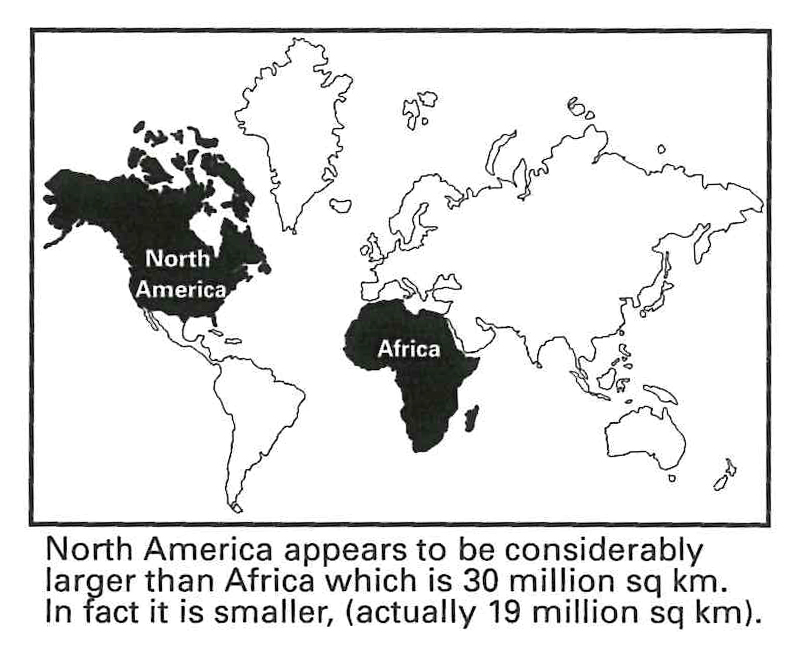
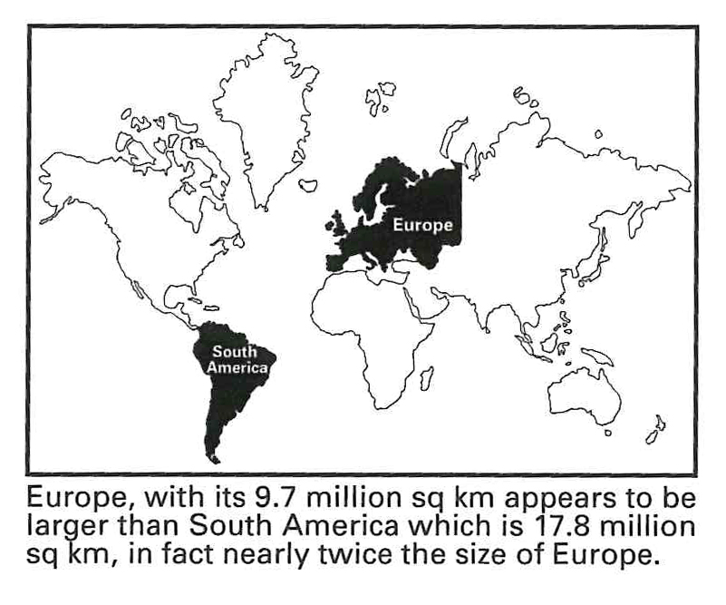
Five thousand years of human history have brought us to the threshold of a new age. It is an age typified by science and technology, by the end of colonial domination, by a growing awareness of the interdependence of all nations and all peoples .
Such a moment in history demands that we look critically at our understanding of the world. This understanding is based to a significant degree, on the work of map-makers of the age when Europe dominated and exploited the world. Surprisingly, maps still reflect that bygone area.
The map is the work of the late German historian Arno Peters and provides a helpful corrective to the distortions of traditional maps. While the Peters Map is superior in its portrayal of proportions and sizes, its importance goes far beyond questions of cartographic accuracy. No less than our world view is at stake.


Consider the characteristics of the Peters Map:
EQUAL AREA. This map shows all areas – whether countries, continents or oceans – according to their actual size. Accurate comparisons become possible.
EQUAL AXIS. All North-South lines run vertically on this map. Thus, geographic points can be seen in their precise directional relationship- northwest, southwest, southeast, northeast or southwest.
EQUAL POSITIONS. All East-West lines run parallel. thus the relationship of any point in the map to its distance from the equator or to the angle of the sun can easily be determined.
FAIRNESS TO ALL PEOPLES. By setting forth all countries in their true size and location, this map allows each one its actual position in the world.
In this complex and interdependent world in which the nations now live, the peoples of the world deserve the most accurate possible portrayal of their world.
Peters World Map area scale 1:1,230,000 million. One square centimetre on the map = 123,000 square kilometres in nature. Heights in metres.

Peters World Political Wall Map is available now for 11.99
Also available as a Geographical Wall Map.