
Maps offer us a chance to see not just how our world looks today, but how it once looked. But what about the places that are no longer mapped?
Cities forgotten under the dust of newly settled land? Rivers and seas whose changing shape has shifted the landscape around them? Or, even, places that have seemingly vanished, without a trace?
In Atlas of Vanishing Places (the winner of the 2020 Edward Stanford Travel Writing Award’s Dorling Kindersley Illustrated Travel Book of the Year) Travis Elborough takes us on a voyage to all corners of the world in search of the lost, disappearing and vanished. Specially commissioned cartography shows each place as it once was and how it is today.
To celebrate being an award winner, here is an extract with accompanying maps by Martin Brown :
RIVER DANUBE
EUROPE
48° 13′ 18.1″ N / 16° 24′ 52.3″ E
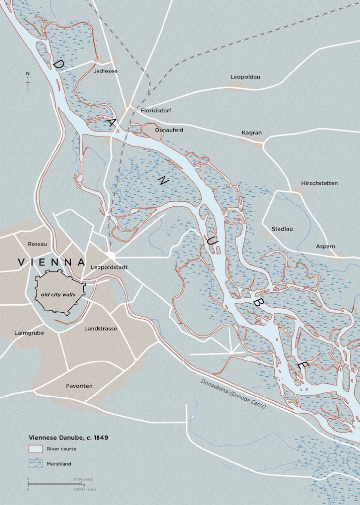
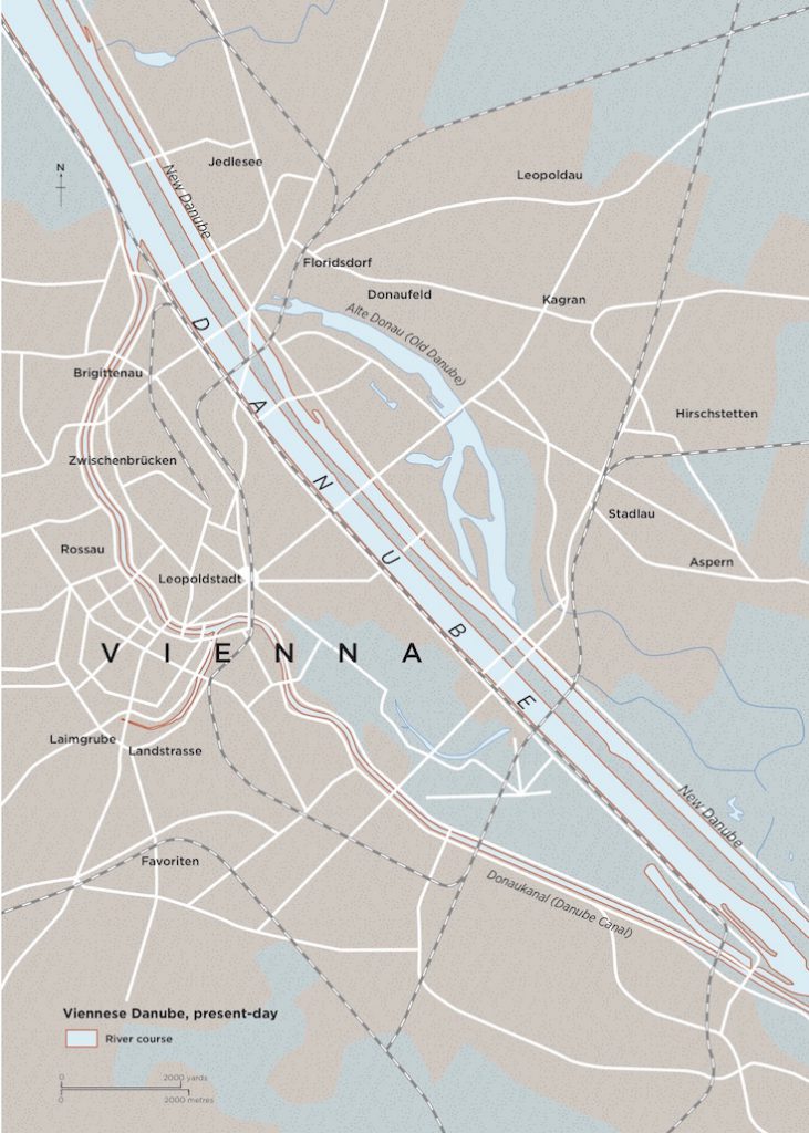
In his Cosmographia, the sixteenth-century German cartographer and cosmographer Sebastian Münster would claim that the River Danube began life as a drainage channel from the times of Noah and the biblical flood. But its waters, also said to have been sailed by the Golden Fleece-seeking Jason and the Argonauts of Greek myth and hailed as ‘the greatest of all the rivers which we know’ by the ‘Father of History’ Herodotus, have run their current course, more or less, for close to three million years. As such, the river has provided a backdrop to the monumental shifts in European history, a witness equally to the arrival of the earliest Mesolithic human society and the birth and expansion of the European Union, as well as the rise and fall of the Macedonian, Roman, Habsburg and Ottoman empires, Nazi Germany and the Soviet Union. While the lands around it have changed shapes and names, the Danube has appeared an almost constant, if actually still much shifting, presence on charts of the continent since the earliest days of mapmaking.
The Danube stretches from its source in the Black Forest in southern Germany to Sulina, the easternmost point of Romania, where the land promptly gives way to sand and the lapping waves of the Black Sea. Unique among the major European rivers for travelling west to east rather than north to south, its 1,777-mile (2,850-km) course currently crosses ten countries – Germany, Austria, Slovakia, Hungary, Croatia, Serbia, Bulgaria, Romania, Moldova and the Ukraine. Serving for centuries as a bridge between Europe and Asia, the Danube has equally acted as a barrier both between the east and west and the north and south. The river still separates present-day Slovakia and Hungary and helps define Romania’s borders with Serbia, the Ukraine and Bulgaria.
In classical times Alexander the Great opted to use the Danube –or the Ister, as the ancient Greeks knew it – to determine the upper limits of his empire. The Romans, similarly having founded Vindobona (Vienna) as a military stronghold at a favourable site on its banks, stationed troops along the length of the river to defend their territories from marauding northern hoards. More recently though and during the Cold War, when ‘an iron curtain’ fell across Europe separating the communist countries of the Soviet Union in the east from those of the capitalist west, the Danube, like the city of Berlin, was divided, with a kind of liquid roadblock operating between Vienna and Bratislava and splicing the river into western and eastern halves. After the fall of the Soviet Union and the end of the Balkan Wars, shipping remained stalled at Novi Sad, the Serbian city whose Freedom Bridge over the Danube was bombed by Nato in 1999.
Today, and thanks to European Union funding, the whole length of the river is once again navigable. But the eastern end of the Danube remains heavily at risk from a future ecological disaster. Unprotected pools of heavy metals and toxic sludge have been identified in defunct plants and reservoirs near the river in Hungary, Serbia and Romania. The legacy of heavy industries such as bauxite and uranium mining, promoted by the regimes of the Soviet bloc, they threaten to leak into its waterway with potentially devastating consequences for the river basin as a whole.
Always a working river, the Danube as it stands is fundamentally a product of modern industrialization, its present form shaped by the wharves, docks and shipyards assembled along its banks, themselves heavily embanked and canalized, and the bridges thrown up over it. This process was begun in earnest in the 1870s, when the French construction company Castor, Couvreux et Hersent, who had worked on the Suez Canal, were hired to re-route a meandering 8-mile (12-km) long stretch of the river at Vienna into a new straight riverbed, the first of a series of such ‘improvements’ undertaken along its course in the late nineteenth century, and throughout the twentieth century.
The Danube we have now has lost some 80 per cent of its original flood plain, and only 30 per cent of it is free-flowing. As an elderly Heinrich Heine once admonished a young Karl Marx to remember, ‘the difference between water and a river is that the latter has a memory, a past, a history’. If the Danube has that in spades, it is up to us to ensure it also has a healthy future too.
From Atlas of Vanishing Places by Travis Elborough
Maps © Martin Brown
White Lion Publishing, £22.00 hardback
View all the 2020 Edward Stanford Travel Writing Award winners.