 A group of Stanfords staff – current and former – frequently meet up at a London station on a Saturday morning and head off for a bracing country walk. I joined them for the first time, but with more than a little trepidation, as they mentioned something about it being 13 miles long and the weather forecast was rain…
It wasn’t looking good; I had only walked for 10 minutes from the front door but I was already drenched. The sky was miserable and the forecasted rain was fulfilling its promise and pelting down. A 13-mile walk in this was going to be no fun at all.
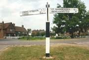
However, somehow I got to Euston for 9am and met the others, by which time the weather was perking up and consequently so were our spirits. A mere 40-minute train ride and the six of us tumbled out at Berkhamsted station.
This was to be a day of not only walking, but with some sightseeing thrown in, too. For starters, just next to the station, we walked round the remains of the Norman Berkhamsted castle. Once the home of Edward the Black Prince, the castle remained in use by royalty until 1495. However, years of nature’s will, man’s plundering and then development of the railway have left little else but two of the original three moats, a few walls, and your imagination.
From here it was out into the fields and up onto Berkhamsted Common where we entered woods packed with bluebells, cowslips, Jack-by-the-Hedge, wild garlic, and huge veteran trees, and the occasional glimpse of darting fallow and muntjac deer, all with the soundtrack of chiff-chaffs’ and willow warblers’ songs.
We staggered into the village of Aldbury right on time for lunch at the aptly named Valiant Trooper, an ancient, low-beamed and stone-floored pub. The sun was well and truly making an effort by now so we recuperated in the pub’s garden with cheese ploughmans, wooden boards of cured meats, crusty bread, homemade pork pies and a bucket of chunky chips, washed down with a pint or two of the pub’s own brew, Trooper Ale.
Gavin, the key organiser of these walks and former British department sales assistant at Stanfords, got out his map measurer and OS map. With bated breath we waited for his verdict… We were less than halfway.
We gradually gathered up the motivation to march onwards, and were quickly rewarded when we entered the centre of Aldbury to see the epitome of an English village – chocolate box red-brick cottages encircling a duck pond, complete with medieval church and village stocks on the side. To top it off, Mark and I, both avid fans of The Avengers, realised Aldbury had been used as a filming location for a favourite episode entitled ‘Murdersville’, involving the lovely Emma Peel being dunked in the pond by homicidal villagers. We saw no sign of such atrocities on this day, and instead busied ourselves with snapping furiously away on our cameras – every which way you looked was impossibly picturesque.
The others finally dragged us away with Mark daydreaming of Mrs Peel, and up we went into the wooded Ashridge estate to reach the National Trust-owned Bridgewater Monument. This tower was built in 1832 in memory of Francis Egerton, 3rd Duke of Bridgewater, “the father of inland navigation”. It is 108 feet (33m) tall, with no less than 170 steps inside – we know, we counted. The clamber in near-darkness on uneven stone spiral stairs is recompensed with breathtaking views from the top – even Canary Wharf and Wembley stadium are visible on the horizon for homesick Londoners.
I wasn’t too sure I should have undertaken the ascent of so many steps when I knew we still had half the walk left to do. Mark had sensibly opted to lay spread-eagled on the grass at the bottom of the monument instead. I began to wish I had pretended to suffer from vertigo, too.
Before I had a chance to consider an escape to the National Trust tea-room, however, the others were disappearing at an alarming rate into the distance. And that’s where they remained for the next hour or two as I struggled to catch up and not be distracted with photo opportunities, while Mark slipped into a delirium of hayfever-induced visions of Emma Peel as he stumbled and sneezed along.
The scenery from this wooded ridgeway is truly stunning – over the rolling Chilterns countryside dotted with tiny villages, wooden windmills and (in April/May) fluorescent yellow oilseed rape fields. Then we passed the photogenic Incombe Hole – a swirling dry gorge of bright green grass dotted with trees and bushes.
We were getting near our target – Ivinghoe Beacon – the end of the chalk ridgeway, with panoramic views over Buckinghamshire, Bedfordshire and Hertfordshire countryside, including the Whipsnade white lion cut out of chalk on the opposite ridge. The late-afternoon sun was blazing in a blue sky only dotted with puffs of clouds.
Now it was a mere three-and-a-half-mile gambol over the fields to Tring station. Easy!
If you fancy giving this walk a go, use the Time Out Country walks near London vol. 2 as your guide, and don’t forget your Ordnance Survey map 181: Chiltern Hills North.
Browse our whole collection of maps and guides to the Chilterns
- Browse our collection of maps & guides:
- > England travel guides
- > England road maps and atlases
- > Travel literature inspired by England
Author: Rachel Ricks